Calhoun County, Georgia
Calhoun County is a rural county in the southwestern part of the U.S. state of Georgia. Its county seat is Morgan.
Calhoun County | |
|---|---|
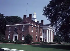 Calhoun County Courthouse in Morgan | |
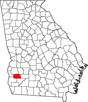 Location within the U.S. state of Georgia | |
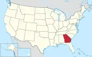 Georgia's location within the U.S. | |
| Coordinates: 31°32′N 84°37′W | |
| Country | |
| State | |
| Founded | February 20, 1854 |
| Named for | John C. Calhoun |
| Seat | Morgan |
| Largest city | Morgan |
| Area | |
| • Total | 284 sq mi (740 km2) |
| • Land | 280 sq mi (700 km2) |
| • Water | 3.2 sq mi (8 km2) 1.1% |
| Population (2020) | |
| • Total | 5,573 |
| • Density | 20/sq mi (8/km2) |
| Time zone | UTC−5 (Eastern) |
| • Summer (DST) | UTC−4 (EDT) |
| Congressional district | 2nd |
| Website | calhouncountyga |
History
Calhoun County was named for John C. Calhoun, the seventh Vice President of the United States.[1] It was created from parts of Early and Baker counties on February 20, 1854.[2][3]
Rival political factions disagreed about whether the county seat should be in Concord, a community north of present-day Leary, or in Dickey, then known as Whitney. As a compromise, a spot halfway between Concord and Whitney was chosen for the county seat, and the town of Morgan was established there.[2]
In 1923 the state legislature moved the county seat to Arlington as directed by a county referendum. This decision was reversed in 1929, restoring Morgan as the county seat.[2]
Calhoun Memorial Hospital, a 25-bed critical access hospital in Arlington originally founded as a Hill-Burton hospital,[4] closed in 2013 after 62 years of operation.[5][6]
In 2008, members of the Downtown Business Authority in Arlington founded the South Georgia Regional Information Technology Authority (SGRITA) with help from the state government to provide wireless broadband service to several counties in rural southwest Georgia.[7][8] In 2017 SGRITA moved its office to Blakely in Early County.[9]
Geography
The county seat is Morgan,[10] where the historic Calhoun County Courthouse is located.
According to the U.S. Census Bureau, the county has a total area of 284 square miles (740 km2), of which 280 square miles (730 km2) is land and 3.2 square miles (8.3 km2) (1.1%) is water.[11]
The vast majority of Calhoun County is in the Ichawaynochaway Creek sub-basin of the ACF River Basin (Apalachicola-Chattahoochee-Flint River Basin). The county's western and southwestern corner, from Arlington running northwest to west of Edison, is in the Spring Creek sub-basin of the same larger ACF River Basin.[12]
The United States Department of Agriculture has designated most of the county's land as prime farmland.[2] Agricultural, forestry, and wildlife plantations line the county's eastern edge.[13]
Adjacent counties
- Terrell County (northeast)
- Dougherty County (east)
- Baker County (southeast)
- Early County (southwest)
- Clay County (west)
- Randolph County (northwest)
Demographics
| Census | Pop. | Note | %± |
|---|---|---|---|
| 1860 | 4,913 | — | |
| 1870 | 5,503 | 12.0% | |
| 1880 | 7,024 | 27.6% | |
| 1890 | 8,438 | 20.1% | |
| 1900 | 9,274 | 9.9% | |
| 1910 | 11,334 | 22.2% | |
| 1920 | 10,225 | −9.8% | |
| 1930 | 10,576 | 3.4% | |
| 1940 | 10,438 | −1.3% | |
| 1950 | 8,578 | −17.8% | |
| 1960 | 7,341 | −14.4% | |
| 1970 | 6,606 | −10.0% | |
| 1980 | 5,717 | −13.5% | |
| 1990 | 5,013 | −12.3% | |
| 2000 | 6,320 | 26.1% | |
| 2010 | 6,694 | 5.9% | |
| 2020 | 5,573 | −16.7% | |
| U.S. Decennial Census[14] 1790-1960[15] 1900-1990[16] 1990-2000[17] 2010-2020[18] | |||
2020 census
| Race | Num. | Perc. |
|---|---|---|
| White (non-Hispanic) | 1,766 | 31.69% |
| Black or African American (non-Hispanic) | 3,569 | 64.04% |
| Native American | 8 | 0.14% |
| Asian | 19 | 0.34% |
| Pacific Islander | 7 | 0.05% |
| Other/Mixed | 62 | 1.11% |
| Hispanic or Latino | 149 | 2.67% |
As of the 2020 United States census, there were 5,573 people, 1,736 households, and 1,152 families residing in the county. Of these people, 4.0% were under 5 years old, 16.9% were under 18, and 16.6% were 65 or over. The population was 39.3% female. The foreign-born population was 4.1% of the total. Of residents aged 5 or older, 7.7% spoke a language other than English at home.
There were 1,736 households. The average household size was 2.56. The county had 2,406 housing units, of which 65.6% were owner-occupied. [18]
2010 census
As of the 2010 United States Census, there were 6,694 people, 2,002 households, and 1,292 families living in the county.[20] The population density was 23.9 inhabitants per square mile (9.2/km2). There were 2,409 housing units at an average density of 8.6 per square mile (3.3/km2).[21] The racial makeup of the county was 61.3% black or African American, 34.7% white, 0.4% Asian, 0.3% Pacific islander, 0.1% American Indian, 2.1% from other races, and 1.0% from two or more races. Those of Hispanic or Latino origin made up 3.9% of the population.[20] In terms of ancestry, 7.3% were American, and 6.3% were Irish.[22]
Of the 2,002 households, 32.7% had children under the age of 18 living with them, 38.2% were married couples living together, 22.6% had a female householder with no husband present, 35.5% were non-families, and 32.5% of all households were made up of individuals. The average household size was 2.49 and the average family size was 3.20. The median age was 38.7 years.[20]
The median income for a household in the county was $30,522 and the median income for a family was $37,309. Males had a median income of $27,096 versus $20,845 for females. The per capita income for the county was $12,452. About 20.3% of families and 28.8% of the population were below the poverty line, including 42.0% of those under age 18 and 14.6% of those age 65 or over.[23]
Economy
Many farms in Calhoun County grow corn, oats, sorghum, and wheat.[2] Still Pond Vineyard Winery & Distillery produces moonshine, vodka, brandy, whisky, and 19 varieties of muscadine wine.[24]
Calhoun State Prison in Morgan is a major employer. Calhoun Nursing Home, a 60-bed long-term care facility in Edison, is now operated by Miller County.[25] Willowood Personal Care Home is an assisted-living facility, also in Edison.[26]
Government
Calhoun County has a council-manager government with five commissioners elected by district.[27]
Education
The Calhoun County School District has an elementary school and a middle-high school all in Edison. The district has about 530 students.[28]
Pataula Charter Academy opened in 2010 in Edison as a tuition-free public charter school serving several counties in southwest Georgia. It has about 609 students in kindergarten through 12th grade.[29]
The Calhoun County Library in Edison is part of the Kinchafoonee Regional Library System.[30]
Recreation
The Chickasawahatchee Wildlife Management Area covers 19,700 acres, including parts of Calhoun, Dougherty, and Baker Counties. It has campsites, hiking trails, a shooting range, and an archery range. It also offers hunting, fishing, canoeing, and bird watching.[31]
Calhoun County and its cities normally hold several annual festivals. Usually in May Arlington hosts a May Day festival and Edison hosts the Billie Lane King Cotton Charity Horse Show.[2] In November the Southwest Georgia High Cotton 65-mile Yard Sale generally occurs along State Route 37.[32] And the Leary Christmas Parade normally happens in December.[33]
Communities
Unincorporated communities
- Dickey
- Williamsburg
- Moye
Transportation
Politics
Calhoun County is staunchly Democratic in US presidential elections. The last Republican candidate to win the county was Richard Nixon in 1972.
| Year | Republican | Democratic | Third party | |||
|---|---|---|---|---|---|---|
| No. | % | No. | % | No. | % | |
| 2020 | 923 | 41.99% | 1,263 | 57.46% | 12 | 0.55% |
| 2016 | 830 | 40.99% | 1,179 | 58.22% | 16 | 0.79% |
| 2012 | 883 | 40.34% | 1,298 | 59.30% | 8 | 0.37% |
| 2008 | 862 | 38.97% | 1,342 | 60.67% | 8 | 0.36% |
| 2004 | 890 | 44.08% | 1,119 | 55.42% | 10 | 0.50% |
| 2000 | 768 | 40.70% | 1,107 | 58.66% | 12 | 0.64% |
| 1996 | 541 | 28.96% | 1,217 | 65.15% | 110 | 5.89% |
| 1992 | 464 | 22.99% | 1,301 | 64.47% | 253 | 12.54% |
| 1988 | 644 | 41.52% | 901 | 58.09% | 6 | 0.39% |
| 1984 | 776 | 41.88% | 1,077 | 58.12% | 0 | 0.00% |
| 1980 | 652 | 31.24% | 1,414 | 67.75% | 21 | 1.01% |
| 1976 | 436 | 23.83% | 1,394 | 76.17% | 0 | 0.00% |
| 1972 | 892 | 64.31% | 495 | 35.69% | 0 | 0.00% |
| 1968 | 234 | 12.25% | 697 | 36.49% | 979 | 51.26% |
| 1964 | 1,066 | 78.67% | 289 | 21.33% | 0 | 0.00% |
| 1960 | 131 | 14.03% | 803 | 85.97% | 0 | 0.00% |
| 1956 | 107 | 8.91% | 1,094 | 91.09% | 0 | 0.00% |
| 1952 | 147 | 15.36% | 810 | 84.64% | 0 | 0.00% |
| 1948 | 36 | 7.00% | 399 | 77.63% | 79 | 15.37% |
| 1944 | 37 | 4.79% | 736 | 95.21% | 0 | 0.00% |
| 1940 | 33 | 5.13% | 610 | 94.87% | 0 | 0.00% |
| 1936 | 14 | 1.77% | 777 | 97.98% | 2 | 0.25% |
| 1932 | 10 | 2.01% | 483 | 97.18% | 4 | 0.80% |
| 1928 | 91 | 13.75% | 571 | 86.25% | 0 | 0.00% |
| 1924 | 66 | 16.02% | 343 | 83.25% | 3 | 0.73% |
| 1920 | 5 | 1.10% | 449 | 98.90% | 0 | 0.00% |
| 1916 | 2 | 0.72% | 265 | 96.01% | 9 | 3.26% |
| 1912 | 70 | 16.24% | 300 | 69.61% | 61 | 14.15% |
References
- Krakow, Kenneth K. (1975). Georgia Place-Names: Their History and Origins (PDF). Macon, GA: Winship Press. p. 31. ISBN 0-915430-00-2. Archived (PDF) from the original on July 10, 2003.
- "Calhoun County". Archived from the original on March 15, 2023. Retrieved November 28, 2021.
- "Calhoun County historic marker". Archived from the original on December 8, 2022. Retrieved November 28, 2021.
- Report on Hill-Burton Hospitals and Their Obligations. U.S. Government Printing Office. 1984.
- "Small rural hospital closes doors". February 4, 2013. Archived from the original on October 4, 2022. Retrieved November 29, 2021.
- "Calhoun Memorial Hospital closes". Archived from the original on December 2, 2022. Retrieved November 29, 2021.
- "Georgia citizens take broadband into their own hands". April 24, 2009. Archived from the original on November 26, 2022. Retrieved November 29, 2021.
- "Sgrita". Archived from the original on November 29, 2021. Retrieved November 29, 2021.
- "SGRITA relocating to City Hall". Archived from the original on November 29, 2021. Retrieved November 29, 2021.
- "Ballotpedia". Archived from the original on November 9, 2022. Retrieved November 28, 2021.
- "US Gazetteer files: 2010, 2000, and 1990". United States Census Bureau. February 12, 2011. Archived from the original on August 24, 2019. Retrieved April 23, 2011.
- "Georgia Soil and Water Conservation Commission Interactive Mapping Experience". Georgia Soil and Water Conservation Commission. Archived from the original on October 3, 2018. Retrieved November 24, 2015.
- "Calhoun County Georgia". Archived from the original on November 3, 2020. Retrieved November 29, 2021.
- "U.S. Decennial Census". United States Census Bureau. Archived from the original on April 26, 2015. Retrieved June 17, 2014.
- "Historical Census Browser". University of Virginia Library. Archived from the original on August 11, 2012. Retrieved June 19, 2014.
- "Population of Counties by Decennial Census: 1900 to 1990". United States Census Bureau. Archived from the original on February 2, 2019. Retrieved June 19, 2014.
- "Census 2000 PHC-T-4. Ranking Tables for Counties: 1990 and 2000" (PDF). United States Census Bureau. Archived (PDF) from the original on March 27, 2010. Retrieved June 19, 2014.
- "Calhoun County QuickFacts". United States Census Bureau. Retrieved November 28, 2021.
- "Explore Census Data". data.census.gov. Archived from the original on November 26, 2022. Retrieved December 18, 2021.
- "DP-1 Profile of General Population and Housing Characteristics: 2010 Demographic Profile Data". United States Census Bureau. Archived from the original on February 13, 2020. Retrieved December 27, 2015.
- "Population, Housing Units, Area, and Density: 2010 - County". United States Census Bureau. Archived from the original on February 13, 2020. Retrieved December 27, 2015.
- "DP02 SELECTED SOCIAL CHARACTERISTICS IN THE UNITED STATES – 2006-2010 American Community Survey 5-Year Estimates". United States Census Bureau. Archived from the original on February 13, 2020. Retrieved December 27, 2015.
- "DP03 SELECTED ECONOMIC CHARACTERISTICS – 2006-2010 American Community Survey 5-Year Estimates". United States Census Bureau. Archived from the original on February 13, 2020. Retrieved December 27, 2015.
- "Still Pond". Archived from the original on March 23, 2023. Retrieved November 30, 2021.
- "Calhoun Nursing Home". Archived from the original on April 5, 2023. Retrieved November 29, 2021.
- "Willowood". Archived from the original on August 11, 2022. Retrieved November 29, 2021.
- "Calhoun County Commissioners". Retrieved November 30, 2021.
- "School Grades". Archived from the original on May 13, 2023. Retrieved November 29, 2021.
- "Pataula Charter Academy". Archived from the original on February 5, 2023. Retrieved November 29, 2021.
- "Calhoun County Library". Archived from the original on May 19, 2023. Retrieved November 29, 2021.
- "Chickasawahatchee WMA". Archived from the original on May 9, 2023. Retrieved November 29, 2021.
- "Southwest Georgia High Cotton 65-Mile Yard Sale set for Saturday". WALB NEWS 10. November 8, 2019. Archived from the original on November 9, 2019. Retrieved May 26, 2023.
- Monk, Krista (November 30, 2018). "Weather prompts South GA cities to cancel or postpone Christmas parades". WALB NEWS 10. Archived from the original on December 1, 2018. Retrieved May 26, 2023.
- Leip, David. "Dave Leip's Atlas of U.S. Presidential Elections". uselectionatlas.org. Archived from the original on March 23, 2018. Retrieved March 19, 2018.
External links
- Calhoun County historical marker
Places adjacent to Calhoun County, Georgia | ||||||||||||||||
|---|---|---|---|---|---|---|---|---|---|---|---|---|---|---|---|---|
| ||||||||||||||||
Municipalities and communities of Calhoun County, Georgia, United States | ||
|---|---|---|
| Cities | Map of Georgia highlighting Calhoun County | |
| Unincorporated communities | ||
| Footnotes | ‡This populated place also has portions in an adjacent county or counties | |