California Historical Landmarks in Amador County
This list includes properties and districts listed on the California Historical Landmark listing in Amador County, California. Click the "Map of all coordinates" link to the right to view a Google map of all properties and districts with latitude and longitude coordinates in the table below.


References
- "California Historical Landmarks By County". Ohp.parks.ca.gov. Retrieved 2019-04-03.
See also
- National Register of Historic Places listings in Amador County, California
- List of California Historical Landmarks
Wikimedia Commons has media related to California Historical Landmarks in Amador County, California.
Municipalities and communities of Amador County, California, United States | ||
|---|---|---|
| Cities | 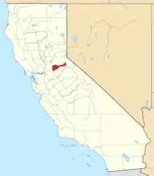 Amador County map | |
| CDPs | ||
| Other unincorporated communities | ||
| Ghost towns | ||
| Footnotes | ‡This CDP also has portions in an adjacent county or counties | |
This article is issued from Wikipedia. The text is licensed under Creative Commons - Attribution - Sharealike. Additional terms may apply for the media files.