California Historical Landmarks in Calaveras County

List table of the properties and districts — listed on the California Historical Landmarks — within Calaveras County, California.

  • Note: Click the "Map of all coordinates" link to the right to view a Google map of all properties and districts with latitude and longitude coordinates in the table below.
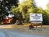
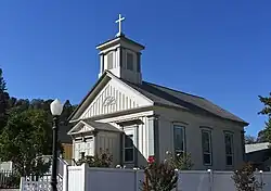
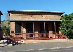
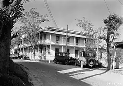
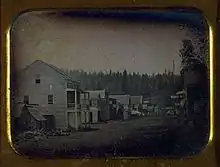
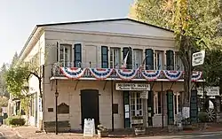
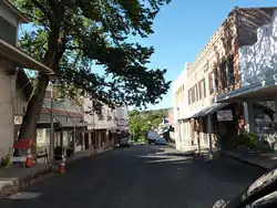
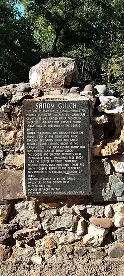
Listings

Image [1] Landmark name Location City or town Summary

Upload Photo
288 Altaville State Hwy 49 & Hwy 4
38°04′46″N 120°33′18″W
Altaville
Angels Camp
Angels Camp
287 Angels Camp Historic district
38°04′07″N 120°32′22″W
Angels Camp
Angels Hotel
Angels Hotel
734 Angels Hotel Main St. and Birds Way
38°04′07″N 120°32′21″W
Angels Camp Also on the NRHP list as NPS-72000220
Big Bar (Amador County, California)
41 Big Bar (Amador County, California)
38°18′43″N 120°43′12″W
Jackson Big Bar mine is in both Calaveras County and Amador County

Upload Photo
769 Birthplace of Archie Stevenot State Hwy 4, 3.7 miles south of Angels Camp
38°01′40″N 120°30′24″W
Angels Camp

Upload Photo
465 Old mining camp of Brownsville Pennsylvania Gulch Rd.
38°07′43″N 120°26′31″W
Murphys

Upload Photo
255 Calaveritas Historic district
38°09′29″N 120°36′36″W
Calaveritas
Camanche
Camanche
254 Camanche Historic district
38°12′48″N 120°56′07″W
Camanche

Upload Photo
257 Campo Seco Historic district
38°13′38″N 120°51′12″W
Campo Seco
California Caverns
California Caverns
956 California Caverns Cave City Rd.
38°12′10″N 120°30′32″W
Cave City

Upload Photo
274 Carson Hill Historic district
38°01′42″N 120°30′24″W
Carson Hill

Upload Photo
265 Chili Gulch Double Springs Rd.
38°12′58″N 120°42′27″W
Mokelumne Hill
Congregational Church
261 Congregational Church Northeast corner of Main and Church Sts.
38°18′00″N 120°42′23″W
Mokelumne Hill
Copperopolis
Copperopolis
296 Copperopolis Historic district
37°58′41″N 120°38′18″W
Copperopolis
Courthouse of Calaveras County and the Léger Hotel
663 Courthouse of Calaveras County and the Léger Hotel Corner of Main & Lafayette Sts.
38°18′04″N 120°42′21″W
Mokelumne Hill This was the county courthouse from 1852-1866
Double Springs
Double Springs
264 Double Springs Double Springs Rd.
38°12′19″N 120°47′28″W
Valley Springs
Douglas Flat
Douglas Flat
272 Douglas Flat Historic district
38°06′52″N 120°27′18″W
Douglas Flat

Upload Photo
282 El Dorado Mountain Ranch Rd. & Whiskey Slide Rd.
38°13′42″N 120°32′27″W
Mountain Ranch

Upload Photo
258 Fourth Crossing Historic district
38°07′53″N 120°38′05″W
Fourth Crossing

Upload Photo
280 Glencoe Historic district
38°21′15″N 120°35′06″W
Glencoe
I.O.O.F. Hall
I.O.O.F. Hall
256 I.O.O.F. Hall Northeast corner of Main and Center Sts.
38°18′08″N 120°42′22″W
Mokelumne Hill

Upload Photo
266 Jenny Lind
38°05′42″N 120°52′12″W
Jenny Lind

Upload Photo
284 Jesus Maria Historic district
38°17′08″N 120°38′51″W
Jesus Maria

Upload Photo
262 Milton Historic district
38°01′55″N 120°51′08″W
Milton
Mokelumne Hill
Mokelumne Hill
269 Mokelumne Hill
38°18′02″N 120°42′23″W
Mokelumne Hill
Murphys
Murphys
275 Murphys Historic district
38°08′15″N 120°27′35″W
Murphys
Murphys Hotel
Murphys Hotel
267 Murphys Hotel 457 Main at Algiers St.
38°08′16″N 120°27′54″W
Murphys Also known as Mitchler Hotel. Also on the NRHP list as NPS-71000134
O'Byrne Ferry
O'Byrne Ferry
281 O'Byrne Ferry O'Byrne Ferry Rd.
37°53′49″N 120°34′34″W
Copperopolis

Upload Photo
295 Paloma Paloma Rd. & Edster St.
38°15′33″N 120°45′42″W
Paloma

Upload Photo
466 Peter L. Traver Building 470 Main St.
38°08′16″N 120°27′54″W
Murphys

Upload Photo
271 Pioneer Cemetery State Hwy 12, .7 miles west of State Hwy 49 junction
38°12′31″N 120°42′29″W
San Andreas

Upload Photo
735 Prince-Garibaldi Building 298 S. Main St.
38°04′46″N 120°33′15″W
Altaville

Upload Photo
286 Rail Road Flat Historic district
38°20′36″N 120°30′44″W
Rail Road Flat
Red Brick Grammar School
499 Red Brick Grammar School 125 N. Main St.
38°04′59″N 120°33′43″W
Altaville Also on the NRHP list as NPS-79000471

Upload Photo
276 Robinson's Ferry Vista point on State Hwy 49
38°00′33″N 120°30′17″W
Angels Camp
San Andreas
San Andreas
252 San Andreas Historic district
38°11′46″N 120°40′50″W
San Andreas
Sandy Gulch
Sandy Gulch
253 Sandy Gulch Historic district
38°22′49″N 120°31′58″W
Sandy Gulch
Stone Corral
Stone Corral
263 Stone Corral Stone Corral Ranch, Hwy 26,
38°06′06″N 120°55′35″W
Rancho Calaveras

Upload Photo
273 Vallecito Historic district
38°05′25″N 120°28′25″W
Vallecito
Vallecito Bell Monument
370 Vallecito Bell Monument Church St. & Cemetery Ln.
38°05′11″N 120°28′27″W
Vallecito

Upload Photo
251 Valley Springs Historic district
38°11′30″N 120°49′45″W
Valley Springs

Upload Photo
268 West Point Historic district
38°23′57″N 120°31′39″W
West Point

See also

References

  1. "California Historical Landmarks By County". Ohp.parks.ca.gov. Retrieved 2019-04-03.
This article is issued from Wikipedia. The text is licensed under Creative Commons - Attribution - Sharealike. Additional terms may apply for the media files.