California Historical Landmarks in Contra Costa County
List table of the properties and districts — listed on the California Historical Landmarks — within Contra Costa County, Northern California.
- Note: Click the "Map of all coordinates" link to the right to view a Google map of all properties and districts with latitude and longitude coordinates in the table below.
Listings
| Image | [1] | Landmark name | Location | City or town | Summary |
|---|---|---|---|---|---|
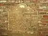
 Alvarado Adobe |
512 | Alvarado Adobe | San Pablo Blvd. & Church Ln. 37°57′31″N 122°20′26″W |
San Pablo | |
 Captain Pedro Fages Trail |
853 | Captain Pedro Fages Trail | 856 Danville Blvd. 37°50′04″N 122°00′59″W |
Danville | |
Upload Photo |
356 | Castro Home | 9800 San Pablo Ave. 37°53′53″N 122°18′05″W |
El Cerrito | |
.JPG.webp) Don Fernando Pacheco Adobe |
455 | Don Fernando Pacheco Adobe | 3119 Grant St. 37°59′46″N 122°02′33″W |
Concord | Also on the NRHP list as NPS-80000798 |
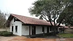
 Don Salvio Pacheco Adobe |
515 | Don Salvio Pacheco Adobe | 1870 Adobe St. 37°58′35″N 122°02′16″W |
Concord | |
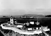 East Brother Light Station |
951 | East Brother Light Station | Point San Pablo 37°57′48″N 122°26′00″W |
Point San Pablo | |
 John Muir home |
312 | John Muir home | 4202 Alhambra Ave. 37°59′29″N 122°08′00″W |
Martinez | Also on the NRHP list as NPS-66000083 |
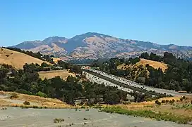 Mount Diablo |
905 | Mount Diablo | Mount Diablo State Park 37°52′54″N 121°54′51″W |
Danville | |
.JPG.webp) Mount Diablo coal field |
932 | Mount Diablo coal field | Black Diamond Mines Regional Preserve 37°57′01″N 121°51′25″W |
Antioch | Also on the NRHP list as NPS-91001425 |
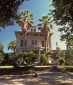
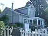 The Old Homestead |
731 | The Old Homestead | 993 Loring Ave 38°03′18″N 122°13′16″W |
Crockett | |
.jpg.webp) Richmond Shipyards District |
1032 | Richmond Shipyards District | Historic district 37°54′22″N 122°21′53″W |
Richmond | Also on the NRHP list as NPS-00000364 |
Upload Photo |
1002-1 | Site of Giant Powder Company | Point Pinole Regional Shoreline 37°59′32″N 122°21′19″W |
Richmond | The location of an earlier Giant factory in San Francisco is listed as California Historical Landmark number 1002. |
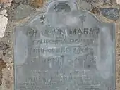 Site of the murder of Dr. John Marsh |
722 | Site of the murder of Dr. John Marsh | Across the street from 4575 Pacheco Blvd 38°00′19″N 122°05′15″W |
Martinez | |
_-_panoramio_(1).jpg.webp) Vicente Martinez Adobe |
511 | Vicente Martinez Adobe | Alhambra Way & Hwy 4 37°59′32″N 122°07′51″W |
Martinez |
References
- "California Historical Landmarks By County". Ohp.parks.ca.gov. Retrieved 2019-04-03.
See also
Wikimedia Commons has media related to California Historical Landmarks in Contra Costa County, California.
This article is issued from Wikipedia. The text is licensed under Creative Commons - Attribution - Sharealike. Additional terms may apply for the media files.