California Historical Landmarks in Lassen County
This list includes properties and districts listed on the California Historical Landmark listing in Lassen County, California. Click the "Map of all coordinates" link to the right to view a Google map of all properties and districts with latitude and longitude coordinates in the table below.
| Image | [1] | Landmark name | Location | City or town | Summary |
|---|---|---|---|---|---|
Upload Photo |
758 | Fort Janesville | North of Janesville Elementary School 40°18′N 120°32′W |
Janesville | |
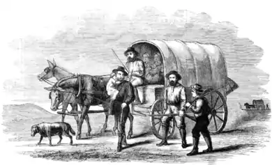 Lassen Emigrant Trail |
678 | Lassen Emigrant Trail | Hwy 36 40°18′52″N 121°03′21″W |
Westwood | |
Lassen Emigrant Trail, Bieber |
763 | Lassen Emigrant Trail, Bieber | County of Lassen Library-Historical Museum 41°07′17″N 121°08′17″W |
Bieber | |
 Noble Emigrant Trail |
677 | Noble Emigrant Trail | State Hwy 395 40°25′07″N 120°17′05″W |
Litchfield | Also on the NRHP list as NPS-75000222 |
Noble Emigrant Trail, Susanville |
675 | Noble Emigrant Trail, Susanville | Lassen Memorial Park 40°25′08″N 120°39′18″W |
Susanville | Also on the NRHP list as NPS-75000222 |
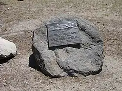
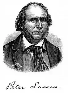 Peter Lassen's Grave |
565 | Peter Lassen's Grave | 2550 Wingfield Rd. 40°21′04″N 120°38′23″W |
Susanville | |
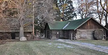 Roop's Fort |
76 | Roop's Fort | Memorial Park, N. Weatherlow & Nevada St. 40°25′08″N 120°39′20″W |
Susanville | Also on the NRHP list as NPS-74000516 |
References
- "California Historical Landmarks By County". Ohp.parks.ca.gov. Retrieved 2019-04-03.
See also
Wikimedia Commons has media related to California Historical Landmarks in Lassen County, California.
- National Register of Historic Places listings in Lassen County, California
- List of California Historical Landmarks
This article is issued from Wikipedia. The text is licensed under Creative Commons - Attribution - Sharealike. Additional terms may apply for the media files.