California Historical Landmarks in Marin County
List table of the properties and districts — listed on the California Historical Landmarks — within Marin County, Northern California.
- Note: Click the "Map of all coordinates" link to the right to view a Google map of all properties and districts with latitude and longitude coordinates in the table below.
Listings
| Image | [1] | Landmark name | Location | City or town | Summary |
|---|---|---|---|---|---|
 Angel Island |
529 | Angel Island | Angel Island State Park 37°52′N 122°26′W |
San Francisco Bay | |
 Bird's Nest Glen |
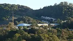
679 | Bird's Nest Glen | Marin Town and Country Club |
Fairfax | |
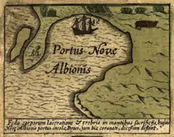 New Albion |
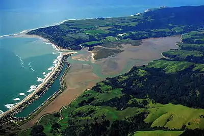
1061 | New Albion | Drakes Bay, Point Reyes, California 38°02′05″N 122°56′26″W |
Inverness | This California Historical Landmark location is the landing site of Francis Drake's Golden Hind in 1579. It is related to the Drakes Bay National Historic and Archaeologic District National Historic Landmark. |
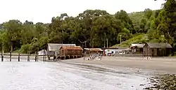 China Camp |
924 | China Camp | 899 North San Pedro Rd. 37°59′57″N 122°29′18″W |
Santa Venetia | Also on the NRHP list as NPS-79000493 |
 First sawmill in Marin County |
207 | First sawmill in Marin County | Old Mill Park 37°54′14″N 122°31′09″W |
Mill Valley | |
 Golden Gate Bridge |
974 | Golden Gate Bridge | Golden Gate Bridge 37°49′11″N 122°28′43″W |
||
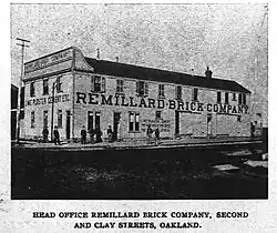 Greenbrae Brick Kiln |
917 | Greenbrae Brick Kiln | 125 E Sir Francis Drake Blvd. 37°56′41″N 122°30′21″W |
Larkspur | |
 Lighter Wharf |
221 | Lighter Wharf | Bolinas Lagoon |
Bolinas | |
 Marin County Civic Center |
999 | Marin County Civic Center | 10 Avenue of the Flags 37°59′59″N 122°31′48″W |
San Rafael | Also on the NRHP list as NPS-91002055 |
 Mission San Rafael Arcángel |
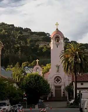
220 | Mission San Rafael Arcángel | 5th Ave. and A St. 37°58′28″N 122°31′40″W |
San Rafael | |
.jpg.webp) Olema Lime Kilns |
222 | Olema Lime Kilns | State Hwy 1 37°59′18″N 122°44′46″W |
Olema | Also on the NRHP list as NPS-76000217 |
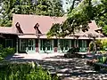 Outdoor Art Club |
922 | Outdoor Art Club | 1 W Blithedale Ave. 37°54′24″N 122°32′48″W |
Mill Valley | |
Olompali State Historic Park |
210 | Olompali State Historic Park | 8901 Redwood Hwy 38°09′09″N 122°34′11″W |
Novato | |
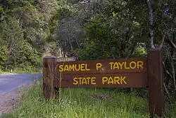 Pioneer Paper Mill |
552 | Pioneer Paper Mill | Samuel P. Taylor State Park 38°01′44″N 122°44′30″W |
Lagunitas | |
 St. Vincent's School for Boys |
630 | St. Vincent's School for Boys | 1 Saint Vincents Dr. |
San Rafael |
References
- "California Historical Landmarks By County". Ohp.parks.ca.gov. Retrieved 2019-04-03.
See also
Wikimedia Commons has media related to California Historical Landmarks in Marin County, California.
This article is issued from Wikipedia. The text is licensed under Creative Commons - Attribution - Sharealike. Additional terms may apply for the media files.