California Historical Landmarks in Placer County
List table of the properties and districts — listed on the California Historical Landmarks — within Placer County, California.
- Note: Click the "Map of all coordinates" link to the right to view a Google map of all properties and districts with latitude and longitude coordinates in the table below.
Listings
| Image | [1] | Landmark name | Location | City or town | Summary |
|---|---|---|---|---|---|
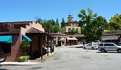 Auburn |
404 | Auburn | Historic district 38°53′55″N 121°04′28″W |
Auburn | |
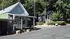 Dutch Flat |
397 | Dutch Flat | Historic district 39°12′22″N 120°50′16″W |
Dutch Flat | |
Emigrant Gap |
403 | Emigrant Gap | Emigrant Gap Vista Pt, Interstate 80 39°18′11″N 120°39′58″W |
Emigrant Gap | |
 Foresthill |
399 | Foresthill | Historic district 39°01′10″N 120°50′10″W |
Foresthill | |
 Gold Run |
405 | Gold Run | Historic district 39°10′51″N 120°51′21″W |
Gold Run | |
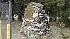
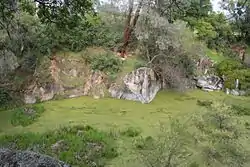 Griffith Quarry |
885 | Griffith Quarry | Taylor and Rock Springs Rds. 38°51′04″N 121°09′52″W |
Penryn | |
 Iowa Hill |
401 | Iowa Hill | Historic district 39°06′31″N 120°51′34″W |
Iowa Hill | |
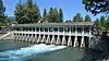 Lake Tahoe outlet gates |
797 | Lake Tahoe outlet gates | 73 N Lake Blvd. 39°10′00″N 120°08′36″W |
Tahoe City | |
 Michigan Bluff |
402 | Michigan Bluff | Historic district 39°02′35″N 120°44′29″W |
Michigan Bluff | |
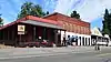
.jpg.webp) Ophir |
463 | Ophir | Historic district 38°53′28″N 121°07′25″W |
Ophir | |
Upload Photo |
799 | Overland Emigrant Trail | Big Bend Ranger Station, 2008 Hampshire Rocks Rd. |
Soda Springs | |
Upload Photo |
585 | Pioneer Express Trail | Folsom Lake State Recreation Area 38°43′30″N 121°10′19″W |
Folsom | |
 Pioneer Ski Area of America |
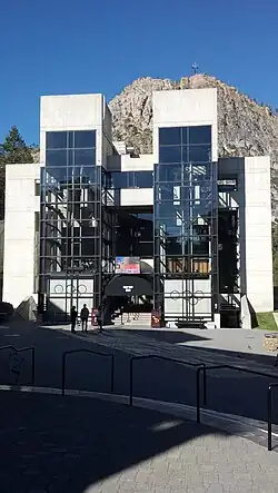
724 | Pioneer Ski Area of America | Cable Car Building 39°11′48″N 120°14′09″W |
Squaw Valley | |
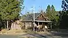
%252C_historical_depot_building.jpg.webp) Transcontinental Railroad - Auburn |
780 | Transcontinental Railroad - Auburn | 639 Lincoln Way 38°54′07″N 121°03′58″W |
Auburn | Building now serves as a Chamber of Commerce |
 Transcontinental Railroad - Colfax |
780 | Transcontinental Railroad - Colfax | Grass Valley Street and Railroad Tracks in Railroad Park 39°06′01″N 120°57′10″W |
Colfax | |
.jpg.webp) Transcontinental Railroad - Newcastle |
780 | Transcontinental Railroad - Newcastle | Main and Page Sts 38°52′32″N 121°08′03″W |
Newcastle | |
.jpg.webp) Transcontinental Railroad - Rocklin |
780 | Transcontinental Railroad - Rocklin | Rocklin Rd and First St 38°47′30″N 121°14′16″W |
Rocklin | |
.jpg.webp) Transcontinental Railroad - Roseville |
780 | Transcontinental Railroad - Roseville | Church St. & Washington Blvd. 38°45′04″N 121°17′10″W |
Roseville | |
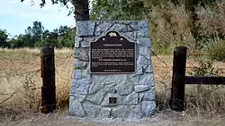 Virginiatown |
400 | Virginiatown | 4725 Virginiatown Rd. 38°54′02″N 121°12′53″W |
Newcastle | |
 Yankee Jims |
398 | Yankee Jims | Colfax Foresthill and Springs Garden Rds. 39°01′46″N 120°51′42″W |
Foresthill |
References
- "California Historical Landmarks By County". Ohp.parks.ca.gov. Retrieved 2019-04-03.
See also
Wikimedia Commons has media related to California Historical Landmarks in Placer County, California.
This article is issued from Wikipedia. The text is licensed under Creative Commons - Attribution - Sharealike. Additional terms may apply for the media files.