California Historical Landmarks in Solano County
This list includes properties and districts listed on the California Historical Landmark listing in Solano County, California. Click the "Map of all coordinates" link to the right to view a Google map of all properties and districts with latitude and longitude coordinates in the table below.
| Image | [1] | Landmark name | Location | City or town | Summary |
|---|---|---|---|---|---|
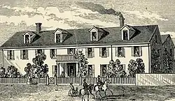
 Benicia Arsenal |
176 | Benicia Arsenal | Adams and Jefferson Sts. 38°03′15″N 122°08′08″W |
Benicia | Also on the NRHP list as NPS-76000534 |
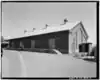
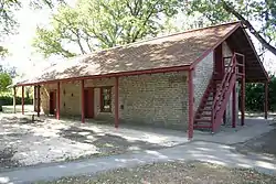
 Benicia Barracks |
177 | Benicia Barracks | Francesca Terrace Park 38°03′23″N 122°08′17″W |
Benicia | |
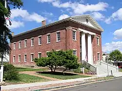 Benicia Capitol |
153 | Benicia Capitol | 1st and G Sts. 38°03′01″N 122°09′28″W |
Benicia | |
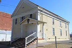 Benicia Lodge No. 5 |
174 | Benicia Lodge No. 5 | 110 W. J. St. 38°03′09″N 122°09′27″W |
Benicia | |
 Benicia Seminary |
795 | Benicia Seminary | City park 38°03′14″N 122°09′23″W |
Benicia | |
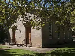
 First Presbyterian Church of Benicia |
175 | First Presbyterian Church of Benicia | Benicia City Park 38°03′13″N 122°09′26″W |
Benicia | Site is now Benicia City Park, on K Street. |
 First U.S. Naval Station in the Pacific |
751 | First U.S. Naval Station in the Pacific | Mare Island Naval Shipyard 38°05′24″N 122°15′48″W |
Vallejo | Also on the NRHP list as NPS-75002103 |
Upload Photo |
880 | Fischer-Hanlon House | 135 W. G. St. Benicia Capitol State Historic Park 38°03′01″N 122°09′32″W |
Benicia | |
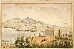
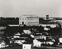 Former California State Capitol |
574 | Former California State Capitol | Vallejo Station 38°06′00″N 122°15′33″W |
Vallejo | Lost in August 20, 1859 fire |
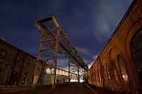
.jpg.webp) Matthew Turner Shipyard Park |
973 | Matthew Turner Shipyard Park | Matthew Turner Shipyard Park 38°03′44″N 122°10′45″W |
Benicia | |
 Rockville Stone Chapel |
779 | Rockville Stone Chapel | Rockville Cemetery, Suisun Valley Rd. 38°14′50″N 122°07′16″W |
Rockville | |
 Saint Paul's Episcopal Church |
862 | Saint Paul's Episcopal Church | 120 E J St. at 1st St. 38°03′06″N 122°09′24″W |
Benicia | |
.jpg.webp) University of California Experimental Farm |
804 | University of California Experimental Farm | Putah Creek Rd. 38°30′17″N 121°58′50″W |
Winters | Also called Wolfskill Grant |
 Vaca-Peña Adobe |
534 | Vaca-Peña Adobe | Peña Adobe Park 38°20′15″N 122°00′55″W |
Vacaville | Also on the NRHP list as NPS-72000261 |
References
- "California Historical Landmarks By County". Ohp.parks.ca.gov. Retrieved 2019-04-03.
See also
Wikimedia Commons has media related to California Historical Landmarks in Solano County, California.
This article is issued from Wikipedia. The text is licensed under Creative Commons - Attribution - Sharealike. Additional terms may apply for the media files.