Callao, Missouri
Callao is a city in Macon County, Missouri, United States. The population was 251 at the 2020 census.[4]
Callao | |
|---|---|
 Location of Callao, Missouri | |
| Coordinates: 39°45′44″N 92°37′25″W | |
| Country | United States |
| State | Missouri |
| County | Macon |
| Area | |
| • Total | 0.52 sq mi (1.34 km2) |
| • Land | 0.52 sq mi (1.34 km2) |
| • Water | 0.00 sq mi (0.00 km2) |
| Elevation | 837 ft (255 m) |
| Population (2020) | |
| • Total | 251 |
| • Density | 485.49/sq mi (187.54/km2) |
| Time zone | UTC-6 (Central (CST)) |
| • Summer (DST) | UTC-5 (CDT) |
| ZIP code | 63534 |
| Area code | 660 |
| FIPS code | 29-10486[3] |
| GNIS feature ID | 2393496[2] |
History
Callao was laid out in 1858, a year before the railroad was extended to that point.[5][6] The town most likely took its name from the port city of Callao, Peru. Townsfolk did not know what to call the new town. They hung a map of the world on the wall, blindfolded a man like Pin the Tail on the Donkey, aimed him at the map and his finger landed on Callao, Peru.[7][8] A post office called Callao has been in operation since 1859.[9]
The Johnson Morrow House was listed on the National Register of Historic Places in 1994.[10]
Geography
According to the United States Census Bureau, the city has a total area of 0.51 square miles (1.32 km2), all land.[11]
Demographics
| Census | Pop. | Note | %± |
|---|---|---|---|
| 1870 | 310 | — | |
| 1880 | 330 | 6.5% | |
| 1890 | 371 | 12.4% | |
| 1900 | 498 | 34.2% | |
| 1910 | 526 | 5.6% | |
| 1920 | 542 | 3.0% | |
| 1930 | 468 | −13.7% | |
| 1940 | 398 | −15.0% | |
| 1950 | 370 | −7.0% | |
| 1960 | 329 | −11.1% | |
| 1970 | 373 | 13.4% | |
| 1980 | 326 | −12.6% | |
| 1990 | 332 | 1.8% | |
| 2000 | 291 | −12.3% | |
| 2010 | 292 | 0.3% | |
| 2020 | 251 | −14.0% | |
| U.S. Decennial Census[12] | |||
2010 census
As of the census[13] of 2010, there were 292 people, 112 households, and 81 families living in the city. The population density was 572.5 inhabitants per square mile (221.0/km2). There were 144 housing units at an average density of 282.4 per square mile (109.0/km2). The racial makeup of the city was 96.2% White, 1.0% African American, 0.3% Native American, and 2.4% from two or more races. Hispanic or Latino of any race were 1.4% of the population.
There were 112 households, of which 32.1% had children under the age of 18 living with them, 46.4% were married couples living together, 11.6% had a female householder with no husband present, 14.3% had a male householder with no wife present, and 27.7% were non-families. 23.2% of all households were made up of individuals, and 5.4% had someone living alone who was 65 years of age or older. The average household size was 2.61 and the average family size was 2.96.
The median age in the city was 39.8 years. 26.7% of residents were under the age of 18; 7.5% were between the ages of 18 and 24; 20.9% were from 25 to 44; 33.2% were from 45 to 64; and 11.6% were 65 years of age or older. The gender makeup of the city was 50.3% male and 49.7% female.
2000 census
As of the census[3] of 2000, there were 291 people, 117 households, and 78 families living in the city. The population density was 580.0 inhabitants per square mile (223.9/km2). There were 152 housing units at an average density of 303.0 per square mile (117.0/km2). The racial makeup of the city was 99.31% White, 0.34% Native American, and 0.34% from two or more races.
There were 117 households, out of which 24.8% had children under the age of 18 living with them, 55.6% were married couples living together, 7.7% had a female householder with no husband present, and 32.5% were non-families. 24.8% of all households were made up of individuals, and 12.8% had someone living alone who was 65 years of age or older. The average household size was 2.49 and the average family size was 2.95.
In the city the population was spread out, with 23.7% under the age of 18, 8.9% from 18 to 24, 24.7% from 25 to 44, 23.4% from 45 to 64, and 19.2% who were 65 years of age or older. The median age was 40 years. For every 100 females there were 99.3 males. For every 100 females age 18 and over, there were 88.1 males.
The median income for a household in the city was $24,659, and the median income for a family was $32,813. Males had a median income of $22,500 versus $15,125 for females. The per capita income for the city was $12,573. About 18.7% of families and 26.1% of the population were below the poverty line, including 65.3% of those under the age of eighteen and 9.6% of those 65 or over.
References
- "ArcGIS REST Services Directory". United States Census Bureau. Retrieved August 28, 2022.
- U.S. Geological Survey Geographic Names Information System: Callao, Missouri
- "U.S. Census website". United States Census Bureau. Retrieved January 31, 2008.
- "Explore Census Data". data.census.gov. Retrieved February 1, 2022.
- Earngey, Bill (1995). Missouri Roadsides: The Traveler's Companion. University of Missouri Press. p. 32. ISBN 9780826210210.
- Ramsay, Robert L. (1952). Our Storehouse of Missouri Place Names. University of Missouri Press. p. 28. ISBN 9780826205865.
- Handed down town history from my father and others from Callao, MO
- Eaton, David Wolfe (1916). How Missouri Counties, Towns and Streams Were Named. The State Historical Society of Missouri. pp. 191.
- "Post Offices". Jim Forte Postal History. Retrieved October 30, 2016.
- "National Register Information System". National Register of Historic Places. National Park Service. July 9, 2010.
- "US Gazetteer files 2010". United States Census Bureau. Archived from the original on July 2, 2012. Retrieved July 8, 2012.
- "Census of Population and Housing". Census.gov. Retrieved June 4, 2015.
- "U.S. Census website". United States Census Bureau. Retrieved July 8, 2012.
External links
- Historic maps of Callao in the Sanborn Maps of Missouri Collection Archived 2013-07-23 at the Wayback Machine at the University of Missouri
Municipalities and communities of Macon County, Missouri, United States | ||
|---|---|---|
| Cities | 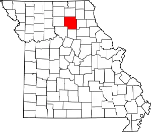 Map of Missouri highlighting Macon County | |
| Townships | ||
| CDP | ||
| Other unincorporated communities | ||
| Ghost towns | ||