Calmels-et-le-Viala
Calmels-et-le-Viala (French pronunciation: [kalmɛl e lə vjala]; Occitan: Caumèls e Lo Vialar) is a commune in the Aveyron department in southern France.
Calmels-et-le-Viala | |
|---|---|
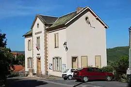 The town hall in Calmels-et-le-Viala | |
Location of Calmels-et-le-Viala | |
 Calmels-et-le-Viala  Calmels-et-le-Viala | |
| Coordinates: 43°56′48″N 2°45′11″E | |
| Country | France |
| Region | Occitania |
| Department | Aveyron |
| Arrondissement | Millau |
| Canton | Saint-Affrique |
| Government | |
| • Mayor (2020–2026) | Anne-Marie Constans[1] |
| Area 1 | 23.20 km2 (8.96 sq mi) |
| Population | 201 |
| • Density | 8.7/km2 (22/sq mi) |
| Time zone | UTC+01:00 (CET) |
| • Summer (DST) | UTC+02:00 (CEST) |
| INSEE/Postal code | 12042 /12400 |
| Elevation | 269–574 m (883–1,883 ft) (avg. 350 m or 1,150 ft) |
| 1 French Land Register data, which excludes lakes, ponds, glaciers > 1 km2 (0.386 sq mi or 247 acres) and river estuaries. | |
Geography
The commune is traversed by the Dourdou de Camarès River.
Population
| Year | Pop. | ±% |
|---|---|---|
| 1962 | 339 | — |
| 1968 | 303 | −10.6% |
| 1975 | 239 | −21.1% |
| 1982 | 211 | −11.7% |
| 1990 | 214 | +1.4% |
| 1999 | 207 | −3.3% |
| 2008 | 247 | +19.3% |
See also
References
- "Répertoire national des élus: les maires". data.gouv.fr, Plateforme ouverte des données publiques françaises (in French). 2 December 2020.
- "Populations légales 2020". The National Institute of Statistics and Economic Studies. 29 December 2022.
Wikimedia Commons has media related to Calmels-et-le-Viala.
This article is issued from Wikipedia. The text is licensed under Creative Commons - Attribution - Sharealike. Additional terms may apply for the media files.