Cape Davies
Cape Davies (71°50′S 100°04′W) is an ice-covered cape, lying at the northeast end of Hughes Peninsula, on the north side of Thurston Island, Antarctica.[1] The cape plotted from air photos taken by U.S. Navy Operation Highjump in December 1946 and named by the Advisory Committee on Antarctic Names (US-ACAN). The cape was named for Frank Davies, a physicist with the Byrd Antarctic Expedition (ByrdAE) in 1928-30.[1]
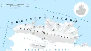
Map of Thurston Island.
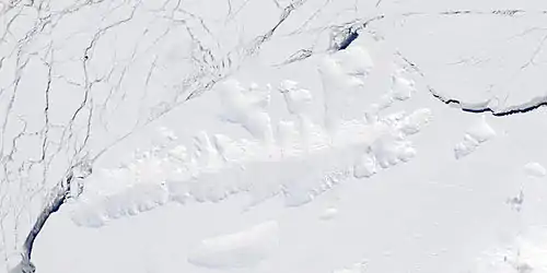
Satellite image of Thurston Island.
Maps
- Thurston Island – Jones Mountains. 1:500000 Antarctica Sketch Map. US Geological Survey, 1967.
- Antarctic Digital Database (ADD). Scale 1:250000 topographic map of Antarctica. Scientific Committee on Antarctic Research (SCAR), 1993–2016.
References
- "Cape Davies". Geographic Names Information System. United States Geological Survey, United States Department of the Interior. Retrieved 20 April 2022.
![]() This article incorporates public domain material from websites or documents of the United States Geological Survey.
This article incorporates public domain material from websites or documents of the United States Geological Survey.
This article is issued from Wikipedia. The text is licensed under Creative Commons - Attribution - Sharealike. Additional terms may apply for the media files.