Topalu
Topalu is a commune located on the right bank of the Danube in Constanța County, Northern Dobruja, Romania.
Topalu | |
|---|---|
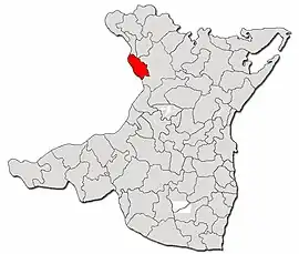 Location in Constanța County | |
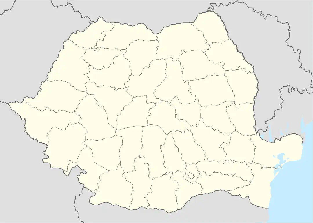 Topalu Location in Romania | |
| Coordinates: 44°33′N 28°3′E | |
| Country | Romania |
| County | Constanța |
| Subdivisions | Topalu, Capidava |
| Government | |
| • Mayor (2020–2024) | Constantin Baltă[1] (PSD) |
| Area | 79.29 km2 (30.61 sq mi) |
| Population (2011-10-31)[2] | 1,785 |
| • Density | 23/km2 (58/sq mi) |
| Time zone | EET/EEST (UTC+2/+3) |
| Vehicle reg. | CT |
| Website | www |
Administration
The commune includes two villages:
History
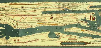
Tabula Peutingeriana
Capidava is depicted in the form Calidava/Calidaua in Segmentum VIII of Tabula Peutingeriana (1st-4th century AD) on a Roman road between Axiopolis and Carsium.[4][5] The map provides accurate data on the distances between Axiopolis, Capidava and Carsium. These distances coincide with the distances between the present localities of Hinog - Capidava and Capidava - Hârșova. This is also verified by the discovery of military marking pillar at Seimenii Mici that indicates the distance of 18,000 feet (27 km) from Axiopolis to Capidava.[6]
Ancient times
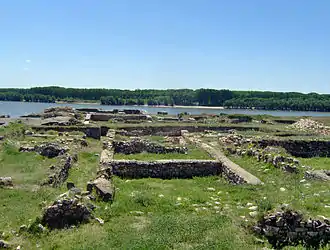
The village Capidava is the site of the fortified Geto-Dacian center with the same name, Capidava.
After the Roman conquest of Dacia it became a Roman city and castra in the province of Scythia Minor (modern Dobruja).
See also
References
- "Results of the 2020 local elections". Central Electoral Bureau. Retrieved 15 June 2021.
- "Populaţia stabilă pe judeţe, municipii, oraşe şi localităti componenete la RPL_2011" (XLS). National Institute of Statistics.
- "Constanța County at the 2011 census" (PDF) (in Romanian). INSSE. February 2, 2012. Archived from the original (PDF) on March 24, 2012. Retrieved March 8, 2012.
- Anonymous. "Segmentum VIII,3". Tabula Peutingeriana (in Latin). 1-4th century AD.
- Olteanu, Sorin. "Categorii de toponime în funcţie de origine şi aşezare" [Toponymy categories according to origin and location]. Linguae Thraco-Daco-Moesorum (in Romanian). Archived from the original on 16 July 2011. Retrieved 3 January 2010.
- Florescu, Radu; Manea, Florentina. Oberländer-Târnoveanu, Irina; Bor, Corina (eds.). "Capidava". Bucharest, Romania: Institute for Cultural Memory (Institutul de Memorie Culturală) - cIMeC. Archived from the original on 31 October 2010. Retrieved 2 February 2011.
Further reading
- Grumeza, Ion (2009). Dacia: Land of Transylvania, Cornerstone of Ancient Eastern Europe. Hamilton Books. ISBN 978-0-7618-4465-5.
The shores of the Danube were well monitored from the Dacian fortresses Acidava, Buricodava, Dausadava (the shrine of the wolves), Diacum, Drobeta (Turnu Severin), Nentivava (Oltenita), Suvidava (Corabia), Tsirista, Tierna/Dierna (Orsova) and what is today Zimnicea. Downstream were also other fortresses: Axiopolis (Cernadova), Barbosi, Buteridava, Capidava(Topalu), Carsium(Harsova), Durostorum(Silistra), Sacidava/Sagadava (Dunareni) along with still others...
- Early Byzantine Capidava
- Official Capidava Archaeological Site
- Official Capidava Fortress Site at Constanţa County Council
- Capidava at Encyclopedia Dacica
- Capidava at Turism Constanţa hosted by The Public Office for Tourism, Commerce and Public Services, part of the Constanţa County Council
- Capidava hosted by the Romanian National Institute of Historical Monuments
- Capidava article at ziare.com
External links
- Official Capidava Archaeological Site
- Official Capidava Fortress Site at Constanţa County Council
- Capidava at Encyclopedia Dacica
- Capidava at Turism Constanţa hosted by The Public Office for Tourism, Commerce and Public Services, part of the Constanţa County Council
- Capidava hosted by the Romanian National Institute of Historical Monuments
- Capidava article at ziare.com