Catawba County, North Carolina
Catawba County (/kəˈtɔːbə/ kuh-TAW-buh)[1] is a county in the U.S. state of North Carolina. As of the 2020 census, the population was 160,610.[2] Its county seat is Newton,[3] and its largest community is Hickory.
Catawba County | |
|---|---|
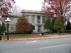 Historic Catawba County Courthouse | |
 Flag  Seal Logo | |
| Motto: "Making. Living. Better." | |
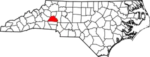 Location within the U.S. state of North Carolina | |
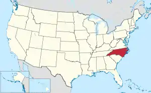 North Carolina's location within the U.S. | |
| Coordinates: 35°40′N 81°13′W | |
| Country | |
| State | |
| Founded | 1842 |
| Named for | Catawba Tribe |
| Seat | Newton |
| Largest community | Hickory |
| Area | |
| • Total | 416.02 sq mi (1,077.5 km2) |
| • Land | 401.37 sq mi (1,039.5 km2) |
| • Water | 14.65 sq mi (37.9 km2) 3.52% |
| Population (2020) | |
| • Total | 160,610 |
| • Estimate (2022) | 163,462 |
| • Density | 400.15/sq mi (154.50/km2) |
| Time zone | UTC−5 (Eastern) |
| • Summer (DST) | UTC−4 (EDT) |
| Congressional district | 10th |
| Website | www |
The county is part of the Hickory-Lenoir-Morganton, NC Metropolitan Statistical Area.
History
Catawba County formed in 1842 from Lincoln County, was named after the Catawba River. The word "catawba" is rooted in the Choctaw sound kat'a pa, loosely translated as "to divide or separate, to break." However, scholars are fairly certain that this word was imposed from outside.[4] The Native Americans who once inhabited the region known as the Catawba people, were considered one of the most powerful Southeastern Siouan-speaking tribes in the Carolina Piedmont. They now live along the border of North Carolina, near the city of Rock Hill, South Carolina. Scots-Irish and German colonial immigrants first settled in the Catawba River valley in the mid-18th century. An official history of the Scots-Irish and German settlement was documented in 1954, by Charles J. Preslar Jr,[5] and more recently by a series of three books by Gary Freeze, called The Catawbans.
Geography
According to the U.S. Census Bureau, the county has a total area of 416.02 square miles (1,077.5 km2), of which 401.37 square miles (1,039.5 km2) is land and 14.65 square miles (37.9 km2) (3.52%) is water.[6]
State and local protected areas/sites
- Houck's Chapel
- Mountain Creek Park
- Murray's Mill Historic Site
- Old Hickory Tavern Birthplace of Hickory
- Old Piedmont Wagon
Major water bodies
- Balls Creek
- Betts Creek
- Catawba River
- Clark Creek
- Henry Fork
- Jacob Fork
- Lake Hickory
- Lake Norman
- Lookout Shoals Lake
- Lyle Creek
- McLin Creek
- Muddy Creek
- Pinch Gut Creek
- Pott Creek
- Snow Creek
- South Fork Catawba River
Adjacent counties
- Alexander County – north
- Iredell County – east
- Lincoln County – south
- Caldwell County – northwest
- Burke County – west
Demographics
| Census | Pop. | Note | %± |
|---|---|---|---|
| 1850 | 8,862 | — | |
| 1860 | 10,729 | 21.1% | |
| 1870 | 10,984 | 2.4% | |
| 1880 | 14,946 | 36.1% | |
| 1890 | 18,689 | 25.0% | |
| 1900 | 22,133 | 18.4% | |
| 1910 | 27,918 | 26.1% | |
| 1920 | 33,839 | 21.2% | |
| 1930 | 43,991 | 30.0% | |
| 1940 | 54,653 | 24.2% | |
| 1950 | 61,794 | 13.1% | |
| 1960 | 73,191 | 18.4% | |
| 1970 | 90,873 | 24.2% | |
| 1980 | 105,208 | 15.8% | |
| 1990 | 118,412 | 12.6% | |
| 2000 | 141,685 | 19.7% | |
| 2010 | 154,358 | 8.9% | |
| 2020 | 160,610 | 4.1% | |
| 2022 (est.) | 163,462 | [7] | 1.8% |
| U.S. Decennial Census[8] 1790–1960[9] 1900–1990[10] 1990–2000[11] 2010[12] 2020[7] | |||
2020 census
| Race | Number | Percentage |
|---|---|---|
| White (non-Hispanic) | 116,120 | 72.3% |
| Black or African American (non-Hispanic) | 12,628 | 7.86% |
| Native American | 379 | 0.24% |
| Asian | 6,937 | 4.32% |
| Pacific Islander | 78 | 0.05% |
| Other/Mixed | 7,091 | 4.42% |
| Hispanic or Latino | 17,377 | 10.82% |
As of the 2020 census, there were 160,610 people, 62,417 households, and 41,861 families residing in the county.
2010 census
At the 2010 census,[14] there were 154,358 people, 55,533 households, and 39,095 families residing in the county. The population density was 354 people per square mile (137 people/km2). There were 59,919 housing units at an average density of 150 units per square mile (58 units/km2). The racial makeup of the county was 87.1% White, 8.5% Black or African American, 0.3% Native American, 3.1% Asian, 0.05% Pacific Islander, and 1.14% from two or more races, 9.4% of the population were Hispanic or Latino of any race.
There were 55,533 households, out of which 31.50% had children under the age of 18 living with them, 55.10% were married couples living together, 10.90% had a female householder with no husband present, and 29.60% were non-families. 24.60% of all households were made up of individuals, and 9.10% had someone living alone who was 65 years of age or older. The average household size was 2.51 and the average family size was 2.98.
In the county, the population was spread out, with 24.30% under the age of 18, 8.80% from 18 to 24, 31.10% from 25 to 44, 23.50% from 45 to 64, and 12.30% who were 65 years of age or older. The median age was 36 years. For every 100 females there were 97.30 males. For every 100 females age 18 and over, there were 94.70 males.
The median income for a household in the county was $43,536, and the median income for a family was $47,474. Males had a median income of $30,822 versus $23,352 for females. The per capita income for the county was $20,358. About 6.50% of families and 9.10% of the population were below the poverty line, including 12.50% of those under age 18 and 9.70% of those age 65 or over.
Law, government, and politics
Catawba County is a member of the regional Western Piedmont Council of Governments. The county has been represented primarily by Republicans since World War II: no Democratic presidential candidate has won Catawba County since Franklin D. Roosevelt in 1944.[15] Jimmy Carter is the last Democrat to manage even 40 percent of the county's vote.
| Year | Republican | Democratic | Third party | |||
|---|---|---|---|---|---|---|
| No. | % | No. | % | No. | % | |
| 2020 | 56,588 | 67.83% | 25,689 | 30.79% | 1,148 | 1.38% |
| 2016 | 48,324 | 66.79% | 21,216 | 29.32% | 2,811 | 3.89% |
| 2012 | 44,538 | 63.99% | 24,069 | 34.58% | 994 | 1.43% |
| 2008 | 42,993 | 61.90% | 25,656 | 36.94% | 802 | 1.15% |
| 2004 | 39,602 | 67.48% | 18,858 | 32.13% | 228 | 0.39% |
| 2000 | 34,244 | 67.36% | 16,246 | 31.95% | 351 | 0.69% |
| 1996 | 26,898 | 58.03% | 15,601 | 33.66% | 3,855 | 8.32% |
| 1992 | 25,466 | 51.54% | 16,334 | 33.06% | 7,609 | 15.40% |
| 1988 | 28,872 | 69.01% | 12,922 | 30.89% | 44 | 0.11% |
| 1984 | 31,476 | 72.78% | 11,700 | 27.05% | 74 | 0.17% |
| 1980 | 22,873 | 60.39% | 13,873 | 36.63% | 1,132 | 2.99% |
| 1976 | 18,696 | 52.36% | 16,862 | 47.22% | 150 | 0.42% |
| 1972 | 24,106 | 74.46% | 7,744 | 23.92% | 525 | 1.62% |
| 1968 | 18,393 | 56.33% | 6,974 | 21.36% | 7,285 | 22.31% |
| 1964 | 17,116 | 51.98% | 15,814 | 48.02% | 0 | 0.00% |
| 1960 | 19,135 | 58.65% | 13,491 | 41.35% | 0 | 0.00% |
| 1956 | 19,246 | 62.75% | 11,424 | 37.25% | 0 | 0.00% |
| 1952 | 16,814 | 59.27% | 11,554 | 40.73% | 0 | 0.00% |
| 1948 | 9,471 | 47.50% | 8,844 | 44.36% | 1,622 | 8.14% |
| 1944 | 7,211 | 41.55% | 10,146 | 58.45% | 0 | 0.00% |
| 1940 | 5,656 | 33.49% | 11,233 | 66.51% | 0 | 0.00% |
| 1936 | 6,387 | 36.70% | 11,017 | 63.30% | 0 | 0.00% |
| 1932 | 5,817 | 40.56% | 8,446 | 58.90% | 77 | 0.54% |
| 1928 | 7,556 | 60.58% | 4,916 | 39.42% | 0 | 0.00% |
| 1924 | 5,998 | 50.32% | 5,754 | 48.28% | 167 | 1.40% |
| 1920 | 5,935 | 52.34% | 5,404 | 47.66% | 0 | 0.00% |
| 1916 | 2,624 | 50.39% | 2,569 | 49.34% | 14 | 0.27% |
| 1912 | 203 | 4.85% | 2,110 | 50.38% | 1,875 | 44.77% |
| 1908 | 2,010 | 51.42% | 1,864 | 47.68% | 35 | 0.90% |
| 1904 | 1,309 | 42.47% | 1,497 | 48.57% | 276 | 8.96% |
| 1900 | 1,522 | 46.23% | 1,612 | 48.97% | 158 | 4.80% |
| 1896 | 1,004 | 27.27% | 2,649 | 71.94% | 29 | 0.79% |
| 1892 | 705 | 20.85% | 1,711 | 50.59% | 966 | 28.56% |
| 1888 | 765 | 23.85% | 2,349 | 73.22% | 94 | 2.93% |
| 1884 | 662 | 22.30% | 2,307 | 77.70% | 0 | 0.00% |
| 1880 | 624 | 24.89% | 1,883 | 75.11% | 0 | 0.00% |
Board of Commissioners
| Office[17] | Holder | Party | Term expires |
|---|---|---|---|
| County Commissioner (chairman) | Randy Isenhower | Republican | 2022 |
| County Commissioner (vice-chair) | Barbara Beatty | Republican | 2020 |
| County Commissioner | Kitty Barnes | Republican | 2022 |
| County Commissioner | Sherry Butler | Republican | 2022 |
| County Commissioner | Dan Hunsucker | Republican | 2020 |
Soil and Water Conservation District Supervisors
| Holder[17] | Term expires |
|---|---|
| David Caldwell | 2020 |
| Julia Elmore | 2022 |
| Laura Parnell | 2022 |
| Susie Devine | Appointed (2020) |
| Steve Killian | Appointed (2022) |
Superior Court Judges
| Office[18] | Holder | Party | Term expires |
|---|---|---|---|
| Senior Resident Superior Court Judge | Nathaniel J. Poovey | Republican | 2026 |
| Resident Superior Court Judge | Greg R. Hayes | Republican | 2022 |
District Court Judges
| Office[18] | Holder | Party | Term expires |
|---|---|---|---|
| Chief District Court Judge | Burford A. Cherry | Republican | 2020 |
| District Court Judge | David W. Aycock | Republican | 2022 |
| District Court Judge | Wes W. Barkley | Republican | 2022 |
| District Court Judge | Sherri W. Elliot | Republican | 2022 |
| District Court Judge | Richard S. Holloway | Republican | 2020 |
| District Court Judge | Mark L. Killian | Republican | 2022 |
| District Court Judge | Robert A. Mullinax Jr. | Republican | 2022 |
| District Court Judge | Clifton H. Smith | Republican | 2022 |
| District Court Judge | Amy Sigmon Walker | Republican | 2022 |
Catawba County Sheriff
The Catawba County Sheriff's Office consists of 198 Deputies and Employees. It provides court protection, jail administration, patrol and detective services for all unincorporated county areas, serves civil process and criminal papers, provides School Resource Officers at County High and Middle Schools and CV Community College, and narcotics crime investigation. Newton, Hickory, Conover, and Maiden have municipal police departments. The North Carolina Bureau of Investigation, the SBI, provides investigative assistance to local law enforcement agencies when requested by the sheriff, local police departments, the district attorney, or judges.[19]
Other offices
| Office[17][18] | Holder | Party | Term expires |
|---|---|---|---|
| Sheriff | Don Brown | Republican | 2022 |
| Register of Deeds | Donna Spencer | Republican | 2024 |
| District Attorney | Scott Reilly | Republican | 2022 |
| Clerk of Superior Court | Kim Sigmon | Republican | 2022 |
North Carolina Senate
| District[20] | Representative | Party | Term expires |
|---|---|---|---|
| 42 | Dean Proctor | Republican | 2023 |
North Carolina House of Representatives
| District[20] | Representative | Party | Term expires |
|---|---|---|---|
| 89 | Michael Setzer | Republican | 2023 |
| 96 | Jay Adams | Republican | 2023 |
Senate
| Senator[21] | Party | Term expires |
|---|---|---|
| Ted Budd | Republican | 2029 |
| Thom Tillis | Republican | 2027 |
House of Representatives
| District[22] | Representative | Party | Term expires |
|---|---|---|---|
| 10th | Patrick McHenry | Republican | 2025 |
Transportation
Major highways
 I-40
I-40 US 70
US 70 US 321
 US 321 Bus.
 NC 10
NC 10 NC 16
NC 16- NC 16 Bus. (Lowesville–Denver business route)
- NC 16 Bus. (Newton–Conover business route)
 NC 16 Truck (truck route)
 NC 18
NC 18 NC 127
 NC 150
Major infrastructure
- Hickory Regional Airport (partially in Burke County)
Rail and mass transit
With approximately twenty freight trains a day, Catawba County is a freight railroad transportation center. This is largely due to the areas strong manufacturing based economy, and its placement along the Norfolk Southern Railway line. The Caldwell County Railroad also serves the county and interchanges with Norfolk Southern in Hickory.[23]
Conover has been designated as the Catawba County passenger rail stop for the Western North Carolina Railroad planned to run from Salisbury, NC, to Asheville.
The Greenway Public Transportation bus service serves the cities of Conover, Hickory, and Newton.[24]
Economy
Catawba County is part of the "North Carolina Data Center Corridor" in western North Carolina.[25] The town of Maiden is home to the Apple iCloud data center and is the largest privately owned solar farm in the United States (operated by Apple). As of 2017, the Catawba County Economic Development Corporation controls a 55-acre business park in Conover designed for data centers and office use.[26] CommScope, Inc., and Corning Corp., manufacturers of fiber optic cabling, became the region's largest employers in the late 1990s. The city of Hickory is home to Lenoir–Rhyne University, the Hickory Motor Speedway, and the minor league baseball team the Hickory Crawdads. The town of Conover is home to the Greater Hickory Classic at Rock Barn.
Education
- Most of the county is served by Catawba County Schools.
- Newton and Conover are served by Newton-Conover City Schools.
- Most of Hickory is served by the Hickory City School System.
Higher education
- Lenoir–Rhyne University
- Catawba Valley Community College
- Appalachian Center at Hickory
- NC Center for Engineering Technologies
Libraries
- The Catawba County Library System serves the residents of Catawba County. The library system operates 7 libraries throughout the county.
- The Hickory Public Library System serves the residents of Hickory. The library system operates 2 libraries: The Patrick Beaver Memorial Library and the Ridgeview Library.
Points of Interest
Museums and historical sites
- Catawba County Firefighters Museum
- Catawba County Museum of History
- Hickory Aviation Museum
- Hickory Museum of Art
- Catawba Science Center
- Murrays Mill
- Bunker Hill Covered Bridge
- Piedmont Wagon Company
Sports and entertainment
Music and performing arts
- Newton-Conover Auditorium
- The Green-Room Theatre
- Western Piedmont Symphony
- Hickory Community Theatre
Other attractions
- Valley Hills Mall
- Lake Norman
- Lake Hickory
- Lake Lookout
Communities

Census-designated places
Unincorporated communities
- Banoak
- Blackburn
- Drums Crossroads
- Long Island
- Monbo
- Olivers Crossroads
- Propst Crossroads
- Sherrills Ford
- Terrell
Townships
- Bandy's
- Caldwell
- Catawba
- Clines
- Hickory
- Jacobs Fork
- Mountain Creek
- Newton
See also
References
- "Catawba". Dictionary.com. Retrieved August 22, 2023.
- "U.S. Census Bureau QuickFacts: Catawba County, North Carolina". www.census.gov. Retrieved May 3, 2022.
- "Find a County". National Association of Counties. Archived from the original on May 31, 2011. Retrieved June 7, 2011.
- Freeze, Gary (1995). The Catawbans: Crafters of a North Carolina County. Catawba County Historical Association. pp. 11–13.
- Preslar, Charles J. Jr. (1954). A History of Catawba County (First ed.). Rowan Publishing Co.
- "2020 County Gazetteer Files – North Carolina". United States Census Bureau. August 23, 2022. Retrieved September 9, 2023.
- "U.S. Census Bureau QuickFacts: Catawba County, North Carolina". United States Census Bureau. Retrieved May 31, 2022.
- "U.S. Decennial Census". United States Census Bureau. Retrieved January 13, 2015.
- "Historical Census Browser". University of Virginia Library. Retrieved January 13, 2015.
- Forstall, Richard L., ed. (March 27, 1995). "Population of Counties by Decennial Census: 1900 to 1990". United States Census Bureau. Retrieved January 13, 2015.
- "Census 2000 PHC-T-4. Ranking Tables for Counties: 1990 and 2000" (PDF). United States Census Bureau. April 2, 2001. Archived (PDF) from the original on March 27, 2010. Retrieved January 13, 2015.
- "State & County QuickFacts". United States Census Bureau. Archived from the original on June 6, 2011. Retrieved October 18, 2013.
- "Explore Census Data". data.census.gov. Retrieved December 21, 2021.
- "U.S. Census website". United States Census Bureau. Retrieved January 31, 2008.
- "26 Nov 1948, Page 27 - Asheville Citizen-Times at Newspapers.com". Newspapers.com. Retrieved June 21, 2019.
- Leip, David. "Dave Leip's Atlas of U.S. Presidential Elections". uselectionatlas.org. Retrieved March 15, 2018.
- "County Elected Officials – Catawba County" (PDF). Archived from the original (PDF) on May 3, 2018. Retrieved May 2, 2018.
- "County Elected Judges – Catawba County" (PDF). Archived from the original (PDF) on May 3, 2018. Retrieved May 2, 2018.
- Hickory PD, Maiden PD, Newton PD, Conover PD, SBI websites.
- "Archived copy" (PDF). Archived from the original (PDF) on May 3, 2018. Retrieved May 2, 2018.
{{cite web}}: CS1 maint: archived copy as title (link) - "U.S. Senate: States in the Senate | North Carolina". www.senate.gov. Retrieved February 6, 2023.
- "DRA 2020". Daves Redistricting. Retrieved February 6, 2023.
- Infrastructure, Caldwell County Economic Development Commission (retrieved June 16, 2014)
- "Greenway Public Transportation | WPRTA". www.mygreenway.org. Retrieved February 6, 2023.
- "North Carolina's Data Center Corridor: From Fiber to Servers | Data Center Knowledge". Data Center Knowledge. January 4, 2013. Retrieved July 11, 2017.
- "ncDataCampus – Catawba EDC". www.catawbaedc.org. Retrieved July 11, 2017.
Further reading
- Freeze, Gary R. The Catawbans: Crafters of a North Carolina County, 1747–1900 Catawba County Historical Association, 1995. ISBN 0-9702776-2-8.
- Freeze, Gary R. The Catawbans: Pioneers in Progress, Vol. 2. Catawba County Historical Association, 2002.
External links
 Geographic data related to Catawba County, North Carolina at OpenStreetMap
- Official website
- Catawba County Chamber of Commerce
Places adjacent to Catawba County, North Carolina | ||||||||||||||||
|---|---|---|---|---|---|---|---|---|---|---|---|---|---|---|---|---|
| ||||||||||||||||
Municipalities and communities of Catawba County, North Carolina, United States | ||
|---|---|---|
| Cities |  Catawba County map | |
| Towns | ||
| CDPs | ||
| Unincorporated communities | ||
| Footnotes | ‡This populated place also has portions in an adjacent county or counties | |
| Counties |  | |
|---|---|---|
| Major city | ||
| Cities and towns 5k-20k | ||
| Cities and towns 0k-5k | ||
| Footnotes |
| |
|  | ||||||||||||
|
| |||||||||||||