Cedar-Isles-Dean, Minneapolis
Cedar-Isles-Dean is a neighborhood in the Calhoun-Isles community in Minneapolis. Its boundaries are the Kenilworth Lagoon and Lake of the Isles to the north and east, West Lake Street to the south, and France Avenue South to the west. Nearby neighborhoods include Bryn Mawr and Kenwood to the north, East Isles to the east, East Bde Maka Ska to the southwest, and West Maka Ska to the south. To the west is the suburb of Saint Louis Park. The neighborhood, one of the most affluent in the city, takes its name from Cedar Lake, Lake of the Isles, and Dean Parkway.
Cedar-Isles-Dean | |
|---|---|
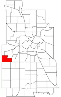 Location of Cedar-Isles-Dean within the U.S. city of Minneapolis | |
| Country | United States |
| State | Minnesota |
| County | Hennepin |
| City | Minneapolis |
| Community | Calhoun-Isles |
| Area | |
| • Total | 0.706 sq mi (1.83 km2) |
| Population (2020)[2] | |
| • Total | 3,753 |
| • Density | 5,300/sq mi (2,100/km2) |
| Time zone | UTC-6 (CST) |
| • Summer (DST) | UTC-5 (CDT) |
| ZIP code | 55416 |
| Area code | 612 |
| Census | Pop. | Note | %± |
|---|---|---|---|
| 1980 | 2,035 | — | |
| 1990 | 2,243 | 10.2% | |
| 2000 | 2,698 | 20.3% | |
| 2010 | 2,925 | 8.4% | |
| 2020 | 3,753 | 28.3% |
The Frank Lloyd Wright-designed Frieda and Henry J. Neils House is located near Cedar Lake in this neighborhood. 44.9541°N 93.3214°W[3]
References
- "Cedar-Isles neighborhood in Minneapolis, Minnesota (MN), 55405, 55416 detailed profile". City-Data. 2011. Retrieved 2013-11-12.
- "Cedar-Isles-Dean neighborhood data". Minnesota Compass. Retrieved 2023-02-19.
- Cedar-Isles-Dean, Minneapolis, MN. Google Earth. Retrieved 2011-03-09.
- Cedar-Isles-Dean, Minneapolis, MN. Google Earth. Retrieved 2011-03-09.
External links
Places adjacent to Cedar-Isles-Dean, Minneapolis | ||||||||||||||||
|---|---|---|---|---|---|---|---|---|---|---|---|---|---|---|---|---|
| ||||||||||||||||
This article is issued from Wikipedia. The text is licensed under Creative Commons - Attribution - Sharealike. Additional terms may apply for the media files.