Kenny, Minneapolis
Kenny is a neighborhood in the Southwest community in Minneapolis. Its boundaries are West 54th Street to the north, Lyndale Avenue South and Highway 121 to the east, West 62nd Street (Highway 62) to the south, and Logan Avenue South to the west.
Kenny | |
|---|---|
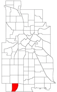 Location of Kenny within the U.S. city of Minneapolis | |
| Country | United States |
| State | Minnesota |
| County | Hennepin |
| City | Minneapolis |
| Community | Southwest |
| Area | |
| • Total | 0.651 sq mi (1.69 km2) |
| Population (2020)[2] | |
| • Total | 3,932 |
| • Density | 6,000/sq mi (2,300/km2) |
| Time zone | UTC-6 (CST) |
| • Summer (DST) | UTC-5 (CDT) |
| ZIP code | 55419 |
| Area code | 612 |
| Census | Pop. | Note | %± |
|---|---|---|---|
| 1980 | 4,081 | — | |
| 1990 | 3,708 | −9.1% | |
| 2000 | 3,493 | −5.8% | |
| 2010 | 3,523 | 0.9% | |
| 2020 | 3,932 | 11.6% |
Kenny contains one body of water, called Grass Lake. It has one elementary school called Kenny Elementary School, and has one middle school called Susan B. Anthony Middle School.
References
- "Kenny neighborhood in Minneapolis, Minnesota (MN), 55419 detailed profile". City-Data. 2011. Retrieved 2013-11-19.
- "Kenny neighborhood data". Minnesota Compass. Retrieved 2023-02-19.
- Kenny, Minneapolis, MN. Google Earth. Retrieved 2011-03-09.
- Kenny, Minneapolis, MN. Google Earth. Retrieved 2011-03-09.
External links
Places adjacent to Kenny, Minneapolis | ||||||||||||||||
|---|---|---|---|---|---|---|---|---|---|---|---|---|---|---|---|---|
| ||||||||||||||||
This article is issued from Wikipedia. The text is licensed under Creative Commons - Attribution - Sharealike. Additional terms may apply for the media files.