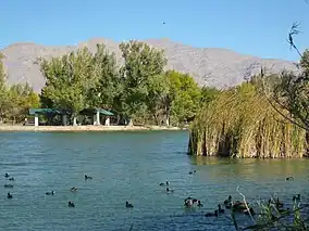
Centennial Hills, Las Vegas
Centennial Hills is a neighborhood in northwest Las Vegas, Nevada, United States. It is bordered by the Snow Mountain Paiute Reservation and Tule Springs Fossil Beds National Monument to the north, Lower Kyle Canyon and the Red Rock Canyon National Conservation Area to the west, Summerlin to the south, and North Las Vegas to the east. The Spring Mountains are visible to the west with Gass Peak in the Las Vegas Range to the north. Lone Mountain lies within the neighborhood.
Centennial Hills | |
|---|---|
Neighborhood | |
.jpg.webp) Aerial view of Centennial Hills in 2014 | |
| Etymology: Name chosen through contest[1] | |
| Country | United States |
| State | Nevada |
| County | Clark County |
| City | Las Vegas |
| Named | January 17, 2001 |
History
On January 17, 2001, northwest Las Vegas, which occupies over a third of the city's area, was unofficially given the name Centennial Hills in a contest, which won with 2,222 votes. Other proposed names for the area were Arrow Canyon with 1,784 votes, Tule Springs with 111 votes, and Cielo de Oro, chosen by Mayor Oscar Goodman, with 35 votes.[1]
On January 21, 2008, the Centennial Hills Hospital opened in Centennial Hills on Durango Drive, as the first tobacco-free campus in Nevada. The campus has 226 beds an area of 354,000 sq ft (32,900 m2) and includes two medical office buildings.[2]
Parks and recreation

Located just north of Centennial Hills, Tule Springs Fossil Beds National Monument is accessible from the neighborhood at Moccasin Road and Durango Drive.[3] Further south off Durango is Tule Springs, an urban retreat which is the location of Floyd Lamb Park, Tule Springs Ranch Historic Site, and Tule Springs Archeological Site.[4]
Among the other parks and playgrounds in the area is the main Centennial Hills Park, which features an amphitheater and has ice age fossil-themed trails and is built around a historic inverted riverbed.[5]
Transportation
Centennial Hills is centered around the interchange of U.S. Route 95 and Clark County Route 215, built in 2003. In 2015, upgrades to the junction preparing for Interstate 11 to pass through proceeded and it was named the Centennial Bowl.[6] Completion of the Centennial Bowl project is due in 2024.[7]
The RTC Centennial Hills Transit Center Park & Ride began construction in June 2009 and opened January 2010.[8]
Roads
Centennial Hills is served by the following roads:
- Highways

 Interstate 11 (future)/U.S. Route 95
 Clark County Route 215 (Las Vegas Beltway)
 Nevada State Route 157 (Kyle Canyon Road)
 Nevada State Route 573 (Craig Road)
 Nevada State Route 574 (Cheyenne Avenue)
 Nevada State Route 599/U.S. Route 95 Business (Rancho Drive)
- Major roads
Education
Notable high schools in Centennial Hills are the Centennial High School, Arbor View High School, and Shadow Ridge High School. Centennial Hills Library, next to Centennial Hills Park, serves the neighborhood.[9]
References
- Neff, Erin (18 January 2001). "Northwest to be called Centennial Hills". Las Vegas Sun. Retrieved 14 August 2021.
- "About the Hospital (archive)". Centennial Hills Hospital. Archived from the original on 2010-04-18. Retrieved 14 August 2021.
- Boone, Jim. "Tule Springs Fossil Beds National Monument - Area Overview". Bird and Hike. Retrieved 14 August 2021.
- Boone, Jim. "Birding Around Floyd Lamb Park at Tule Springs". Bird and Hike. Retrieved 14 August 2021.
- "Centennial Hills Park". Retrieved 14 August 2021.
- Velotta, Richard N. (6 August 2015). "Centennial Bowl interchange project starts". Las Vegas Review-Journal. Retrieved 14 August 2021.
- "NDOT Breaks Ground on $155 Million Final Centennial Bowl Phase in Northwest Las Vegas". Nevada Department of Transportation. 11 January 2021. Retrieved 14 August 2021.
- Hansen, Kyle B. (25 July 2009). "Centennial Hills transit center construction closes road". Las Vegas Sun. Retrieved 14 August 2021.
- "Centennial Hills Library". Retrieved 14 August 2021.