Central Bridge, New York
Central Bridge is a hamlet and census-designated place (CDP) within the towns of Schoharie and Esperance in Schoharie County, New York, United States. As of the 2010 census, the population was 593.
Central Bridge, New York | |
|---|---|
 Central Bridge  Central Bridge | |
| Coordinates: 42°42′40″N 74°20′19″W | |
| Country | United States |
| State | New York |
| County | Schoharie |
| Towns | Schoharie Esperance |
| Area | |
| • Total | 2.87 sq mi (7.43 km2) |
| • Land | 2.86 sq mi (7.40 km2) |
| • Water | 0.01 sq mi (0.04 km2) |
| Elevation | 621 ft (189 m) |
| Population (2020) | |
| • Total | 740 |
| • Density | 259.10/sq mi (100.04/km2) |
| Time zone | UTC-5 (Eastern (EST)) |
| • Summer (DST) | UTC-4 (EDT) |
| ZIP Code | 12035 (Central Bridge) 12092 (Howes Cave) |
| Area code(s) | 518/838 |
| FIPS code | 36-13530 |
| GNIS feature ID | 2628041[2] |
Central Bridge is in northeastern Schoharie County, in the northwestern part of the town of Schoharie and the southwestern section of Esperance. It is in the valley of Cobleskill Creek where it joins Schoharie Creek, a northward-flowing tributary of the Mohawk River. It is bordered to the south by Interstate 88 and to the east by Schoharie Creek. New York State Route 7 runs through the southern part of the community, leading east 11 miles (18 km) to Duanesburg and 23 miles (37 km) to Schenectady, and west 8 miles (13 km) to Cobleskill. New York State Route 30A passes through the center of the CDP, leading north 3 miles (5 km) to Sloansville and 18 miles (29 km) to Fultonville.
The hamlet of Old Central Bridge is in the southern part of the CDP.
Notable person
- George Westinghouse, pioneer in the electrical industry; born in Central Bridge
References
- "ArcGIS REST Services Directory". United States Census Bureau. Retrieved September 20, 2022.
- "Central Bridge Census Designated Place". Geographic Names Information System. United States Geological Survey, United States Department of the Interior.
- "Census of Population and Housing". Census.gov. Retrieved June 4, 2016.
Municipalities and communities of Schoharie County, New York, United States | ||
|---|---|---|
| Towns | 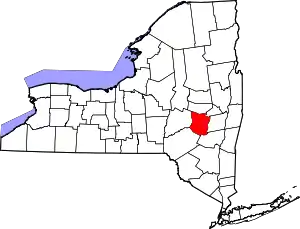 Map of New York highlighting Schoharie County | |
| Villages | ||
| CDPs | ||
| Hamlets | ||