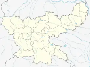
Chatra subdivision
Chatra subdivision is an administrative subdivision of the Chatra district in the North Chotanagpur division in the state of Jharkhand, India.
Chatra subdivision | |
|---|---|
Subdivision | |
 Chatra subdivision Location in Jharkhand, India  Chatra subdivision Chatra subdivision (India) | |
| Coordinates: 25.05°N 87.84°E | |
| Country | |
| State | Jharkhand |
| District | Chatra |
| Headquarters | Chatra |
| Area | |
| • Total | 2,121.63 km2 (819.17 sq mi) |
| Population | |
| • Total | 685,694 |
| • Density | 320/km2 (840/sq mi) |
| Languages | |
| • Official | Hindi, Urdu |
| Time zone | UTC+5:30 (IST) |
| Website | chatra |
History
Chatra was the "headquarters" of Ramgarh district in the 18th-19th century. The renowned reformer, Raja Rammohan Roy, was sheristadar in Ramgarh district, in 1804–05, and used to function from both Ramgarh and Chatra. Subsequently, Ramgarh district became part of North-western Frontier Agency and Hazaribagh district came up. Chatra became a subdivision of Hazaribagh district in 1914. It became a full-fledged district in 1991.[1][2]
Administrative set up
Chatra district has two subdivisions – (1) Chatra subdivision with Chatra, Shalighram Ramnarayanpur (Hunterganj), Itkhori, Pratappur, Kunda, Kanhachatti and Mayurhand CD blocks, and (2) Simaria subdivision with Simaria, Tandwa, Lawalong, Gidhour and Pathalgada block CD blocks.[3]
The two subdivisions are as follows:[3][4]
| Subdivision | Headquarters | Area km2 | Population (2011) | Rural Population % (2011) | Urban Population % (2011) |
|---|---|---|---|---|---|
| Chatra | Chatra | 2,121.63 | 685,694 | 92.71 | 7.29 |
| Simaria | Simaria | 1,668.95 | 357,192 | 96.37 | 3.63 |
M: municipality, CT: census town, R: rural/ urban centre, H: historical/ religious centre, P: power plant, T: tourist centre
Abbreviation used - TPS: thermal power station
Owing to space constraints in the small map, the actual locations in a larger map may vary slightly
Demographics
According to the 2011 Census of India data, Chatra subdivision, in Chatra district, had a total population of 685,694. There were 351,511 (51%) males and 334,183 (49%) females. Scheduled castes numbered 231,266 (33.73%) and scheduled tribes numbered 9,915 (1.45%). Literacy rate was 47.92% (for the total population).[5]
See also – List of Jharkhand districts ranked by literacy rate
Police stations
Police stations in Chatra subdivision were at:[6]
Blocks
Community development blocks in Chatra subdivision are:[7][8]
| CD block | Headquarters | Area km2 | Population (2011) | SC % | ST % | Literacy Rate % | NP, CT |
|---|---|---|---|---|---|---|---|
| Chatra | Chatra | 400.21 | 101,014 | 37.98 | 3.74 | 55.54 | - |
| Shaligram Ramnarayanpur | Hunterganj | 513.18 | 187,590 | 37.29 | 0.33 | 54.83 | - |
| Itkhori | Itkhori | 160.60 | 74,929 | 22.37 | 0.42 | 62.90 | - |
| Kunda | Kunda | 285.08 | 30,018 | 63.57 | 3.85 | 44.84 | - |
| Pratappur | Pratappur | 385.79 | 120,221 | 36.20 | 1.12 | 53.19 | - |
| Kanhachatti | Chiridiri | 227.49 | 63,012 | 32.23 | 3.20 | 62.88 | - |
| Mayurhand block | Mayurhand | 133.28 | 58,925 | 26.22 | 0.36 | 64.41 | - |
Education
In 2011, in Chatra subdivision out of a total 1,026 inhabited villages there were 252 villages with pre-primary schools, 833 villages with primary schools, 442 villages with middle schools, 70 villages with secondary schools, 34 villages with senior secondary schools, 3 locations with general degree colleges, 1 location with non-formal training centre, 2 locations with vocational training institutes, 191 villages with no educational facility.[9]
.*Senior secondary schools are also known as Inter colleges in Jharkhand
Educational institutions
The following institutions are located in Chatra subdivision:
- Chatra College was established at Chatra in 1961. It is affiliated with the Vinoba Bhave University.[10]
- R.N.M. College at Hunterganj is affiliated with the Vinoba Bhave University.[11]
- Bhadrakali College was established at Itkhori in 1979. It is affiliated with Vinoba Bhave University.[12]
(Information about degree colleges with proper reference may be added here)
Healthcare
In 2011, in Chatra subdivision there were 58 villages with primary health centres, 86 villages with primary health subcentres, 65 villages with maternity and child welfare centres, 35 villages with allopathic hospitals, 30 villages with dispensaries, 27 villages with veterinary hospitals, 38 villages with family welfare centres, 1 location with a nursing home, 70 villages with medicine shops.[9]
.*Private medical practitioners, alternative medicine etc. not included
Medical facilities
(Anybody having referenced information about location of government/ private medical facilities may please add it here)
References
- "The History of Chatra District". chatra.jharkhand.org. Retrieved 17 January 2021.
- "Profile". Chatra district website. Archived from the original on 2012-02-15.
- "Chatra". Administrative Setup – Subdivision and Blocks. Chatra district administration. Retrieved 17 January 2021.
- "2011 Census C.D. Block Wise Primary Census Abstract Data(PCA)". Jharkhand – District-wise CD Blocks. Registrar General and Census Commissioner, India. Retrieved 20 November 2015.
- "District Census Handbook, Chatra, Series 21, Part XII B" (PDF). Page 26-27: District Primary Census Abstract, 2011 census. Directorate of Census Operations Jharkhand. Retrieved 17 January 2021.
- "District Police Profile - Chatra". Jharkhand Police. Retrieved 17 January 2021.
- "District Census Handbook, Chatra" (PDF). Census of India 2011 Pages 26, 27. Directorate of Census Operations, Jharkhand. Retrieved 17 January 2021.
- "District Census Handbook, Chatra, Series 21, Part XII A" (PDF). Map of Chatra on the third page. Directorate of Census Operations Jharkhand. Retrieved 17 January 2021.
- "District Census Handbook, Chatra, 2011, Series 21, Part XII A" (PDF). Page 671, Appendix I: Directory. Directorate of Census Operations, Jharkhand. Retrieved 17 January 2021.
- "Chatra College, Chatra". College Dekho. Retrieved 19 January 2021.
- "R.N.M. College, Hunterganj, Chatra". ICBSE. Retrieved 20 January 2021.
- "Bhadrakali College, Itkhori". Board Univ Result. Retrieved 20 January 2021.
