Chennai district
Chennai district, formerly known as Madras district,[lower-alpha 1] is one of the 38 districts in the state of Tamil Nadu, India. It is the smallest and the most densely populated district in the state. The district is coterminous with the city of Chennai, which is administered by the Greater Chennai Corporation. It is surrounded by Tiruvallur district in the north and the west, Kanchipuram district in the south-west, Chenglpattu district in the south, and the Bay of Bengal in the east.
Chennai District
Madras | |
|---|---|
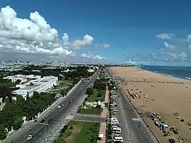 View of Marina Beach | |
Nicknames:
| |
.svg.png.webp) Location in Tamil Nadu | |
| Coordinates: 13°5′2″N 80°16′12″E | |
| Country | |
| State | |
| Region | Chola Nadu |
| Headquarters | Chennai |
| Talukas | Alandur, Aminjikarai, Ambattur, Ayanavaram, Egmore, Guindy, Madhavaram, Maduravoyal, Mylapore, Mambalam, Purasawalkam, Perambur, Shollinganallur, Thiruvottiyur, Tondiarpet, Velachery |
| Government | |
| • District Collector | Tmt.S.Amirtha Jothi, IAS |
| • Commissioner of Police Greater Chennai | Shankar Jiwal, IPS |
| Area | |
| • Total | 426 km2 (164 sq mi) |
| Elevation | 6.7 m (22.0 ft) |
| Population (2011)[4] | |
| • Total | 6,748,026 |
| • Density | 16,000/km2 (41,000/sq mi) |
| Demonym(s) | Chennaiite Chennaikaran |
| Languages | |
| • Official | Tamil |
| Time zone | UTC+5:30 (IST) |
| PIN | 600XXX |
| Telephone code | 44 |
| ISO 3166 code | 044 |
| Vehicle registration | TN01 To TN10 TN13 TN14 TN18 TN22 |
| Sex ratio | 951 female / 1000 male[5] |
| Literacy | 90.33%[5] |
| Website | https://chennai.nic.in/ |
As of 2011, the district had a population of 67,48,026 with a sex-ratio of 989 females for every 1,000 males.[5] Much of the district's population descended from its settlements in the 1st century CE to the Middle Ages, but the diversity has grown much since then. The district consists of only one civic body, the megacity of Chennai, which forms the core and the most notable portion of the much bigger Chennai metropolis, or officially, the Chennai Metropolitan Area. In 2018, the district's limits were expanded, aligning with that of the newly expanded Greater Chennai Corporation, which had annexed adjacent municipalities. It resulted in the area being increased from 175 square kilometres (68 sq mi) to 426 square kilometres (164 sq mi).[3][6] The district is divided into three revenue divisions and ten taluks.
Etymology
The name Chennai was derived from Damarla Chennappa Nayak, the father of a general of the Vijayanagar Empire.[7]
Geography
Chennai district covers an area of 426 km2 located on the Eastern Coastal Plains of India. It is situated on the northeastern corner of Tamil Nadu along the Coramandel coast, a region bounded by the Bay of Bengal and is surrounded inland by the districts of Tiruvallur, Kanchipuram and Chengalpattu. It lies between 12°59' and 13°9' of the northern latitude and 80°12' and 80°19' of the eastern longitude at an average altitude of 6 metres above sea level on a 'sandy shelving breaker swept' beach. Terrain slope varies from 1:5000 to 1:10,000.[8] The terrain is very flat with contours ranging from 2 m to 10 m above mean sea level with a few isolated hillocks in the southwest beyond the district limits at St. Thomas Mount, Pallavaram and Tambaram.[9]
The district runs inland in a rugged semi-circular fashion and its coastline is about 25.60 km (2.5% of the total coastline of Tamil Nadu). Because of its strategic location and economic importance, it is referred to as the "Gateway of South India." The drainage system includes two rivers, namely, Cooum (flowing in the northern part) and Adyar (flowing in the southern part), a canal (the Buckingham), and a stream (the Otteri Nullah) slicing the district into several islands.
The district falls under Seismic Zone III indicating a moderate risk of earthquake. Geologically the district is divided into three regions, namely, sandy, clayey and hard-rock regions. The soil comprises clay, shale and sandstone.[10]
Of the total land area, reserved forests cover 2.71 km2 and is concentrated in and around the Guindy National Park region, one of the few national parks in the world located within a city. The forest cover of the district is as follows:[11]
| Class | Area (Ha) | Percentage |
|---|---|---|
| Dense forest | 151.01 | 1.16 |
| Moderate dense TOF | 121.16 | 0.93 |
| Non-forest | 12,215.56 | 94.06 |
| Open forest | 114.24 | 0.88 |
| Open TOF | 153.73 | 1.18 |
| Water | 231.46 | 1.78 |
| Total | 12,987.16 | 100 |
Climate
Chennai has Tropical savanna climate (Köppen: Aw)
| Climate data for Chennai, India | |||||||||||||
|---|---|---|---|---|---|---|---|---|---|---|---|---|---|
| Month | Jan | Feb | Mar | Apr | May | Jun | Jul | Aug | Sep | Oct | Nov | Dec | Year |
| Record high °C (°F) | 33 (91) |
37 (99) |
39 (102) |
43 (109) |
45 (113) |
43 (109) |
41 (106) |
40 (104) |
39 (102) |
39 (102) |
34 (93) |
33 (91) |
45 (113) |
| Average high °C (°F) | 29 (84) |
31 (88) |
33 (91) |
35 (95) |
38 (100) |
38 (100) |
36 (97) |
35 (95) |
34 (93) |
32 (90) |
29 (84) |
29 (84) |
33 (92) |
| Average low °C (°F) | 19 (66) |
20 (68) |
22 (72) |
26 (79) |
28 (82) |
27 (81) |
26 (79) |
26 (79) |
25 (77) |
24 (75) |
22 (72) |
21 (70) |
24 (75) |
| Record low °C (°F) | 14 (57) |
15 (59) |
17 (63) |
20 (68) |
21 (70) |
21 (70) |
22 (72) |
21 (70) |
21 (70) |
17 (63) |
15 (59) |
14 (57) |
14 (57) |
| Average precipitation mm (inches) | 16.2 (0.64) |
3.7 (0.15) |
3.0 (0.12) |
13.6 (0.54) |
48.9 (1.93) |
53.7 (2.11) |
97.8 (3.85) |
149.7 (5.89) |
109.1 (4.30) |
282.7 (11.13) |
350.3 (13.79) |
138.2 (5.44) |
1,266.9 (49.88) |
| Source: Indian Meteorological Department[12] | |||||||||||||
Demographics
According to 2011 census, Chennai district had a population of 4,646,732 in unexpanded old limits area of 176 sq.km. with a sex-ratio of 989 females for every 1,000 males, much above the national average of 929. Scheduled Castes and Scheduled Tribes accounted for 16.78% and 0.22% of the population respectively. The average literacy of the district was 81.27%, compared to the national average of 72.99%.[5] With the expanded limits to 426 sq. km. Chennai district had a population of 6,748,026 as per 2011 census data.[4]
The district had a total of 1,154,982 households. There were a total of 1,817,297 workers, comprising 10,210 cultivators, 10,251 main agricultural labourers, 29,143 in house hold industries, 1,569,950 other workers, 197,743 marginal workers, 4,244 marginal cultivators, 3,423 marginal agricultural labourers, 8,202 marginal workers in household industries and 181,874 other marginal workers.[13]
Religion
Administration and politics

In 2013, five taluks on the district were split to create five new ones: Velachery, Purasawalkam, Ayanavaram, Aminjikarai and Guindy.[14]
In January 2018, the state government announced that the district will be expanded to match the boundaries of the Greater Chennai Corporation. This will integrate six additional taluks from Tiruvallur and Kanchipuram districts into the Chennai district. The new divisions and taluks of the district will be:[3][6]
Revenue divisions and taluks
- North Chennai Revenue Division, headquartered at Tondiarpet, contains taluks of Tiruvottiyur, Madhavaram, Perambur, Tondiarpet, and Purasaiwalkam.
- Central Chennai Revenue Division, headquartered at Ambattur, contains the taluks of Mambalam, Egmore, Aminjikarai, Ayanavaram, Ambattur, and Maduravoyal.
- South Chennai Revenue Division, headquartered at Guindy, contains the taluks of Mylapore, Guindy, Velachery, Alandur, and Sholinganallur.
Members of Parliament
| PC No. | Constituency | Political Party |
Elected Representative |
|---|---|---|---|
| 1 | Chennai North | DMK | V. Kalanithi Veerasamy |
| 2 | Chennai South | DMK | T. Thamizhachi Thangapandian |
| 3 | Chennai Central | DMK | M. Dhayanithi Maaran |
| 4 | Sriperumbudur (partially) | DMK | T.R.Baalu |
Politics
See also
Notes
- Both of these terms are also often used as metonyms for the Chennai metropolitan area's trading and financial services industries, which continue a notable history of being largely based in the city. The name Chennai is colloquially used for a far wider area than just the city. Chennai most often denotes the sprawling Chennai metropolis, including parts from the three districts of Tamil Nadu adjacent to the city/district of Chennai itself. This wider usage of Chennai is documented as far back as 1639, when the Madras Municipal Corporation was created.
References
- "Chennai has emerged as India's Detroit". Deccan Herald. Retrieved 7 June 2017.
- "India Is Becoming A Hub For 'Medical Tourists' — Despite The 'Million Dollar Difference' In Care". Business Insider. 12 June 2014. Retrieved 21 March 2017.
- Dennis S. Jesudasan (5 January 2018). "Chennai district doubles in size". The Hindu. Retrieved 23 November 2019.
- "Chennai District | Government of Tamil Nadu | Gateway of South India | India".
- "District Census Handbook Chennai, Part XII - B" (PDF). Census of India 2011. 16 June 2014.
- Yogesh, Kabirdoss (19 January 2018). "Chennai district boundaries likely to be redrawn on April 1". The Times of India. Retrieved 23 November 2019.
- "District Profile, Chennai". Government of Tamil Nadu. Archived from the original on 15 April 2012. Retrieved 27 November 2015.
- "Session-3 River and Drainage System in CMA" (PDF). CMDA. Retrieved 30 December 2011.
- Chapter IX Macro Drainage System in CMA
- John, Ekatha Ann (29 September 2012). "Disaster body for panel to monitor highrises in Chennai". The Times of India. Chennai. Archived from the original on 29 April 2013. Retrieved 25 July 2015.
- "Forest at Glance". Tamil Nadu Forest Department. Archived from the original on 20 May 2011.
- "Climatological Information for Chennai". Indian Meteorological Department. Archived from the original on 5 February 2009. Retrieved 25 January 2009.
- "Census Info 2011 Final population totals – Chennai district". Office of The Registrar General and Census Commissioner, Ministry of Home Affairs, Government of India. 2013. Retrieved 26 January 2014.
- Mariappan, Julie (21 December 2013). "Chennai now has 10 taluks, as govt gets close to you". The Times of India. Retrieved 23 November 2019.
