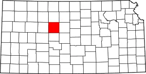
Chetolah, Kansas
Chetolah is a ghost town in Ellis County, Kansas, United States.[1]
History
Chetolah was founded in the 1880s when promoters laid out a town site and built a hotel, livery stable, and store. The Chetolah Town Site Company was incorporated in 1888 and then renamed the Chetolah Land and Town Company in 1889. The company had plans for a railroad connection, but no such connection was ever built.
The initial settlement was unsuccessful, but the town revived in the 1890s with the purported discovery of gold in the grey Carlile Shale of the surrounding hills.[2] A three-year gold rush ensued, and the town grew as promoters attempted various schemes for recovering alleged traces of gold from the shales along the Smoky Hill River. The hotel reopened and a bridge was built across the river into the settlement. Following failure of the gold rush, which both the first Kansas state geologist, Erasmus Haworth,[3] and Thomas Edison had previously declared a hoax,[4] Chetolah was abandoned and became a ghost town. Today, very little remains of the settlement.[1]
See also
References
- "Ellis County, Kansas; City of Chetolah". KSGenWeb. Archived from the original on 6 June 2013. Retrieved 11 June 2014.
- N. W. Bass. Geologic Investigations in Western Kansas with special reference to oil and gas possibilities, Bulletin 11. p. Part I--The Geology of Ellis County, Kansas. Retrieved November 28, 2020.
In 1903 a well was drilled near the center of sec. 10, T. 15 S., R. 20 W. (Darton, 1905), in search of gas for use in mills that were being erected for the extraction of gold from the Carlile shale (Lindgren, 1902)
- Rex C. Buchanan. "'To bring together, correlate, and preserve'--a history of the Kansas Geological Survey, 1864-1989". Retrieved November 28, 2020.
I might have learned that Erasmus Haworth had been the first state geologist and director of the present Geological Survey and that he had mapped the structure on which lies the most productive oil field in Kansas, the El Dorado of Butler County.
- Dan Plazak (2007). "The imaginary gold mines of Kansas" (PDF). Mining History Journal. 14: 11–22. Retrieved November 28, 2020.
Further reading
- Gordon Marlatt, Gold Occurrences in the Cretaceous Mancos Shale, Eastern Utah, Utah Geological and Mineral Survey, 1991. (The Mancos Shale encompasses shale corelating with the Carlile Shale.)
- Lindgren, Waldemar, 1902, Tests for gold and silver in shales from western Kansas: U. S. Geol. Survey, Bull. 202, 21 p.
- Jessica C. Wheeler, Chetolah, Ellis County: Chetolah: One Place, Many Faces, Lost Kansas Communities, 2012.
