Ciego de Ávila Province
Ciego de Ávila (Spanish pronunciation: [ˈsjeɣo ðe ˈaβila]) is one of the provinces of Cuba, and was previously part of Camagüey Province. Its capital is Ciego de Ávila, which lies on the Carretera Central (central highway), and the second city is Morón, further north.
Ciego de Ávila
Provincia de Ciego de Ávila | |
|---|---|
| Ciego de Ávila Province | |
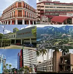 Ciego de Ávila skyline collage | |
 Coat of arms | |
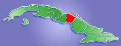 Ciego de Ávila's location in the Island of Cuba | |
| Country | |
| Department | Coastal Department |
| Settled | March 5, 1558 |
| Capital | Ciego de Ávila |
| Area | |
| • Province of Cuba | 6,946.90 km2 (2,682.21 sq mi) |
| Population | |
| • Province of Cuba | 503,353 |
| • Density | 72/km2 (190/sq mi) |
| • Urban | 430,616 |
| • Rural | 72,737 |
| Time zone | UTC-5 (EST) |
| HDI (2019) | 0.784[2] high · 7th of 16 |
| Website | https://www.ciegodeavila.gob.cu/es/ |
The province was separated from Camagüey Province in 1976 by the government.
Geography
Off the north coast of the province, some (cays) of the Jardines del Rey archipelago are being developed as tourist resorts, principally Cayo Coco and Cayo Guillermo. The south coast is characterised by mangroves.
Between Morón and the north coast are several lakes, including the Laguna de Leche (the Lagoon of Milk, so called for its white appearance because of large lime deposits underwater) which is the largest natural lake in Cuba.
Economy
Central Ciego de Ávila is used for cattle ranching, elsewhere in the province sugar, pineapples and citrus fruit are grown. Pineapples are the staple crop, but sweet potatoes, potatoes, yuca, plantains, and bananas are also cultivated for national consumption.
Municipalities
| Municipality | Population (2004) | Area (km²) | Location | Remarks |
|---|---|---|---|---|
| Baraguá | 32,408 | 728 | 21.68222°N 78.62444°W | includes Gaspar |
| Bolivia | 16,612 | 918 | 22.07500°N 78.35028°W | |
| Chambas | 39,868 | 769 | 22.19667°N 78.91306°W | |
| Ciego de Ávila | 135,736 | 445 | 21.84806°N 78.76278°W | Provincial capital |
| Ciro Redondo | 29,560 | 588 | 22.01889°N 78.70278°W | |
| Florencia | 19,811 | 286 | 22.14750°N 78.96694°W | |
| Majagua | 26,617 | 544 | 21.92444°N 78.99056°W | |
| Morón | 60,612 | 615 | 22.11083°N 78.62778°W | includes Cayo Coco |
| Primero de Enero | 27,813 | 713 | 21.94528°N 78.41889°W | |
| Venezuela | 27,333 | 716 | 21.75111°N 78.77889°W |
Source: Population from 2004 Census.[3] Area from 1976 municipal re-distribution.[4]
Demographics
In 2004, the province of Ciego de Ávila had a population of 416,370.[3] With a total area of 6,783.13 km2 (2,618.98 sq mi),[5] the province had a population density of 61.4/km2 (159/sq mi).
References
- "Lugar que ocupa el territorio según la superficie y la población" (PDF). Una MIRADA a Cuba (in Spanish). Oficina Nacional de Estadísticas. Cuba. 2010. Archived from the original (PDF) on 2019-03-11. Retrieved 2012-01-15.
- "Sub-national HDI - Area Database - Global Data Lab". hdi.globaldatalab.org. Retrieved 2018-09-13.
- Atenas.cu (2004). "2004 Population trends, by Province and Municipality" (in Spanish). Archived from the original on 2006-07-14. Retrieved 2007-10-06.
- Statoids (July 2003). "Municipios of Cuba". Retrieved 2007-10-06.
- Government of Cuba (2002). "Population by Province" (in Spanish). Retrieved 2007-10-06.