Circle of Palms Plaza
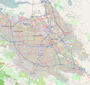
The Circle of Palms Plaza is located in downtown San Jose, California. It is composed of a ring of palm trees encircling a California State Seal, and designates the California Historical Marker 461, the site of California's first state capital from 1849-1851.
 Circle of Palms Plaza with the Fairmont San Jose and Fairmont Plaza | |
 | |
| Area | 2.3-acre (9,000 m²) |
|---|---|
| Location | San Jose, California |
| History of California |
|---|
 |
| Periods |
| Topics |
| Cities |
| Regions |
| Bibliographies |
|
|
History
When California became part of the USA in 1850, San Jose was the oldest civilian settlement dating back to its establishment in 1777, and selected the first official state capital of California.[1][2] A two-story adobe hotel built around 1830 became the first state capitol and hosted the first legislative sessions in 1850 and 1851.[3] The capitol site is designated as California Historical Marker 461. From 1866 to 1887, the Market Street Chinatown occupied the entire block. The settlement was the center of Chinese-American life in the Santa Clara Valley, until it was destroyed by arson. The site was redeveloped into a plaza in the 1980s.
Description
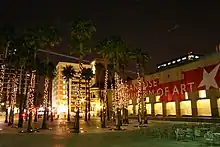
The Circle of Palms Plaza is a ring of palm trees encircling a California State Seal, located between the Fairmont San Jose Hotel, the KQED building (Silicon Valley Financial Center) and the San Jose Museum of Art.[4][5] The concrete around the state seal contains quotes from the 1849 state constitutional convention in Monetery where San Jose was chosen as the capital.
Public activities
Each Winter, the San Jose Downtown Association sets up an outdoor ice rink called "San Jose Downtown Ice" at the Circle of Palms.[6]
Photo gallery
 Circle of Palms Plaza
 The ice rink at the plaza in the Winter
 State seal at center of the Circle of Palms
 Night view of the Circle of Palms Plaza and the San Jose Museum of Art
 San Jose Museum of Art and Circle of Palms
 Circle of Palms Plaza and Fairmont at Night
 Circle of Palms and San Jose Museum of Art
See also
References
- "Spanish Period". November 5, 2013.
- "California Capitol Museum – California State Capitol History: Part 1".
- Favorite Images, Stories, Trivia - Capital & Capitol History, Tigerleaf.com
- "Santa Clara". California State Parks, Office of Historic Preservation. Retrieved April 23, 2008.
- "First State Capitol Building". HMDB.org, the Historical Marker Database. November 17, 2007. Retrieved April 23, 2008.
- "San Jose Downtown Ice". San Jose Downtown Association. Archived from the original on April 18, 2008. Retrieved April 23, 2008.
External links
- Scenes of San Jose: Circle of Palms, photo by Dana Grover
- View of the Plaza from above