Clarence-Rockland
Clarence-Rockland is a city in Eastern Ontario, Canada, in the United Counties of Prescott and Russell on the Ottawa River.
Clarence-Rockland | |
|---|---|
| City of Clarence-Rockland Cité de Clarence-Rockland | |
 | |
 Clarence-Rockland 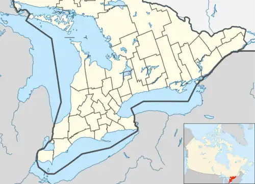 Clarence-Rockland | |
| Coordinates: 45°29′17″N 75°12′54″W | |
| Country | Canada |
| Province | Ontario |
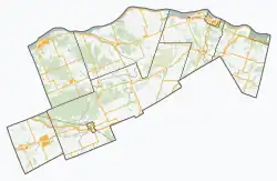
| County | Prescott and Russell |
| Settled | 1840s |
| Incorporation | January 1998 |
| Government | |
| • Type | City |
| • Mayor | Mario Zanth |
| Area | |
| • Land | 297.71 km2 (114.95 sq mi) |
| Population (2021)[1] | |
| • Total | 26,505 |
| • Density | 82.3/km2 (213/sq mi) |
| Time zone | UTC−05:00 (EST) |
| • Summer (DST) | UTC−04:00 (EDT) |
| Area code | 613 / 343 |
| Website | www |
Clarence-Rockland is located immediately to the east of Ottawa and is considered part of the Prescott and Russell County.
The city was formed on January 1, 1998, through the amalgamation of the Town of Rockland with Clarence Township.[2]
Communities
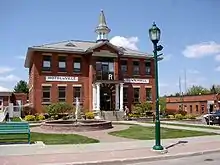
The city includes the communities of Bourget, Cheney, Clarence, Clarence Creek, Hammond, Rockland, and Saint-Pascal-Baylon. The city administrative offices are located in Rockland, which is the largest community in the city.
Demographics
| Year | Pop. | ±% |
|---|---|---|
| 1986 | 12,410 | — |
| 1991 | 15,753 | +26.9% |
| 1996 | 18,633 | +18.3% |
| 2001 | 19,612 | +5.3% |
| 2006 | 20,790 | +6.0% |
| 2011 | 23,185 | +11.5% |
| 2016 | 24,512 | +5.7% |
| 2021 | 26,505 | +8.1% |
| Population amounts prior to 1998 are total of Clarence TP and Rockland T. Source: Statistics Canada | ||
In the 2021 Census of Population conducted by Statistics Canada, Clarence-Rockland had a population of 26,505 living in 10,095 of its 10,316 total private dwellings, a change of 8.1% from its 2016 population of 24,512. With a land area of 297.47 km2 (114.85 sq mi), it had a population density of 89.1/km2 (230.8/sq mi) in 2021.[3]
| 2021 | 2016 | 2011 | |
|---|---|---|---|
| Population | 26,505 (+8.1% from 2016) | 24,512 (5.7% from 2011) | 23,185 (11.5% from 2006) |
| Land area | 297.47 km2 (114.85 sq mi) | 297.71 km2 (114.95 sq mi) | 297.86 km2 (115.00 sq mi) |
| Population density | 89.1/km2 (231/sq mi) | 82.3/km2 (213/sq mi) | 77.8/km2 (202/sq mi) |
| Median age | 43.2 (M: 42.4, F: 44.0) | 42.2 (M: 41.8, F: 42.7) | 40.2 (M: 39.9, F: 40.5) |
| Private dwellings | 10,316 (total) 10,095 (occupied) | 9,537 (total) | 8796 (total) |
| Median household income | $106,000 | $88,823 | $82,898 |
Public transportation
Clarence-Rockland Transpo provides a public transportation service to residents of the city; part of the Rural Partners Transit Service.
References
- "Census Profile, 2016 Census: Clarence-Rockland". Statistics Canada. 8 February 2017. Retrieved July 1, 2019.
- Dunford, Fraser; Society, Ontario Genealogical (2005). Municipal Records in Ontario: History and Guide. Ontario Genealogical Society. ISBN 978-0-7779-2150-0.
- "Population and dwelling counts: Canada, provinces and territories, census divisions and census subdivisions (municipalities), Ontario". Statistics Canada. February 9, 2022. Retrieved March 27, 2022.
- "2021 Community Profiles". 2021 Canadian Census. Statistics Canada. February 4, 2022. Retrieved 2023-10-19.
- "2016 Community Profiles". 2016 Canadian Census. Statistics Canada. August 12, 2021. Retrieved 2019-07-01.
- "2011 Community Profiles". 2011 Canadian Census. Statistics Canada. March 21, 2019. Retrieved 2012-02-28.
- "2006 Community Profiles". 2006 Canadian Census. Statistics Canada. August 20, 2019.
- "2001 Community Profiles". 2001 Canadian Census. Statistics Canada. July 18, 2021.
External links
Places adjacent to Clarence-Rockland | |
|---|---|