Øygarden
Øygarden is a municipality in Vestland county, Norway. It is an island municipality located in the traditional district of Midhordland, stretching along the west coast of the county. The village of Straume is the administrative centre of the municipality. Other villages in the municipality include Alveim, Blomvåg, Vikavågen, Ågotnes, Fjell, Foldnes, Knappskog, Knarrevik, Kolltveit, Landro, Sekkingstad, Skogsvåg, Klokkarvik, Tælavåg, Kausland, and Hammarsland.
Øygarden kommune | |
|---|---|
 View of the local Blomvåg Church | |
 Flag  Vestland within Norway | |
 Øygarden within Vestland | |
| Coordinates: 60°36′39″N 04°49′29″E | |
| Country | Norway |
| County | Vestland |
| District | Midhordland |
| Established | 1 Jan 1964 |
| • Preceded by | Hjelme and Herdla |
| Administrative centre | Straume |
| Government | |
| • Mayor (2019) | Tom Georg Indrevik (H) |
| Area | |
| • Total | 314.50 km2 (121.43 sq mi) |
| • Land | 300.34 km2 (115.96 sq mi) |
| • Water | 14.16 km2 (5.47 sq mi) 4.5% |
| • Rank | #260 in Norway |
| Population (2022) | |
| • Total | 39,032 |
| • Rank | #27 in Norway |
| • Density | 130/km2 (300/sq mi) |
| • Change (10 years) | |
| Demonym | Øygarding[1] |
| Official language | |
| • Norwegian form | Nynorsk |
| Time zone | UTC+01:00 (CET) |
| • Summer (DST) | UTC+02:00 (CEST) |
| ISO 3166 code | NO-4626 |
| Website | Official website |

The municipality consists of a chain of islands to the north and west of the city of Bergen. Øygarden is connected to the mainland by a series of bridges and a single road running across the islands. Some of the major islands include Litlesotra, Store Sotra, Bildøy, Bjorøy, Misje, Turøy, Seløyna, Alvøyna, Ona, Blomøyna, Rongøyna, and Toftøyna.
The 315-square-kilometre (122 sq mi) municipality is the 260th largest by area out of the 356 municipalities in Norway. Øygarden is the 27th most populous municipality in Norway with a population of 39,032. The municipality's population density is 130 inhabitants per square kilometre (340/sq mi) and its population has increased by 16.3% over the previous 10-year period.[3][4]
General information
The municipality of Øygarden was established on 1 January 1964. It was created by a merger that was set in motion by the Schei Committee. The newly created Øygarden was made up of all of the old municipality of Hjelme (population: 956) and almost all of the municipality of Herdla (population: 2131) that was located west of the Hjeltefjorden (except for the islands of Turøy and Misje which went to the neighboring municipality of Fjell).[5]
On 1 January 2020, the three neighboring municipalities of Fjell, Sund, and Øygarden were merged into one large island municipality called Øygarden.[6]
The administrative centre of Øygarden has changed three times over the years. From 1964 until 2009, it was located at the village of Tjeldstø. From 2009 through 2019, it was located in the village of Rong. In 2020, the administrative centre was moved to the large village of Straume after the municipal merger with Fjell and Sund.
Name
The municipality of Øygarden was created in 1964 and the name was created at the same time. The name is the finite form of øygard which means "island group" or more specifically "row (fence) of islands". The first element is identical to the word øy which means "island". The last element is garden which means "the farm".[7]
Coat of arms


The original coat of arms was granted in 1966, shortly after the establishment of the municipality. The blazon was "Azure, a fess engrailed argent below a cairn sable and argent". This means the arms have a blue field (background) and the charge is a reference sea cairn sitting on an islet rising above a sea wave. The wave and a small stripe on the buoy both have a tincture of argent which means it is commonly colored white, but if it is made out of metal, then silver is used. The municipality consisted of larger and smaller islands and islets. The design was chosen to symbolize the importance of fishing and sea navigation for the area. Hence the importance of sea cairns, buoys and lighthouses for safety in the municipality. The arms were designed by Magnus Hardeland. The municipal flag has the same design as the coat of arms.[8][9]
A new coat of arms was adopted in 2019 for use starting on 1 January 2020 after a municipal merger where Sund, Fjell, and Øygarden merged to form a new Øygarden municipality. The new municipality decided to use the coat of arms for the old Sund Municipality which had originally been granted to that municipality on 23 March 1988. The official blazon is "Argent, a lighthouse couped azure" (Norwegian: På sølv grunn ei blå fyrlykt). This means the arms have a field (background) has a tincture of argent which means it is commonly colored white, but if it is made out of metal, then silver is used. The charge is a lighthouse. The lighthouse reflects the municipality's close ties to the sea, and the white colour represents the light emitted from the lighthouse. The arms were designed by Even Jarl Skoglund. The municipal flag has the same design as the coat of arms.[8][10][11][12]
Churches
The Church of Norway has four parishes (sokn) within the municipality of Øygarden. It is part of the Vesthordland prosti (deanery) in the Diocese of Bjørgvin.
| Parish (sokn) | Church name | Location of the church | Year built |
|---|---|---|---|
| Blomvåg | Blomvåg Church | Blomvåg | 1931 |
| Fjell | Fjell Church | Fjell | 1874 |
| Foldnes Church | Foldnes | 2001 | |
| Landro Church | Landro | 1977 | |
| Hjelme | Hjelme Church | Seløyna | 1971 |
| Old Hjelme Church | Seløyna | 1875 | |
| Fjell | Fjell Church | Fjell | 1874 |
| Foldnes Church | Foldnes | 2001 | |
| Landro Church | Landro | 1977 |
Geography
The municipality is made up of many islands. The main islands are (from north to south): Seløyna (7.2 km2 [2.8 sq mi]), Alvøyna (12.2 km2 [4.7 sq mi]), Ona (6.8 km2 [2.6 sq mi]), Blomøyna (9.1 km2 [3.5 sq mi]), Rongøyna (2.7 km2 [1.0 sq mi]), Toftøyna (7.5 km2 [2.9 sq mi]), Misje, Turøyna Sotra, Litlesotra, Geitung, Bildøyna, Bjorøy, Algrøyna, Lokøyna, Syltøyna, Toftøya, Lerøyna, Bjelkarøyna, Tyssøyna, Risøy, Vardøy, Golten, and Viksøy. Besides these larger islands, the municipality consists of hundreds small islands, islets, and reefs. Some of the other islands include Hernar in the far north and Førehjelmo.[7]
The landscape is low and relatively flat. Several smaller lakes are located on the islands. The west side of the islands is an important nesting site for birds. The North Sea lies to the west of the islands and the Hjeltefjorden.[7]
Tjeldstø Marka on Alvøyna has been a protected nature reserve since 1995. It is one of the largest wetland reserves in Hordaland. The Ormhilleren friluftsområde is another nature reserve surrounding the Rongesundet strait.[13]
Population
| Historical population | ||||||||
|---|---|---|---|---|---|---|---|---|
| Year | 1964 | 1970 | 1980 | 1990 | 2000 | 2010 | 2020 | 2023 |
| Pop. | 3,087 | 2,835 | 2,534 | 3,158 | 3,623 | 4,267 | 38,316 | 39,368 |
| ±% | — | −8.2% | −10.6% | +24.6% | +14.7% | +17.8% | +798.0% | +2.7% |
| Note: The municipal borders were changed in 2020, causing a significant change in the population. Source: Statistics Norway[14] | ||||||||
Government
All municipalities in Norway are responsible for primary education (through 10th grade), outpatient health services, senior citizen services, welfare and other social services, zoning, economic development, and municipal roads and utilities. The municipality is governed by a municipal council of directly elected representatives. The mayor is indirectly elected by a vote of the municipal council.[15] The municipality falls under the Hordaland District Court and the Gulating Court of Appeal.
Municipal council
The municipal council (Kommunestyre) of Øygarden is made up of 45 representatives that are elected to four year terms. The party breakdown of the council is as follows:
| Party Name (in Nynorsk) | Number of representatives | |
|---|---|---|
| Labour Party (Arbeidarpartiet) | 8 | |
| People's Action No to More Road Tolls (Folkeaksjonen nei til meir bompengar) | 4 | |
| Progress Party (Framstegspartiet) | 4 | |
| Green Party (Miljøpartiet Dei Grøne) | 2 | |
| Conservative Party (Høgre) | 10 | |
| Christian Democratic Party (Kristeleg Folkeparti) | 4 | |
| Red Party (Raudt) | 1 | |
| Centre Party (Senterpartiet) | 4 | |
| Socialist Left Party (Sosialistisk Venstreparti) | 2 | |
| Liberal Party (Venstre) | 1 | |
| Sotra List (Sotralista) | 5 | |
| Total number of members: | 45 | |
| Party Name (in Nynorsk) | Number of representatives | |
|---|---|---|
| Labour Party (Arbeidarpartiet) | 6 | |
| Progress Party (Framstegspartiet) | 2 | |
| Conservative Party (Høgre) | 3 | |
| Christian Democratic Party (Kristeleg Folkeparti) | 2 | |
| Socialist Left Party (Sosialistisk Venstreparti) | 1 | |
| Cross-party Election List for Øygarden (Tverrpolitisk valliste for Øygarden) | 9 | |
| Total number of members: | 23 | |
| Party Name (in Nynorsk) | Number of representatives | |
|---|---|---|
| Labour Party (Arbeidarpartiet) | 7 | |
| Progress Party (Framstegspartiet) | 2 | |
| Conservative Party (Høgre) | 4 | |
| Christian Democratic Party (Kristeleg Folkeparti) | 1 | |
| Socialist Left Party (Sosialistisk Venstreparti) | 1 | |
| Cross-party Election List for Øygarden (Tverrpolitisk valliste for Øygarden) | 9 | |
| Total number of members: | 23 | |
| Party Name (in Nynorsk) | Number of representatives | |
|---|---|---|
| Labour Party (Arbeidarpartiet) | 7 | |
| Progress Party (Framstegspartiet) | 3 | |
| Christian Democratic Party (Kristeleg Folkeparti) | 1 | |
| Socialist Left Party (Sosialistisk Venstreparti) | 1 | |
| Joint List(s) of Non-Socialist Parties (Borgarlege Felleslister) | 1 | |
| Cross-party Election List for Øygarden (Tverrpolitisk valliste for Øygarden) | 10 | |
| Total number of members: | 23 | |
| Party Name (in Nynorsk) | Number of representatives | |
|---|---|---|
| Labour Party (Arbeidarpartiet) | 7 | |
| Progress Party (Framstegspartiet) | 2 | |
| Christian Democratic Party (Kristeleg Folkeparti) | 2 | |
| Joint List(s) of Non-Socialist Parties (Borgarlege Felleslister) | 2 | |
| Cross-party Election List for Øygarden (Tverrpolitisk valliste for Øygarden) | 10 | |
| Total number of members: | 23 | |
| Party Name (in Nynorsk) | Number of representatives | |
|---|---|---|
| Labour Party (Arbeidarpartiet) | 5 | |
| Christian Democratic Party (Kristeleg Folkeparti) | 2 | |
| Joint List(s) of Non-Socialist Parties (Borgarlege Felleslister) | 4 | |
| Cross-party Election List for Øygarden (Tverrpolitisk valliste for Øygarden) | 12 | |
| Total number of members: | 23 | |
| Party Name (in Nynorsk) | Number of representatives | |
|---|---|---|
| Labour Party (Arbeidarpartiet) | 7 | |
| Christian Democratic Party (Kristeleg Folkeparti) | 2 | |
| Joint List(s) of Non-Socialist Parties (Borgarlege Felleslister) | 3 | |
| Cross-party Election List for Øygarden (Tverrpolitisk valliste for Øygarden) | 11 | |
| Total number of members: | 23 | |
| Party Name (in Nynorsk) | Number of representatives | |
|---|---|---|
| Labour Party (Arbeidarpartiet) | 9 | |
| Christian Democratic Party (Kristeleg Folkeparti) | 5 | |
| Socialist Left Party (Sosialistisk Venstreparti) | 1 | |
| Joint List(s) of Non-Socialist Parties (Borgarlege Felleslister) | 3 | |
| Election list for South Øygarden (Valliste for Søre Øygarden) | 5 | |
| Total number of members: | 23 | |
| Party Name (in Nynorsk) | Number of representatives | |
|---|---|---|
| Labour Party (Arbeidarpartiet) | 5 | |
| Conservative Party (Høgre) | 6 | |
| Socialist Left Party (Sosialistisk Venstreparti) | 1 | |
| Liberal Party (Venstre) | 1 | |
| Joint List(s) of Non-Socialist Parties (Borgarlege Felleslister) | 3 | |
| Election list for Blomvåg parish (Vallista for Blomvåg sokn) | 7 | |
| Total number of members: | 23 | |
| Party Name (in Nynorsk) | Number of representatives | |
|---|---|---|
| Labour Party (Arbeidarpartiet) | 4 | |
| Conservative Party (Høgre) | 2 | |
| Christian Democratic Party (Kristeleg Folkeparti) | 7 | |
| Election list for Blomvåg parish (Vallista for Blomvåg sokn) | 6 | |
| Common list (Samlingslista) | 4 | |
| Total number of members: | 23 | |
| Party Name (in Nynorsk) | Number of representatives | |
|---|---|---|
| Labour Party (Arbeidarpartiet) | 3 | |
| Conservative Party (Høgre) | 6 | |
| Christian Democratic Party (Kristeleg Folkeparti) | 7 | |
| Election list for Blomvåg parish (Vallista for Blomvåg sokn) | 3 | |
| Common list (Samlingslista) | 4 | |
| Total number of members: | 23 | |
| Party Name (in Nynorsk) | Number of representatives | |
|---|---|---|
| Labour Party (Arbeidarpartiet) | 3 | |
| Christian Democratic Party (Kristeleg Folkeparti) | 4 | |
| Blomvåg parish list (Blomvåg Sokn liste) | 10 | |
| Common list (Samlingslista) | 6 | |
| Total number of members: | 23 | |
| Party Name (in Nynorsk) | Number of representatives | |
|---|---|---|
| Labour Party (Arbeidarpartiet) | 1 | |
| Centre Party (Senterpartiet) | 8 | |
| Liberal Party (Venstre) | 3 | |
| Local List(s) (Lokale lister) | 11 | |
| Total number of members: | 23 | |
| Party Name (in Nynorsk) | Number of representatives | |
|---|---|---|
| Local List(s) (Lokale lister) | 23 | |
| Total number of members: | 23 | |
| Party Name (in Nynorsk) | Number of representatives | |
|---|---|---|
| Local List(s) (Lokale lister) | 23 | |
| Total number of members: | 23 | |
Economy
The municipality has a significant aquaculture industry, primarily with salmon, cod, and shellfish. Agriculture is limited in the municipality and is largely a part-time occupation, with most farmers have another profession too. The type of agriculture in Øygarden is dominated by raising livestock (sheep, cattle, and chickens).[7]
Since 1988, petroleum activities have become a major industry in Øygarden. The transportation of oil from the Oseberg oil field through a pipeline to Sture on Alvøyna was the start of the oil boom. In 1996, a natural gas processing plant at Kollsnes on the island of Ona was completed.
Notable people
- Martin Rasmussen Hjelmen (1904 in Øygarden – 1944), a Norwegian sailor and communist activist[28]
- John Alvheim (1930 in Øygarden – 2005), a nurse anaesthetist, aid worker, and politician
- Lars Arne Nilsen (born 1964 in Sotra), a Norwegian football manager
- Alexander Dale Oen (1985 in Øygarden – 2012), a swimmer on the Norwegian national team; silver medallist at the 2008 Summer Olympics
Gallery
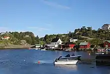
.jpeg.webp) Spjeld Storelva
Spjeld Storelva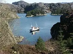 Fjord landscape, Sotra
.jpeg.webp) Nordra Straumsundet
Nordra Straumsundet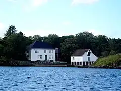 Bukken
References
- "Navn på steder og personer: Innbyggjarnamn" (in Norwegian). Språkrådet.
- "Forskrift om målvedtak i kommunar og fylkeskommunar" (in Norwegian). Lovdata.no.
- Statistisk sentralbyrå. "Table: 06913: Population 1 January and population changes during the calendar year (M)" (in Norwegian).
- Statistisk sentralbyrå. "09280: Area of land and fresh water (km²) (M)" (in Norwegian).
- Jukvam, Dag (1999). "Historisk oversikt over endringer i kommune- og fylkesinndelingen" (PDF) (in Norwegian). Statistisk sentralbyrå. ISBN 9788253746845.
- "Vår nye kommune" (in Norwegian). Retrieved 28 October 2017.
- Store norske leksikon. "Øygarden" (in Norwegian). Retrieved 28 November 2014.
- "Civic heraldry of Norway - Norske Kommunevåpen". Heraldry of the World. Retrieved 22 May 2023.
- "Øygarden kommune, våpen". Digitalarkivet (in Norwegian). Arkivverket. Retrieved 22 May 2023.
- "Sund, Hordaland (Norway)". Flags of the World. Retrieved 22 May 2023.
- "Civic heraldry of Norway - Norske Kommunevåpen". Heraldry of the World. Retrieved 2 February 2020.
- "Kommunevåpen for Sund kommune" (in Norwegian). Sund kommune. Retrieved 17 December 2014.
- En liten perle i Øygarden [A small pearl in Øygarden]
- Statistisk sentralbyrå. "Table: 06913: Population 1 January and population changes during the calendar year (M)" (in Norwegian).
- Hansen, Tore; Vabo, Signy Irene, eds. (20 September 2022). "kommunestyre". Store norske leksikon (in Norwegian). Kunnskapsforlaget. Retrieved 14 October 2022.
- "Tall for Norge: Kommunestyrevalg 2019 - Vestland". Valg Direktoratet. Retrieved 2 February 2020.
- "Table: 04813: Members of the local councils, by party/electoral list at the Municipal Council election (M)" (in Norwegian). Statistics Norway.
- "Tall for Norge: Kommunestyrevalg 2011 - Hordaland". Valg Direktoratet. Retrieved 2 February 2020.
- "Kommunestyrevalget 1995" (PDF) (in Norwegian). Oslo-Kongsvinger: Statistisk sentralbyrå. 1996. Retrieved 20 February 2020.
- "Kommunestyrevalget 1991" (PDF) (in Norwegian). Oslo-Kongsvinger: Statistisk sentralbyrå. 1993. Retrieved 20 February 2020.
- "Kommunestyrevalget 1987" (PDF) (in Norwegian). Oslo-Kongsvinger: Statistisk sentralbyrå. 1988. Retrieved 20 February 2020.
- "Kommunestyrevalget 1983" (PDF) (in Norwegian). Oslo-Kongsvinger: Statistisk sentralbyrå. 1984. Retrieved 20 February 2020.
- "Kommunestyrevalget 1979" (PDF) (in Norwegian). Oslo: Statistisk sentralbyrå. 1979. Retrieved 20 February 2020.
- "Kommunevalgene 1975" (PDF) (in Norwegian). Oslo: Statistisk sentralbyrå. 1977. Retrieved 10 May 2020.
- "Kommunevalgene 1972" (PDF) (in Norwegian). Oslo: Statistisk sentralbyrå. 1973. Retrieved 10 May 2020.
- "Kommunevalgene 1967" (PDF) (in Norwegian). Oslo: Statistisk sentralbyrå. 1967. Retrieved 10 May 2020.
- "Kommunevalgene 1963" (PDF) (in Norwegian). Oslo: Statistisk sentralbyrå. 1964. Retrieved 10 May 2020.
- Uklart om likvidasjoner
External links
- Municipal fact sheet from Statistics Norway (in Norwegian)
| |||
 | Towns and cities |  | |
| Municipalities | |||