Collinston, Utah
Collinston is an unincorporated community on the northeastern edge of Box Elder County, Utah, United States.[1]
Collinston, Utah | |
|---|---|
 Collinston Location of Colliston within the State of Utah  Collinston Collinston (the United States) | |
| Coordinates: 41°46′29″N 112°5′42″W | |
| Country | United States |
| State | Utah |
| County | Box Elder |
| Settled | 1860 |
| Named for | Collins Fulmer |
| Elevation | 4,432 ft (1,351 m) |
| Time zone | UTC-7 (Mountain (MST)) |
| • Summer (DST) | UTC-6 (MDT) |
| ZIP codes | 84306 |
| GNIS feature ID | 1428419[1] |
Description
| Census | Pop. | Note | %± |
|---|---|---|---|
| 1890 | 798 | — | |
| 1900 | 340 | −57.4% | |
| 1910 | 114 | −66.5% | |
| 1920 | 155 | 36.0% | |
| 1930 | 132 | −14.8% | |
| 1940 | 114 | −13.6% | |
| 1950 | 145 | 27.2% | |
| Source: U.S. Census Bureau[2] | |||
Mainly an agricultural community, the town is located 3 miles (4.8 km) southeast of Fielding and almost directly west of Riverside, at coordinates 41°46′29″N 112°5′42″W (441.7746496, -112.0949517).[1] Its elevation is 4,432 feet (1,351 m). It has a post office with the ZIP code 84306.[3]
Collinston is mentioned as the approximate location where Captain John C. Frémont crossed the Bear River in 1843.[4]
The town was originally known as Hampton or Hampton Ford. It was named for Ben Hampton, who, with William Godbe, operated a toll ferry across the Bear River from 1867 to 1868. James Standing later bought the ferry and bridge rights and moved the town to higher ground 1 mile (1.6 km) east. The name was changed to Collinston, after Utah Northern Railroad conductor Collins Fulmer.[5]
See also
References
- "Collinston". Geographic Names Information System. United States Geological Survey, United States Department of the Interior.
- "Census of Population and Housing". census.gov. United States Census Bureau. Archived from the original on February 8, 2006. Retrieved November 4, 2011.
- USPS – Cities by ZIP Code Archived 2011-05-17 at the Wayback Machine
- Hooton Jr LW: "The Bear River" Archived 2008-08-21 at the Wayback Machine. Accessed 2008-05-12.
- Van Cott, John W. (1990). Utah Place Names: A Comprehensive Guide to the Origins of Geographic Names: A Compilation. Salt Lake City: University of Utah Press. p. 87. ISBN 978-0-87480-345-7. OCLC 797284427. Retrieved March 16, 2018.
External links
![]() Media related to Collinston, Utah at Wikimedia Commons
Media related to Collinston, Utah at Wikimedia Commons
Municipalities and communities of Box Elder County, Utah, United States | ||
|---|---|---|
| Cities | 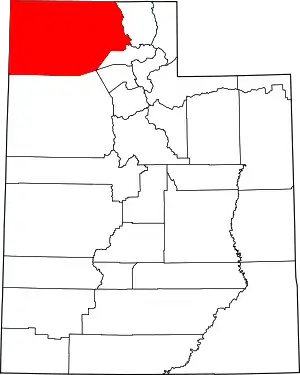 Map of Utah highlighting Box Elder County | |
| Towns | ||
| CDPs | ||
| Unincorporated areas | ||
| Ghost towns | ||
| Indian reservation | ||