Thatcher, Utah
Thatcher is a census-designated place in Box Elder County, Utah, United States. It is a small farming community, located 3 miles (5 km) southwest of Bothwell and 7 miles (11 km) west of Tremonton. The population was 789 at the 2010 census.
Thatcher, Utah | |
|---|---|
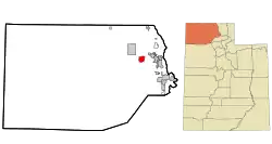
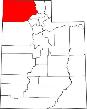
 Location in Box Elder County and the state of Utah | |
 Location of Utah in the United States | |
| Coordinates: 41°40′52″N 112°19′11″W | |
| Country | United States |
| State | Utah |
| County | Box Elder |
| Settled | 1890 |
| Named for | Moses Thatcher |
| Area | |
| • Total | 11.7 sq mi (30.3 km2) |
| • Land | 11.7 sq mi (30.3 km2) |
| • Water | 0.0 sq mi (0.0 km2) |
| Elevation | 5,003 ft (1,525 m) |
| Population | |
| • Total | 789 |
| • Density | 67/sq mi (26.0/km2) |
| Time zone | UTC-7 (Mountain (MST)) |
| • Summer (DST) | UTC-6 (MDT) |
| ZIP code | 84337 |
| Area code | 435 |
| GNIS feature ID | 2584779[1] |
The community was named for Moses Thatcher, an apostle for the Church of Jesus Christ of Latter-day Saints.[3] Thatcher was first settled in 1890.[4]
Thatcher Mountain, 2 miles (3 km) to the west, is named after the community.
Demographics
As of the census[2] of 2010, there were 789 people living in the CDP. There were 230 housing units. The racial makeup of the town was 95.9% White, 0.5% Black or African American, 0.1% American Indian and Alaska Native, 0.1% Asian, 0.1% Native Hawaiian and Other Pacific Islander, 1.6% from some other race, and 1.5% from two or more races. Hispanic or Latino of any race were 2.4% of the population.
References
- "Thatcher Census Designated Place". Geographic Names Information System. United States Geological Survey, United States Department of the Interior. Retrieved September 18, 2023.. Retrieved May 19, 2011.
- "U.S. Census website". United States Census Bureau. Retrieved May 19, 2011.
- Van Cott, John W. (1990). Utah Place Names. Salt Lake City: University of Utah Press. p. 41. ISBN 0-87480-345-4.
- Andrew Jenson. Encyclopedic History of the Church. (Salt Lake City: Deseret Book, 1941) p. 872
