Comano, Tuscany
Comano is a town and comune in the province of Massa and Carrara, Tuscany, Italy, of some 700 inhabitants.
Comano | |
|---|---|
| Comune di Comano | |
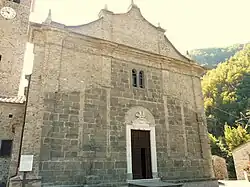
 Pieve of Santa Maria Assunta at Crespiano. | |
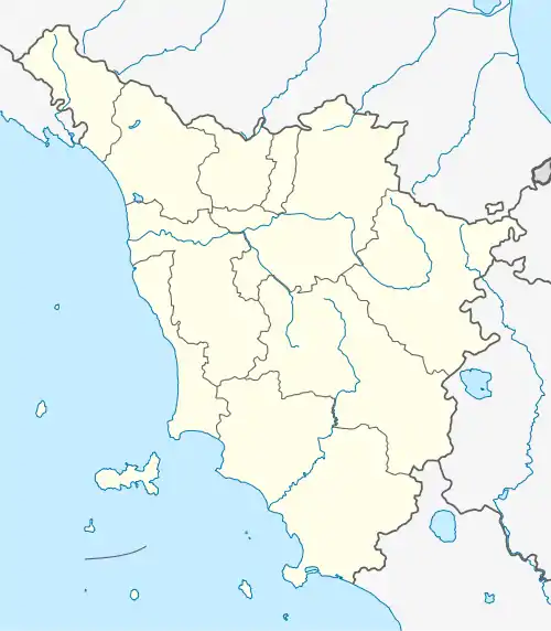
Location of Comano | |
 Comano Location of Comano in Italy  Comano Comano (Tuscany) | |
| Coordinates: 44°17′N 10°08′E | |
| Country | Italy |
| Region | Tuscany |
| Province | Massa and Carrara (MS) |
| Frazioni | Camporaghena, Cattognano, Crespiano, Lagastrello, Montale, Prota, Torsana |
| Government | |
| • Mayor | Cesare Leri |
| Area | |
| • Total | 54 km2 (21 sq mi) |
| Elevation | 530 m (1,740 ft) |
| Population (30 June 2017)[2] | |
| • Total | 699 |
| • Density | 13/km2 (34/sq mi) |
| Demonym | Comanini |
| Time zone | UTC+1 (CET) |
| • Summer (DST) | UTC+2 (CEST) |
| Postal code | 54015 |
| Dialing code | 0187 |
| Website | Official website |
In the nearby is the pieve of Santa Maria Assunta. It was rebuilt in 1079 in Romanesque style; later it was modified in Renaissance and Baroque times. It has also a castle.
History
Comano was part of the territory of Spinetta Malaspina the Great who let the inheritance to his successors when he died (1352): Gabriele, Gugliemo and Galeotto Malaspina, sons of Azzolino II (brother of Spinetta) who therefore wore the title of Signori di Fosdinovo, Marciaso, Comano and Le Terre dei Bianchi.
Subsequently Comano became part of the Marquis of Fivizzano, and then under the Republic of Florence in 1478.
With the Unity of Italy Comano was an outlying town of the municipality of Fivizzano and continued to be until 26 April 1918 when it became an autonomous municipality.
Geography
Comano is situated in the area of Lunigiana in Tuscany, with the main town at the head of the Taverone valley with a backdrop of the breathtaking Apennine Mountains. There are many walking trails leading from the town centre of Comano and the surrounding villages to the hills and mountain peaks. The town, surrounded by the farming community, hosts an annual horse festival in the summer and offers a good selection of shops, restaurants and sport facilities.
The Taverone river has crystal clear waters with waterfalls and rock pools popular in the summer. The area is renowned locally for its pure mountain air and attracts tourism looking for contact with nature.
Comano includes many outlying villages with medieval castles, cobbled lanes and interlinking arches. Comano offers numerous farm restaurants serving local specialities which include pattona, a pancake cake made from chestnut flour served with fresh ricotta cheese, wild mushrooms, ravioli pasta and vegetable cakes. The area also produces honey from wild flowers and also chestnut honey which is often served with the local cheese.
The landscape varies from green pastures, chestnut hills and stretches to the high Apennine range. Comano is part of Lungiana, an area that stretches from the coast to the Apennine mountain ridges.
Frazioni
The municipality of Comano comprises three main villages: Comano (530 metres (1,740 ft) alt., population 277), Castello (605 metres (1,985 ft) alt., population 55) and Piano (610 metres (2,000 ft) alt., population 123).
The territory of Comano also comprises many outlying villages: Cabeva, Camporaghena, Campungano, Canola, Casa Pelati, Castello, Castello di Camporaghena, Cassettana, Castagneto di Crespiano, Cattognano, Chiosi, Crespiano, Croce, Felegara, Fontana Rosa, Fumagna, Imocomano, La Costa, Lagastrello, La Greta, La Piana-Groppo San Pietro, La Vigna-Ropiccio, Linari, Montalbino-Battagliolo, Montale, Monterotondo, Piagneto, Piano, Pieve di Crespiano, Prato Castellano, Prota, Scanderaruola, Summocomano, Torsana, and Villa di Cattognano.
Of historical interest: Camporaghena, Cattognano, Crespiano, Groppo San Pietro, Montale, Prota, and Scanderaruola e Torsana.
Main sights
- Church of San Giorgio
- Church of San Giovanni Battista in the village of Montale
- Church of Santi Pietro e Paolo in the village of Camporaghena
- Church of San Genesio in the village of Prota
- Church of San Giacomo in the village of Torsana
- Ancient church Pieve di Santa Maria Assunta in the village of Crespiano
- Castle of Comano
- Castle of Groppo San Pietro
References
- "Superficie di Comuni Province e Regioni italiane al 9 ottobre 2011". Italian National Institute of Statistics. Retrieved 16 March 2019.
- All demographics and other statistics: Italian statistical institute Istat.