Compagnie Meusienne de Chemins de Fer
The Compagnie Meusienne de Chemins de Fer (colloquially Le Meusien) operated from 1888 to 1922 a 203 km (130 mi) long metre gauge (1,000 mm (3 ft 3+3⁄8 in)) rail network in the French Département Meuse. Its most westerly branch was built by the Compagnie des Chemins de Fer d'Intérêt Local de la Meuse and commissioned section by section since 1878. The Société Générale des Chemins de Fer Économiques took over the network in 1922 and operated it until decline and closure between 1929 and 1938.
| Compagnie Meusienne de Chemins de Fer | |
|---|---|
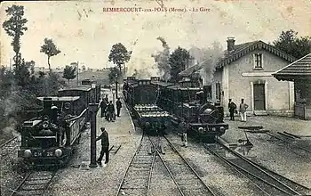 N° 26 Suzanne (Corpet-Louvet 534/1890 on the left) and N° 10 Verdun (Corpet-Louvet 598/1894 on the right hand side) in Rembercourt
| |
| Technical | |
| Line length | 203 km (130 mi) |
| Track gauge | 1,000 mm (3 ft 3+3⁄8 in) metre gauge |
_-_La_Gare_03.jpg.webp)
History
Construction
The Compagnie des Chemins de fer d'Intérêt Local de la Meuse built and commissioned the first section of the local railway from Haironville via Revigny to Triaucourt from 1878 to 1881 and operated it until 1888. A short connecting line to Rembercourt joined the Triaucourt line at Les Merchines.
The concessionaire, Charles Varinot, had taken control of the line from Haironville to Triaucourt in 1888. The Compagnie Meusienne de Chemins de Fer (CM) took over the concession for the Haironville-Triaucourt line in 1888. Between 1891 and 1912, it put additional lines into service from Bar-le-Duc to Verdun, Clermont-en-Argonne and Pierrefitte-sur-Aire.
After the First World War, Société Générale des Chemins de Fer Économiques took over the network in 1922 and operated it together with the Réseau de la Woëvre northeast of Verdun. It operated the entire network until its gradual closure between 1929 and 1938.
However, a 13 km section between Haironville and Robert-Espagne, which had been regauged to standard gauge in the early 1930s, was still operated by steam engines for freight traffic until 1971.
A 4.2 km section of line north of Bar-le-Duc was reopened as a museum railway.
World War I
During the World War I, the locomotive fleet of the Compagnie Meusienne de Chemins de Fer (CM) was strengthened by requisitioning locomotives from metre gauge lines in other parts of France, so that up to 128 locomotives were used on the line. One of these was No. 55 (Corpet Louvet 1253/1909) from the Chemins de Fer Économiques des Charentes (EC). By the end of 1915, operational improvements made it possible to handle a very large amount of freight, which had increased from 800 to 1500 tons per day in addition to carrying 80 passengers per day. In the first five months of 1916, traffic increased to 137,367 soldiers, 84,888 wounded, 201,257 tons of supplies and 69,847 tons of ammunition and weapons transport.[5]
During the war, the railway was popularly called "Varinot" after the name of its former concessionaire or "tacot" or "Tortillard" after the sound that it emitted. The military authorities called it the "Petit Tramway" and General Philippe Pétain described it as the "Petit Meusien". By improving the organisation of the traffic, the number of military transports increased from 22 trains on 21 February 1916 to 31 trains at the end of March to 35 at the end of April and finally even up to 48 trains between Revigny and Beauzée.[5]
Post-war period
The Société Générale des Chemins de Fer Économiques (SE) took over operations in 1922. In the post-war period, from 1919 to 1924, large quantities of building materials were transported along the line for the reconstruction of the destroyed buildings. The trains therefore ran on a timetable as mixed freight and passenger trains, which required numerous shunting manoeuvres in the stations to couple or uncouple additional freight wagons. Because of this and because the maximum speed was limited to 12 km/h, the journeys were very time-consuming.
Decline and closure
As the economic viability was questioned by rising inflation, the operating company merged with the operators of the local railway lines of the Réseau de la Woëvre, located northeast of Verdun, on 1 June 1923. The merged company acquired more modern rolling stock, in particular railcars. On 20 June 1938, operations had largely ceased and the assets were sold. The liquidation was not yet completed with the outbreak of the Second World War in 1939. It was not until the end of Second World War that the company was fully settled in 1946.[6][7]
Sections of track
- Revigny – Haironville: 62 km (39 mi)
- Revigny – Triaucourt: 35 km (22 mi)
- Bar-le-Duc – Verdun: 58 km (36 mi)
- Beauzé – Clermont-en-Argonne: 22 km (14 mi)
- Rembercourt-aux-Pots – Les Merchines: 4 km (2.5 mi)
- La Vaux-Marie – Pierrefitte-sur-Aire: 12 km (7.5 mi)
Stations and bridges
| Stations and bridges | Photos | Condition of the buildings and comments[8] |
|---|---|---|
| Verdun | 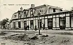 | |
| Nixéville | ||
| Pampaville | ||
| Souhesmes | ||
| Souilly | _-_La_Gare.jpg.webp) | |
| Heippes-Benoite-Vaux | _-_Le_Train_a_la_Gare.jpg.webp) | |
| Clermont-en-Argonne | 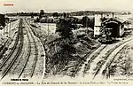 | |
 | During World War I, there was a 600 mm (1 ft 11+5⁄8 in) gauge constructor's or trench railway between Clermont-en-Argonne and Auzéville in operation using German locomotives. | |
| Auzéville | ||
| Rarecourt | ||
| Froidos | ||
| Autrécourt-Lavoye | ||
| Fleury-sur-Aire | ||
| Nubécourt | _-_La_Gare_(1913).jpg.webp) | |
| Beauzée | _-_Avenue_de_la_Gare.jpg.webp) | |
| Triaucourt | _-_La_Gare.jpg.webp) | |
| Vaubecourt | _-_La_Gare.jpg.webp) | |
| Chaumont-sur-Aire | 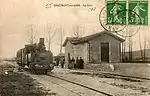 | |
| Longchamps-sur-Aire | _-_Rue_de_la_Gare.jpg.webp) | |
| Pierrefitte-sur-Aire | _-_La_Gare_et_le_Train..jpg.webp) | |
| La Vaux-Marie | .jpg.webp) | |
| L'Isle-en-Barrois | _-_Les_Merchines.jpg.webp) | |
| Villotte-devant-Louppy | ||
| Laheycourt | _-_La_Gare_01.jpg.webp) | |
| Auzecourt | 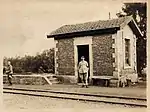 | |
| Noyers | ||
| Maison-du-Val | _stands_in_Maison-du-Val_at_the_head_of_a_southbound_train.jpg.webp) | The timber frame station hut is still preserved |
| Nettancourt | ||
| Revigny | 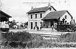 | |
| Contrisson | _-_La_Gare_02.jpg.webp) | The brick-built station hut is Der aus Ziegelsteinen still preserved. |
| Neuville-sur-Ornain | ||
| Canal de la Marne au Rhin | _-_Le_Canal_Martin_et_la_Pont_du_Tramway.jpg.webp) | |
| Mognéville | _-_Rue_Principale.jpg.webp) | The track ran on the main street through the village |
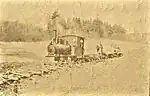
| Robert-Espagne | _at_Robert-Espagne.jpg.webp) | |
| L'Isle-en-Rigault | _pont_ancien_chemin_de_fer.jpg.webp) | |
| Saudrupt | _-_Route_de_Bar-le-Duc_-_Cafe_du_Rivage.jpg.webp) | The track ran on the main street through the village |
| Haironville | _at_Haironville.jpg.webp) | N° 26 Suzanne (Corpet-Louvet 534 of 1890) in Haironville. The station building is still preserved. |
| Rembercourt-aux-Pots | 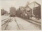 | N° 11 Bar-le-Duc war eine B'1-Lok von Corpet-Louvet (Works-No 599 of 1894). The station building is still preserved. |
| Condé-Génicourt | ||
| Hargeville | _-_Une_Vue_d'ensemble.jpg.webp) | |
| Vavincourt | ||
| Saint-Christophe bei Vavincourt, Forêt de Massonge | ||
| Chemin de Fer Historique de la Voie Sacrée | ||
| Canal de la Marne au Rhin | _-_Vue_sur_le_Canal_de_la_Marne_au_Rhin_-_Le_Pont-Neuf_et_le_Pont_du_Chemin_de_Fer.jpg.webp) | The railway bridge shown in the background ran diagonally across the canal. Not preserved. |
| Bar-le-Duc |  | Station building with a military horse-drawn ambulance of the 6e Corps and a guard house, 1916. Preserved unter the ownership and management of Le Conseil Départemental de la Meuse. |
Locomotives
_and_0-6-2T_No.30_GEORGES_(Corpet_579_of_1893)_at_Lisle-en-Barrois.jpg.webp)
_de_la_Cie_Meusienne%252C_CM_N%C2%B030_Georges%252C_13%252C5t%252C_de_1893%252C_%C3%A0_Vaubecourt_-_Train_Ligne_d'Haironville_%C3%A0_Thiaucourt.jpg.webp)
_from_the_Chemins_de_Fer_%C3%89conomiques_des_Charentes_(EC)_on_the_Meusien_at_Villotte-devant-Louppy_betweeen_Revigny_and_Triaucourt.jpg.webp)
| Manufacturer | Works No[9] | Notation | Delivery date | Other owners | CF No | Name |
|---|---|---|---|---|---|---|
| Ateliers Petau à Passy | C n2t | 1878 | Mallet two-cylinder compound engines | Cie Meusienne de CF "1" – "5" | ||
| Corpet | 294 | Cn2t | 20.10.1879 | Vignaud & Barbaud "La Charente" Charles Varinot "6" until 1886 | Cie Meusienne de CF "28" | |
| Corpet | 362 | Cn2t | 10.12.1881 | Allard Frères until 1883 | Cie Meusienne de CF "28" | "La Ville de Neubourg" "Charente" |
| Corpet | 382 | Cn2t | 07.08.1882 | Entreprise Charles Varinot CF de la Meuse "5" | Cie Meusienne de CF "25" | "Elisa" |
| Corpet | 447 | C1'n2t | 1885 | Cie Meusienne de CF "1" | "L'Aire" | |
| Corpet | 448 | C1'n2t | 1885 | Cie Meusienne de CF "2" | "La Meuse" | |
| Corpet | 449 | C1'n2t | 1885 | Cie Meusienne de CF "3" | "Tannois" | |
| Corpet | 500 | C1'n2t | 10.12.1889 | Exposition de Paris 1889 | Cie Meusienne de CF "7" | "Bernard" |
| Corpet | 506 | First Cn2t Later C1'n2t | 05.11.1889 | Cie Meusienne de CF "4"/"24" | "L'Aisne" | |
| Corpet | 534 | C1'n2t | 10.12.1890 | Département de la Meuse "6" | Cie Meusienne de CF "26" | "Suzanne" |
| Corpet | 535 | C1'n2t | 23.12.1890 | Département de la Meuse "7" | Cie Meusienne de CF "27" | "Marguerite" |
| Corpet | 550 | B1'n2t | 29.03.1892 | Cie Meusienne de CF "8" | "Varinot" | |
| Corpet & Louvet | 578 | C1'n2t | 28.04.1893 | Cie Meusienne de CF "29" | "Germaine" | |
| Corpet & Louvet | 579 | C1'n2t | 10.05.1893 | Cie Meusienne de CF "30" | "Georges" | |
| Corpet & Louvet | 597 | B1'n2t | 15.06.1894 | Cie Meusienne de CF "9" | "Andrée" | |
| Corpet & Louvet | 598 | B1'n2t | 26.06.1894 | Cie Meusienne de CF "10" | "Verdun" | |
| Corpet & Louvet | 599 | B1'n2t | 09.07.1894 | Since 1927 Morillon, Corvol & Cie, Seine-Port | Cie Meusienne de CF "11" | "Bar-le-Duc" |
| Corpet & Louvet | 1230 | C1't | 26.06.1911 | Cie Meusienne de CF "31" | "Caville" | |
| Corpet & Louvet | 1231 | C1't | 30.06.1911 | Cie Meusienne de CF "32" | "Pierrefitte" |
Duration of the sections' operation
| Section[10] | Length | Gauge | Inauguration | Closure | Remarks |
|---|---|---|---|---|---|
| Revigny – Couvonges | 11 km | 1,000 mm (3 ft 3+3⁄8 in) | 1878 | 1929 | |
| Couvonge – L'Isle-en-Rigault | 9 km | 1000 mm | 1879 | 1929 | Later, there were 1,435 mm (4 ft 8+1⁄2 in) standard gauge gauge tracks on the Robert-Espagne-Haironville section of the line. |
| L'Isle-en-Rigault – Haironville | 7 km | 1000 mm | 1881 | 1929 | |
| Revigny – Laheycourt | 15 km | 1000 mm | 1879 | 1936 | |
| Laheycourt – Triaucourt | 20 km | 1000 mm | 1880 | 1936 | |
| Bar-le-Duc – Beauzé | 30 km | 1000 mm | 1891 | 1936 | A 4.2 km section of the line was restored for tourist use as a heritage railway. |
| Beauzé – Verdun | 38 km | 1000 mm | 1895 | 1936 | During World War, a 7.2 kilometres (4.5 mi) long branch line was built between Nixéville and Dugny |
| Beauzé – Clermont-en-Argonne | 22 km | 1000 mm | 1891 | 1936 | |
| Rembercourt-aux-Pots – Les Merchines | 4 km | 1000 mm | 1893 | 1936 | |
| La-Vaux-Marie – Pierrefitte-sur-Aire | 12 km | 1000 mm | 1912 | 1936 |
References
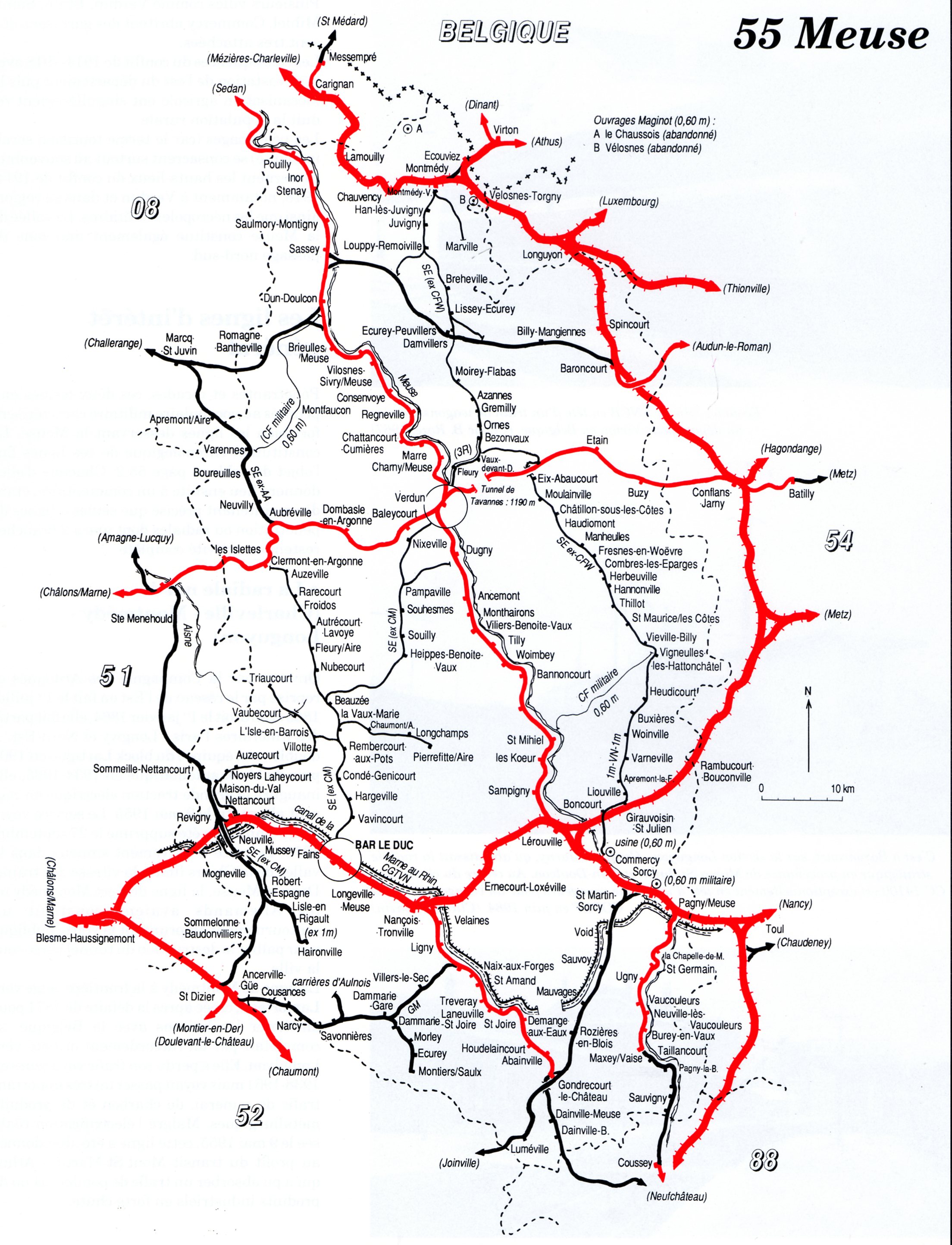
- Carte departementale, 55 Meuse.
- OpenRailwayMap.
- IGN map and aerial photos of 1950.
- Meuse-Argonne offensive, map showing daily position of front line - Map Room G-3, G.H.Q., May 24, 1919 (Route of the track in and near Verdun).
- Christian Boulay: Histoire de la voie sacrée.
- L'histoire du Meusien : Le déclin.
- Brandeville - Le chemin de fer
- Malcolm Ravensdale: The Secondary Railways of France (Les Chemins de Fer Secondaires Français).
- Sébastien Jarne: Inventaire des livraisons de locomotives Corpet- et Corpet & Louvet. 30 Juni 2003.
- FACS: Compagnie des Chemins de fer d'IL de la Meuse.