Coodanup, Western Australia
Coodanup is a south-eastern suburb of Mandurah, Western Australia. Its local government area is the City of Mandurah.
| Coodanup Mandurah, Western Australia | |||||||||||||||
|---|---|---|---|---|---|---|---|---|---|---|---|---|---|---|---|
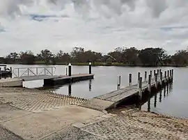 Jetties near the mouth of the Serpentine River at Coodanup | |||||||||||||||
| Coordinates | 32°33′14″S 115°44′56″E | ||||||||||||||
| Population | 4,366 (SAL 2021)[1] | ||||||||||||||
| Established | 1956 | ||||||||||||||
| Postcode(s) | 6210 | ||||||||||||||
| Area | 7.8 km2 (3.0 sq mi) | ||||||||||||||
| LGA(s) | City of Mandurah | ||||||||||||||
| State electorate(s) | Mandurah | ||||||||||||||
| Federal division(s) | Canning | ||||||||||||||
| |||||||||||||||
History
The name "Coodanup" is of unknown origin, although the WA gazetteer states that in 1836, Lieutenant Henry Bunbury noted "Colanup" was the local Noongar name for the mouth of the Serpentine River.[2]
Geography
Coodanup is bounded by the Serpentine River to the east, Harvey Estuary to the south, Pinjarra Road to the north and Mandurah Bypass and Wanjeep Street to the west.[3]
References
- Australian Bureau of Statistics (28 June 2022). "Coodanup (Suburb and Locality)". Australian Census 2021 QuickStats. Retrieved 28 June 2022.
- "History of metropolitan suburb names – C". Western Australian Land Information Authority. Archived from the original on 16 March 2022. Retrieved 28 October 2006.
- 2006 StreetSmart directory, Department of Lands and Surveys, Perth.
This article is issued from Wikipedia. The text is licensed under Creative Commons - Attribution - Sharealike. Additional terms may apply for the media files.