Coolaroo, Victoria
Coolaroo is a suburb in Melbourne, Victoria, Australia, 18 km (11 mi) north of Melbourne's Central Business District, located within the City of Hume local government area. Coolaroo recorded a population of 3,193 at the 2021 census.[1]
| Coolaroo Melbourne, Victoria | |||||||||||||||
|---|---|---|---|---|---|---|---|---|---|---|---|---|---|---|---|
 Coolaroo railway station in October 2019 | |||||||||||||||
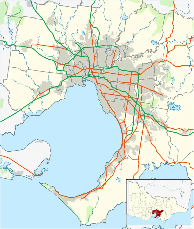 Coolaroo Location in metropolitan Melbourne | |||||||||||||||
| Coordinates | 37.657°S 144.927°E | ||||||||||||||
| Population | 3,193 (2021 census)[1] | ||||||||||||||
| • Density | 1,060/km2 (2,800/sq mi) | ||||||||||||||
| Postcode(s) | 3048 (shared with Meadow Heights) | ||||||||||||||
| Area | 3 km2 (1.2 sq mi) | ||||||||||||||
| Location | 18 km (11 mi) N of Melbourne | ||||||||||||||
| LGA(s) | City of Hume | ||||||||||||||
| State electorate(s) | Broadmeadows | ||||||||||||||
| Federal division(s) | Calwell | ||||||||||||||
| |||||||||||||||
History
Coolaroo is thought to be derived from an Aboriginal word meaning 'brown snake'.[2] The area was acquired by the Housing Commission of Victoria in 1951 for housing estates,[2] with construction not commencing until 1966.[2] Until the late 1990s, Coolaroo's boundaries extended past the railway line and Pascoe Vale Road into the area that is now known as Meadow Heights.[3]
Population
In the 2016 census, there were 3,191 people in Coolaroo. 51.7% of people were born in Australia. The next most common countries of birth were Iraq 9.2%, Turkey 5.5% and Lebanon 3.8%. 37.9% of people spoke only English at home. Other languages spoken at home included Arabic 14.4%, Turkish 11.8% and Assyrian Neo-Aramaic 8.1%, The most common responses for religion were Islam 28.8%, Catholic 23.2% and No Religion 14.4%.[4]
Education
- Coolaroo South Primary School
- St. Mary's Coptic Orthodox College
Facilities
Most of the shopping centres near Coolaroo are located in neighbouring suburbs, including Meadow Heights, which has the Meadow Heights Shopping Centre and Dallas Shopping Centre (Dobell Place and Dargie Court), to the south.
Transport
Bus
Four bus routes service Coolaroo:
- 532 : Craigieburn station – Broadmeadows station via Upfield station. Operated by Broadmeadows Bus Service.[5]
- 540 : Upfield station – Broadmeadows station via Coolaroo. Operated by Dysons.[6]
- 542 : Roxburgh Park station – Pascoe Vale station via Meadow Heights, Broadmeadows and Glenroy. Operated by Dysons.[7]
- 901 : Frankston station – Melbourne Airport (SmartBus service). Operated by Kinetic Melbourne.[8]
Train
Coolaroo railway station is located on the Craigieburn line. It opened to passengers on Sunday 6 June 2010, almost 40 years after plans for a station first surfaced.[9] Coolaroo is also served by Upfield station, which is the terminus for the Upfield line. The station is located on Barry Road, and the station and railway line acts as the suburb boundary between Coolaroo and Campbellfield.
In popular culture
The popular 1997 Australian film The Castle was set in Coolaroo, although the house featured was actually located in Strathmore.[10]
See also
- City of Broadmeadows – Coolaroo was previously within this former local government area.
References
- Australian Bureau of Statistics (28 June 2022). "Coolaroo (Suburbs and Localities)". 2021 Census QuickStats. Retrieved 1 July 2022.
- "Coolaroo", Victorian Places, Victorian Places, retrieved 24 July 2022
- "Meadow Heights", Victorian Places, Victorian Places, retrieved 24 July 2022
- Australian Bureau of Statistics (27 June 2017). "Coolaroo (State Suburb)". 2016 Census QuickStats. Retrieved 3 July 2017.
- 532 Craigieburn Station - Broadmeadows Station via Upfield Station Public Transport Victoria
- 540 Upfield - Broadmeadows via Coolaroo Public Transport Victoria
- 542 Roxburgh Park - Pascoe Vale via Meadow Heights & Broadmeadows & Glenroy Public Transport Victoria
- 901 Frankston - Melbourne Airport (SMARTBUS Service) Public Transport Victoria
- "More peak hour services for Melbourne's south east". Media Release: Minister for Public Transport. 28 April 2010. Retrieved 28 April 2010.
- "The house from The Castle is being moved... and will likely wind up in NSW", The Age, The Age, retrieved 24 July 2022