Cougar, Washington
Cougar is an unincorporated community and former town in Cowlitz County, Washington. Cougar is located around 30 miles (48 km) northeast of Woodland along Washington State Route 503 and situated along the northwest bank of Yale Lake, a reservoir on the Lewis River. The population of Cougar was 122 at the 1990 Census, when it was still incorporated as a town, but disincorporated before the 2000 Census. As of 2020, the population is 93. The Cougar community is part of the Woodland School District, a K-12 school district of about 2,200 students. Cougar is the nearest community to Mount St. Helens, which lies 13 miles (20.9215 km) to its northeast. The eruption of Mount St. Helens on May 18, 1980 was the deadliest and most economically destructive volcanic event in the history of the United States.
Cougar, Washington | |
|---|---|
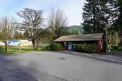 Cougar Post Office | |
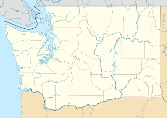 Cougar Location in the state of Washington  Cougar Cougar (the United States) | |
| Coordinates: 46°03′05″N 122°17′58″W | |
| Country | United States |
| State | Washington |
| County | Cowlitz |
| Elevation | 156 m (512 ft) |
| Time zone | UTC−8 (PST) |
| • Summer (DST) | UTC−7 (PDT) |
| ZIP code | 98616 |
| Area code | 360 |
| FIPS code | 53-15010 |
| GNIS feature ID | 1518146 |
A post office called Cougar was established in 1902.[2] The community was named after the cougar.[3]
Geography
Cougar is located at 46°03′05″N 122°17′58″W (46.0514993, -122.2995413).[4]
A notable Cougar resident is Gary Bennett, former Arista Records recording artist and founding member of the country band BR549.
Climate
| Climate data for Cougar, Washington | |||||||||||||
|---|---|---|---|---|---|---|---|---|---|---|---|---|---|
| Month | Jan | Feb | Mar | Apr | May | Jun | Jul | Aug | Sep | Oct | Nov | Dec | Year |
| Record high °F (°C) | 60 (16) |
69 (21) |
78 (26) |
91 (33) |
100 (38) |
104 (40) |
107 (42) |
106 (41) |
104 (40) |
92 (33) |
70 (21) |
60 (16) |
107 (42) |
| Average high °F (°C) | 42.8 (6.0) |
47.3 (8.5) |
52.1 (11.2) |
57.6 (14.2) |
65.3 (18.5) |
71.8 (22.1) |
79.1 (26.2) |
78.8 (26.0) |
73 (23) |
61.8 (16.6) |
49.6 (9.8) |
43.1 (6.2) |
60.2 (15.7) |
| Daily mean °F (°C) | 37.9 (3.3) |
41 (5) |
44.2 (6.8) |
48.4 (9.1) |
54.9 (12.7) |
60.7 (15.9) |
66.2 (19.0) |
66 (19) |
61.6 (16.4) |
53.1 (11.7) |
44 (7) |
38.5 (3.6) |
51.4 (10.8) |
| Average low °F (°C) | 33.1 (0.6) |
34.7 (1.5) |
36.3 (2.4) |
39.3 (4.1) |
44.5 (6.9) |
49.6 (9.8) |
53.2 (11.8) |
53.2 (11.8) |
50.2 (10.1) |
44.5 (6.9) |
38.4 (3.6) |
33.9 (1.1) |
42.6 (5.9) |
| Record low °F (°C) | 8 (−13) |
5 (−15) |
15 (−9) |
28 (−2) |
29 (−2) |
33 (1) |
34 (1) |
38 (3) |
34 (1) |
28 (−2) |
12 (−11) |
2 (−17) |
2 (−17) |
| Average precipitation inches (mm) | 17.9 (450) |
13.6 (350) |
12.2 (310) |
8.5 (220) |
5.3 (130) |
3.8 (97) |
1.3 (33) |
2.1 (53) |
4 (100) |
9 (230) |
17.9 (450) |
18.9 (480) |
114.7 (2,910) |
| Average snowfall inches (cm) | 12.8 (33) |
4 (10) |
1.5 (3.8) |
0.1 (0.25) |
0.0 (0.0) |
0.0 (0.0) |
0.0 (0.0) |
0.0 (0.0) |
0.0 (0.0) |
0.0 (0.0) |
1.5 (3.8) |
5.8 (15) |
25.7 (65) |
| Average precipitation days (≥ 0.01 in.) | 21 | 18 | 20 | 18 | 15 | 11 | 5 | 6 | 9 | 15 | 21 | 21 | 180 |
| Average snowy days (≥ 0.1 in.) | 2.1 | 1.2 | 0.6 | 0.1 | 0.0 | 0.0 | 0.0 | 0.0 | 0.0 | 0.0 | 0.6 | 1.7 | 6.3 |
| Source: weatherbase.com | |||||||||||||
Education
Cougar is in the territory of Woodland Public Schools,[5] which operates Woodland High School.
External links
References
- "USGS—Cougar, Washington". Retrieved June 12, 2014.
- "Post Offices". Jim Forte Postal History. Archived from the original on March 6, 2016. Retrieved July 26, 2016.
- Meany, Edmond S. (1923). Origin of Washington geographic names. Seattle: University of Washington Press. p. 57.
- "2013 U.S. Gazetteer Files". census.gov. Retrieved June 12, 2014.
- "2020 CENSUS - SCHOOL DISTRICT REFERENCE MAP: Cowlitz County, WA" (PDF). U.S. Census Bureau. Retrieved May 30, 2021.
Municipalities and communities of Cowlitz County, Washington, United States | ||
|---|---|---|
| Cities |  Map of Washington highlighting Cowlitz County | |
| CDPs | ||
| Other communities |
| |
| Footnotes | ‡This populated place also has portions in an adjacent county or counties | |
| ||