County Durham (district)
County Durham is a local government district in North East England. It is governed by Durham County Council, a unitary authority.[1] The district has an area of 2,232.6 km2 (862 sq m), and contains 135 civil parishes.[2] It forms part of the larger ceremonial county of Durham, together with boroughs of Darlington, Hartlepool, and the part of Stockton-on-Tees north of the River Tees.
County Durham | |
|---|---|
| Durham | |
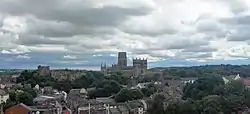 Durham, the administrative centre of the district and its largest settlement | |
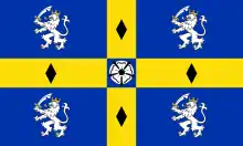 Flag 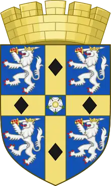 Coat of arms | |
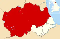 Shown within Durham ceremonial county | |
| Sovereign state | United Kingdom |
| Country | England |
| Region | North East England |
| County | Durham |
| Unitary Authority | 1 April 2009 |
| Seat | Durham |
| Government | |
| • Type | Non-metropolitan Unitary authority |
| • Local Authority | Durham County Council |
| • MPs | Mary Foy (L) Dehenna Davison (C) Paul Howell (C) Grahame Morris (L) Kevan Jones (L) Richard Holden (C) |
| Population (2021) | |
| • Total | 521,346 (Ranked 10th) |
| • Ethnicity | 98.2% White 1.8% Other |
| Time zone | UTC+0 (Greenwich Mean Time) |
| Postcode | |
| Dialling code | 0191 |
| ISO 3166-2 | GB-DUR |
| ONS code | 00EJ (ONS) E06000047 (GSS) |
| Website | Council website |
History
Between 1974 and 1 April 2009 County Durham was governed as a two-tier non-metropolitan county, with a county council and district councils. The original eight districts were Chester-le-Street, Darlington, Derwentside, Durham (city), Easington, Sedgefield, Teesdale, and Wear Valley.[3] In 1997 Darlington was removed from the non-metropolitan county and became a separate unitary authority.[4] In 2009 the remaining districts were abolished and replaced by a single district covering the non-metropolitan county, with Durham County Council as the sole local authority.[5]
Geography
The district has multiple hamlets and villages. Settlements with town status include Consett, Barnard Castle, Peterlee, Seaham, Bishop Auckland, Newton Aycliffe, Middleton-in-Teesdale, Shildon, Chester-le-Street, Crook, Stanley, Willington, Stanhope, Spennymoor, Ferryhill and Sedgefield while Durham is the only city in the district.
| Local authority | In relation to the district |
|---|---|
| Northumberland | North |
| Gateshead | North east |
| City of Sunderland | North east |
| Hartlepool | South east |
| Stockton-on-Tees | South east |
| Darlington | South |
| North Yorkshire | South |
| Westmorland and Furness | West |
Governance
Following the 2021 United Kingdom local elections, the council is now under control of a coalition of the Liberal Democrats, Conservative Party, Independents and North East Party.
Education
Durham LEA has a comprehensive school system with 36 state secondary schools (not including sixth form colleges) and five independent schools (four in Durham and one in Barnard Castle). Easington district has the largest school population by year, and Teesdale the smallest with two schools. Only one school in Easington and Derwentside districts have sixth forms, with about half the schools in the other districts having sixth forms.
Notes
References
- "Durham unitary authority approved". BBC News. BBC News. 25 July 2007. Retrieved 1 August 2021.
- "County Durham". Ordnance Survey. Retrieved 23 May 2021.
- "Durham council leader explains the benefits of a becoming large unitary authority". The Northern Echo. Retrieved 1 August 2021.
- "The Durham (Borough of Darlington) (Structural Change) Order 1995". legislation.gov.uk. Retrieved 18 June 2023.
- "The County Durham (Structural Change) Order 2008". legislation.gov.uk. Retrieved 18 June 2023.
External links
| Unitary authorities | |
|---|---|
| Major settlements (cities in italics) |
|
| Topics | |

