County Route 15 (Nassau County, New York)
Nassau County Route 15 is a 4.02-mile (6.47 km), unsigned county road in Nassau County, New York. It travels between Port Washington Boulevard (NY 101) in Port Washington at its north end and Old Northern Boulevard (CR D71 / CR 7A) in the Village of Roslyn at its southern end.[3][4][5] A small portion also passes through the Village of Flower Hill.[6]
County Route 15 | |
|---|---|
CR 15 highlighted in red | |
| Route information | |
| Maintained by NCDPW | |
| Length | 4.02 mi[1] (6.47 km) |
| Existed | 1959[2]–present |
| Major junctions | |
| North end | |
| South end | Old Northern Boulevard (CR 7A / D71) in Roslyn |
| Location | |
| Country | United States |
| State | New York |
| County | Nassau |
| Highway system | |
This route travels along Beacon Hill Road and West Shore Road (also known as Roslyn West Shore Road), and is maintained in its entirety by the Nassau County Department of Public Works.[3][7]
Description
The CR 15 designation for West Shore and Beacon Hill Roads can be traced back to 1959, when the Nassau County Department of Public Works created a numbered highway system as part of their "Master Plan" for the county highway system. This plan marked CR 15 along its current alignment.[7]
County Route 15 is classified as a minor arterial highway by the New York State Department of Transportation and is eligible for federal aid.[8][9]
Route description
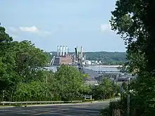
Starting from its northern end, County Route 15 starts in Port Washington at the intersection of Beacon Hill Road, Main Street, and Port Washington Boulevard (NY 101).[3][8][9] From there, it continues east-southeast through Port Washington, along Beacon Hill Road. It then makes a sharp turn to the south, and becomes West Shore Road. CR 15 then becomes a divided highway and passes the North Hempstead Beach Park (also known as Bar Beach) and the Harbor Links Country Club. Continuing south, the road soon becomes undivided once again and passes the Town of North Hempstead Solid Waste Center, the Hempstead Harbor Shoreline Park, and the Harbor Park Industrial Park. It then enters the Village of Flower Hill and the village's Harbor Village housing development, along with the historic George Washington Denton House.[6][11] It then passes underneath the William Cullen Bryant Viaduct (NY 25A) and enters Roslyn.[5] Just south of the bridge, CR 15 passes Mott Avenue (CR D63), and then intersects with Old Northern Boulevard (CR D71 / CR 7A), where it terminates.[3][8][9]
Nassau County Route 15 is roughly four miles (6.4 km) in length.[3][8][9][1]
Major intersections
| Location | mi[1][8][9] | km | Destinations | Notes | |
|---|---|---|---|---|---|
| Roslyn | 0.00 | 0.00 | Old Northern Boulevard (CR D71) | Southern terminus; continues south as Old Northern Boulevard | |
| Flower Hill | 0.26 | 0.42 | John Bean Court | ||
| Port Washington | 2.99 | 4.81 | Marginal Drive | ||
| 3.26 | 5.25 | Beacon Drive | Transition from West Shore Road to Beacon Hill Road | ||
| 3.34 | 5.38 | Crest Road | |||
| 3.57 | 5.75 | Crescent Hill | |||
| 4.02 | 6.47 | At-grade intersection; northern terminus | |||
1.000 mi = 1.609 km; 1.000 km = 0.621 mi
| |||||
References
- New York State Department of Transportation (July 1, 2020). County Roads Listing – Nassau County (PDF) (Report). p. 13. Retrieved November 20, 2020.
- Nassau County Department of Public Works (1959). "Master Plan for Nassau County". Nassau County Department of Public Works.
- "Nassau County Road Jurisdiction Viewer" (Map). nassau-county.maps.arcgis.com. Retrieved October 26, 2020.
- "Nassau County Route 15 - West Shore Road". East Coast Roads. Retrieved October 26, 2020.
- "Nassau County Route 15 - West Shore Road - Photo Gallery". East Coast Roads. Retrieved October 26, 2020.
- Google (October 26, 2020). "Flower Hill" (Map). Google Maps. Google. Retrieved October 26, 2020.
- Nassau County Department of Public Works (1959). "Master Plan for Nassau County". Nassau County Department of Public Works.
- "New York State Department of Transportation Functional Class Viewer". gis.dot.ny.gov. Retrieved April 2, 2023.
- "New York State Roadway Inventory System Viewer". gis.dot.ny.gov. Retrieved April 2, 2023.
- "Nassau-Suffolk County Road History". NYC Roads. Archived from the original on January 3, 2009. Retrieved October 26, 2020.
- "NPGallery Asset Detail". npgallery.nps.gov. Retrieved October 26, 2020.