List of county routes in Rockland County, New York
County routes in Rockland County, New York, are maintained by the Rockland County highway department and signed with the Manual on Uniform Traffic Control Devices-standard yellow-on-blue pentagon route marker. Most of the routes act as primary roads in the less developed areas and also serve to interconnect the various villages and hamlets of the county example CR 80 is congers road in new city and congers. Across the county, routes are numbered such that odd-numbered routes are north–south and increase in number from east to west, while even-numbered routes are east–west and increase from south to north.
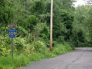 CR 109's southern terminus at the dead end ahead despite the erroneous north marking above 109. | |
| Highway names | |
|---|---|
| Interstates | Interstate X (I-X) |
| US Highways | U.S. Route X (US X) |
| State | New York State Route X (NY X) |
| County: | County Route X (CR X) |
| System links | |
There are 63 current routes and seven routes no longer maintained by the county, making for a total of 70 routes. The longest routes are CR 33, CR 23, and CR 80, all at over ten miles (16 km). The shortest route is CR 118A in Stony Point at 0.11 miles (0.18 km) long. There are also two routes that cross into Orange County and keep the same number from Rockland: CR 106 in Tuxedo and CR 72 in Sloatsburg. Also, several routes enter from New Jersey; two of these include CR 41 in Chestnut Ridge and CR 89 in Airmont. The northernmost route is CR 118 in Stony Point and the southernmost is CR 4 in Palisades.[1]
List of routes
| Number[2] | Length (mi)[3] | Length (km) | Southern or western terminus | Northern or eastern terminus | Local names | Formed | Removed | Notes |
|---|---|---|---|---|---|---|---|---|
| 1.60 | 2.57 | Piermont village line | South Nyack village line | River Road in Grand View-on-Hudson | — | — | ||
| — | — | new jersey state line in palisades | US 9W in palisades | Closter Road in Orangetown | — | — | ||
| 3.69 | 5.94 | CR 38 in Orangetown | US 9W in Piermont | Tweed Boulevard and Park Road | — | — | ||
| 1.93 | 3.11 | New Jersey state line at Tappan | NY 340 in Sparkill | Old Tappan Road and Washington and Main streets | — | — | ||
| 2.65 | 4.26 | Orangeburg Road | Clarkstown town line | Greenbush Road in Orangetown | — | — | ||
| 1.99 | 3.20 | Maple Road in Valley cottage | CR 80 in congers | Kings Highway in Clarkstown | — | — | ||
| 5.51 | 8.87 | CR 8 in tappan | West Nyack Road in Clarkstown | Western highway S And N | — | — | ||
| 0.64[4] | 1.03 | CR 20 / CR 22 | CR 17 | Hunt Road in Orangetown | — | — | Former number.[5] | |
| 0.75 | 1.21 | New Jersey state line | CR 20 | Hog and Blaisdell roads in Orangetown | — | — | ||
| 4.46 | 7.18 | South Main Street | NY 303 | Gilbert Avenue, Veterans Memorial Drive, and Orangeburg Road in Orangetown | — | — | ||
| 1.06[4] | 1.71 | CR 16 / CR 20 | Dead end | Old Orangeburg Road in Orangetown | — | — | Former number.[5] | |
| 10.57[lower-alpha 1] | 17.01 | New Jersey state line in Orangetown | CR 90 in Clarkstown | South Blue Hill Road, and Blue Hill, Convent, Blue Hill, Sickletown, Strawtown, and Ridge roads |
— | — | ||
| 0.22 | 0.35 | CR 23 | Dead end | Old Blue Hill Road in Orangetown | — | — | ||
| 2.83 | 4.55 | CR 20 | CR 15 | Gilbert Avenue and Sickletown and Convent roads in Orangetown | — | — | ||
| 2.71 | 4.36 | CR 23 | CR 33 | Germonds Road in Clarkstown | — | — | ||
| 2.01 | 3.23 | NY 303 | US 9W | Spruce Street and Clauseland Mountain and Old Mountain roads in Orangetown | — | — | ||
| 2.94 | 4.73 | CR 80 | CR 90 | North Main Street and Haverstraw Road in Clarkstown | — | — | ||
| 1.02 | 1.64 | New Jersey state line | NY 304 | Old Passack Road and West Washington Avenue in Orangetown | — | — | ||
| 12.61 | 20.29 | NY 304 in Orangetown | CR 106 in Stony Point | Central Avenue, Middletown, Little Tor, and Ramapo roads, Main Street, and Central Highway | — | — | Overlaps with US 202 between Little Tor Road and Main Street[lower-alpha 2] | |
| 0.30 | 0.48 | CR 33 | CR 46 | Old Middletown Road in Clarkstown | — | — | ||
| 4.10 | 6.60 | CR 30 in Orangetown | CR 35A / CR 60 in Clarkstown | South Highland Avenue and Pascack Road | — | — | ||
| 3.35 | 5.39 | NY 59 in Spring Valley | CR 80 in Clarkstown | New Clarkstown and West Clarkstown roads | — | — | Signed route also includes segment 2 of CR 52[lower-alpha 3] | |
| CR 35C | 3.35 | 5.39 | CR 35 | CR 35A | Perlman Drive | — | — | |
| 0.65 | 1.05 | CR 15 | NY 303 | Leber Road in Orangetown | — | — | ||
| 0.27 | 0.43 | Old Nyack Turnpike in Clarkstown | Pipetown Hill Road in Ramapo | Central Avenue | — | — | Unsigned | |
| 1.36 | 2.19 | CR 11 | South Nyack village line | Bradley Parkway and Bradley Hill Road in Orangetown | — | — | ||
| 1.53 | 2.46 | New Jersey state line | NY 45 | Red Schoolhouse Road in Chestnut Ridge | — | — | ||
| 1.98 | 3.19 | CR 33 in Clarkstown | CR 23 in Orangetown | Townline Road | — | — | ||
| 0.58 | 0.93 | CR 23 | CR 15 | Green Road in Clarkstown | — | — | ||
| 1.08 | 1.74 | CR 35 | CR 33 | Convent Road in Clarkstown | — | — | ||
| 4.31 | 6.94 | US 202 in Haverstraw | CR 108 in Stony Point | Thiells–Mount Ivy, Letchworth Village, Hammond, Willow Grove, Thiells, and Reservoir roads |
— | — | ||
| 0.37 | 0.60 | CR 86 | Dead end | Firemen's Memorial Drive in Ramapo | — | — | ||
| 1.19 | 1.92 | CR 80 in Ramapo | NY 45 in Ramapo | Summit Park and Sanatorium roads | — | — | ||
| 1.66 | 2.67 | CR 73 in Ramapo | CR 37 in Ramapo | Old Nyack Turnpike | — | — | ||
| 0.14 | 0.23 | CR 35 | NY 59 | Forman Drive in Clarkstown | — | — | Signed as part of CR 35A | |
| 1.51 | 2.43 | US 9W / US 202 | CR 118 | Buckberg Road in Stony Point | — | — | ||
| 1.09 | 1.75 | CR 35 | CR 33 | Smith Road in Clarkstown | — | — | ||
| 2.80 | 4.51 | CR 93 in Montebello | Maple Avenue in Ramapo | Montebello, Airmont, and Highview roads | — | — | ||
| 1.61 | 2.59 | CR 112 | CR 118 | Bulsontown Road in Stony Point | — | — | ||
| 1.34 | 2.16 | CR 80 | — | McNamara Road on Wesley Hills–New Hempstead village line | — | — | ||
| 0.34 | 0.55 | CR 72 | Sloatsburg village line | Eagle Valley Road in Ramapo | — | — | ||
| 1.83 | 2.95 | CR 65 | CR 106 | Cedar Flats Road in Stony Point | — | — | Unsigned | |
| 0.15 | 0.24 | CR 69 | Dead end | Queensboro Road in Stony Point | — | — | ||
| 1.52 | 2.45 | NY 45 | CR 52 | Hungry Hollow Road in Chestnut Ridge | — | — | ||
| 1.83 | 2.95 | Orange County line in Ramapo (becomes CR 72) | NY 17 in Ramapo | Sterling Mine Road | — | — | ||
| 2.26 | 3.64 | New Jersey state line | NY 59 / NY 306 | East Saddle River Road in Ramapo | — | — | Formerly part of NY 306 | |
| 5.28 | 8.50 | US 202 in Ramapo | CR 35A in Clarkstown | Viola and Eckerson roads | — | — | ||
| 2.81 | 4.52 | Ladentown Road in Ramapo | CR 98 in Haverstraw | Call Hollow Road | — | — | ||
| 0.49 | 0.79 | CR 33 | South Main Street | Collyer Avenue in Clarkstown | — | — | ||
| 12.93 | 20.81 | US 202 in Ramapo | US 9W in Clarkstown | Grandview Avenue, New Hempstead Road, Main Street, and Congers and Lake roads | — | — | ||
| 0.07 | 0.11 | CR 80 | CR 85 | Grandview Avenue in Montebello | — | — | ||
| 6.24 | 10.04 | CR 73 in Ramapo | US 202 in Wesley Hills | South Monsey, New County, College, Forshay, and Wilder roads | — | — | ||
| 0.79 | 1.27 | CR 98 | CR 106 | Blanchard Road in Stony Point | — | — | ||
| 1.32 | 2.12 | US 202 | NY 306 | Lime Kiln Road in Wesley Hills | — | — | ||
| 5.70 | 9.17 | New Jersey state line | US 202 | Cherry Lane and Spook Rock Road in Ramapo | — | — | ||
| 1.83 | 2.95 | NY 306 in Pomona | NY 45 in Ramapo | Pomona Road | — | — | ||
| 1.82 | 2.93 | New Jersey state line in Airmont | CR 64 in Montebello | Airmont Road | — | — | ||
| 0.81 | 1.30 | CR 29 in Clarkstown | US 9W in Haverstraw | South Mountain Road | — | — | ||
| 0.77 | 1.24 | NY 59 | CR 64 | Hemion Road in Ramapo | — | — | ||
| 3.67 | 5.91 | CR 98 in Haverstraw | CR 108 in West Haverstraw | Letchworth Village Road, Suffern Lane, and Railroad Avenue | — | — | ||
| 1.75 | 2.82 | NY 59 | Dead end | Torne Valley Road in Ramapo | — | — | ||
| 0.91 | 1.46 | Sloatsburg village line | Dead end | Stony Brook Road in Ramapo | — | — | ||
| 4.03 | 6.49 | CR 106 in Haverstraw | US 9W / US 202 in Stony Point | Gate Hill Road, Willow Grove Road, and Filors Lane | — | — | ||
| 0.14 | 0.23 | CR 106 | CR 98 | Old Gate Hill Road in Stony Point | — | — | ||
| 1.17 | 1.88 | CR 47 | US 9W / US 202 | Washburn Lane in Stony Point | — | — | ||
| 7.74 | 12.46 | Orange County line in Haverstraw (becomes CR 106) | US 9W / US 202 in Stony Point | Kanawauke Road, Gate Hill Road, and Central Drive | — | — | ||
| 4.13 | 6.65 | CR 106 in Stony Point | CR 94 in Haverstraw | Old Route 210, Main Street and Grassy Point, River, and Beach roads | — | — | ||
| 0.08 | 0.13 | Dead end | CR 108 | Gagan Road in West Haverstraw | — | — | ||
| 0.82 | 1.32 | US 9W / US 202 | CR 108 | Tomkins Avenue and Beach Road in Stony Point | — | — | ||
| 1.37 | 2.20 | CR 108 | US 9W / US 202 | Wayne Avenue in Stony Point | — | — | ||
| 2.46 | 3.96 | CR 65 / CR 69 | US 9W / US 202 | Mott Farm Road in Stony Point | — | — | ||
| 0.11 | 0.18 | CR 118 | US 9W / US 202 | Gays Hill Road in Stony Point | — | — | ||
| ||||||||
See also
Notes
- Mileage does not include the overlaps with CR 20 or CR 26
- The overlap between CR 33 and US 202 exists only to connect the two segments of CR 33; it is maintained by NYSDOT.
- As signed, CR 35A begins south of this junction at CR 35 and overlaps a short section of NY 59. The portion of the route south of NY 59 is officially designated CR 52.
References
- Perry, N.W. (2001). "Rockland County Roads". Empire State Roads. Retrieved March 20, 2012.
- "County Roads Listing - Rockland County". Rockland County Highway Department. Retrieved 22 October 2013.
- "County Roads Listing - Rockland County" (PDF). New York State Department of Transportation. June 22, 2021. Retrieved August 13, 2021.
- "Local Roads and Streets Listing – Rockland County" (PDF). New York State Department of Transportation. June 27, 2018. Retrieved December 22, 2018.
- Nyack Digital Raster Quadrangle (Map). 1:24,000. New York State Department of Transportation. 1991. Retrieved December 22, 2018.