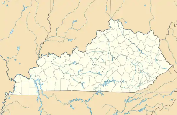
Coxton, Kentucky
Coxton is an unincorporated coal town and census-designated place (CDP) in Harlan County, Kentucky, United States. Their post office[3] is closed. The community was listed as a CDP in 2014, so no population figures are available from the 2010 census.
Coxton, Kentucky | |
|---|---|
 Coxton  Coxton | |
| Coordinates: 36°51′26″N 83°16′13″W | |
| Country | United States |
| State | Kentucky |
| County | Harlan |
| Area | |
| • Total | 0.22 sq mi (0.57 km2) |
| • Land | 0.21 sq mi (0.54 km2) |
| • Water | 0.01 sq mi (0.04 km2) |
| Elevation | 1,217 ft (371 m) |
| Population (2020) | |
| • Total | 176 |
| • Density | 850.24/sq mi (328.26/km2) |
| Time zone | UTC-5 (Eastern time zone) |
| • Summer (DST) | UTC-4 (EDT) |
| FIPS code | 21-17938 |
| GNIS feature ID | 490235[2] |
Geography
Coxton is in central Harlan County in the valley of the Clover Fork of the Cumberland River. It is bordered by Blackjoe to the west and Brookside to the east, both unincorporated. Kentucky Route 38 runs along the southern edge of the Coxton CDP, across the Clover Fork from the center of town. KY 38 leads west down the Clover Fork valle 4 miles (6 km) to Harlan, the county seat, and east (upriver) 4.5 miles (7.2 km) to Evarts.
References
- "2020 U.S. Gazetteer Files". United States Census Bureau. Retrieved March 18, 2022.
- U.S. Geological Survey Geographic Names Information System: Coxton, Kentucky
- U.S. Geological Survey Geographic Names Information System: Coxton, Kentucky
- "Census of Population and Housing". Census.gov. Retrieved June 4, 2016.
Municipalities and communities of Harlan County, Kentucky, United States | ||
|---|---|---|
| Cities | 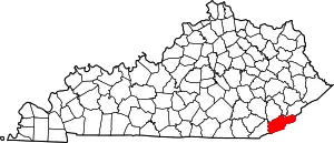 Location of Harlan County, Kentucky | |
| CDPs | ||
| Other unincorporated communities |
| |
| Ghost towns | ||
This article is issued from Wikipedia. The text is licensed under Creative Commons - Attribution - Sharealike. Additional terms may apply for the media files.