Crooked Creek, Georgia
Crooked Creek is a census-designated place in Putnam County, Georgia, United States. Its population was 685 as of the 2020 census. The community is located on the western bank of the Oconee River.
Crooked Creek, Georgia | |
|---|---|
 Crooked Creek, Georgia | |
| Coordinates: 33°15′42″N 83°16′04″W | |
| Country | United States |
| State | Georgia |
| County | Putnam |
| Area | |
| • Total | 3.83 sq mi (9.93 km2) |
| • Land | 3.23 sq mi (8.37 km2) |
| • Water | 0.60 sq mi (1.56 km2) |
| Elevation | 420 ft (130 m) |
| Population (2020) | |
| • Total | 685 |
| • Density | 212.01/sq mi (81.86/km2) |
| Time zone | UTC-5 (Eastern (EST)) |
| • Summer (DST) | UTC-4 (EDT) |
| ZIP code | 31024[2] |
| Area code(s) | 706 & 762 |
| GNIS feature ID | 2587031[3] |
References
- "2020 U.S. Gazetteer Files". United States Census Bureau. Retrieved December 18, 2021.
- "Crooked Creek ZIP Code". zipdatamaps.com. 2023. Retrieved January 12, 2023.
- "Crooked Creek Census Designated Place". Geographic Names Information System. United States Geological Survey, United States Department of the Interior.
- "Census of Population and Housing". Census.gov. Retrieved June 4, 2016.
Municipalities and communities of Putnam County, Georgia, United States | ||
|---|---|---|
| City | 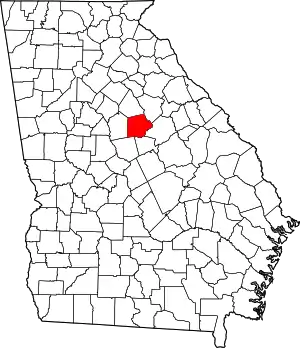 Map of Georgia highlighting Putnam County | |
| CDP | ||
| Unincorporated communities | ||
| Ghost town | ||
This article is issued from Wikipedia. The text is licensed under Creative Commons - Attribution - Sharealike. Additional terms may apply for the media files.