Dakshinkali
Dakshinkali is a municipality in Kathmandu District in the Province No. 3 of Nepal that was established on 2 December 2014 by merging the former Village development committees Chalnakhel, Chhaimale, Sheshnarayan, Sokhel, Talku Dudechaur and Old-Dakshinkali.[1][2] The municipality's name means 'Southern Kali' and refers to a several centuries old temple complex that lies in the vicinity.
Dakshinkali Municipality
दक्षिणकाली नगरपालिका | |
|---|---|
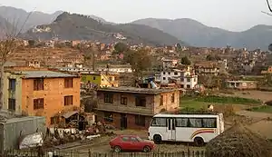
 Dakshinkali in 2009 | |
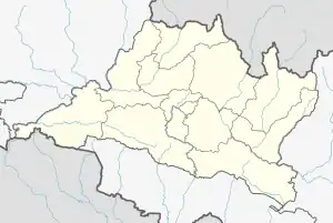
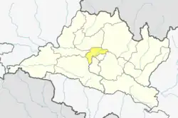
 Dakshinkali Municipality Location in Nepal  Dakshinkali Municipality Dakshinkali Municipality (Nepal) | |
| Coordinates: 27°35′0″N 85°15′0″E | |
| Country | |
| Region | Central |
| Zone | Bagmati Zone |
| District | Kathmandu District |
| Established | December 2014 |
| Government | |
| • Mayor | Mohan Basnet (NC) |
| • Deputy Mayor | Basanti Tamang (Dangol) (NC) |
| Area | |
| • Total | 42.6 km2 (16.4 sq mi) |
| Population | |
| • Total | 24,297 |
| • Density | 570/km2 (1,500/sq mi) |
| • Ethnicities | Newar Bahun Chhetri Tamang Magar |
| Time zone | UTC+5:45 (NST) |
| Website | www |
Population
Dakshinkali municipality has a total population of 24,297 according to 2011 Nepal census.[3]
- Dakshinkali municipality
 Pharping
 Fields
 Grain harvest
 Cave of Goraknath
 Rice terraces
 Prayer flags
 Monastery of Vajrayogini
 Dakshinkali temple
See also
References
- "Govt announces 61 municipalities". The Kathmandu Post. 3 December 2014. Retrieved 2 December 2014.
- "Govt creates 61 new municipalities". República. 3 December 2014. Retrieved 2 December 2014.
- "2011 Nepal census (Ward Level)" (PDF). Central Bureau of Statistics. November 2012. Archived from the original (PDF) on July 31, 2013.
This article is issued from Wikipedia. The text is licensed under Creative Commons - Attribution - Sharealike. Additional terms may apply for the media files.

