Daoli District
Daoli District (simplified Chinese: 道里区; traditional Chinese: 道裏區; pinyin: Dàolǐ Qū) is one of nine districts of the prefecture-level city of Harbin, the capital of Heilongjiang Province, Northeast China, forming part of the city's urban core. It is located on the Songhua River. It borders the districts of Songbei to the north, Daowai to the northeast, Nangang to the east, and Shuangcheng to the south, as well as the prefecture-level city of Suihua to the northwest.
Daoli
道里区 | |
|---|---|
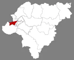 Location of Daoli in Harbin | |
.png.webp) Harbin in Heilongjiang | |
| Coordinates: 45°45′20″N 126°37′00″E[1] | |
| Country | China |
| Province | Heilongjiang |
| Sub-provincial city | Harbin |
| District seat | Fushun Subdistrict |
| Area | |
| • Total | 479.2 km2 (185.0 sq mi) |
| Elevation | 130 m (430 ft) |
| Population (2020 census)[3] | |
| • Total | 1,097,430 |
| • Density | 2,300/km2 (5,900/sq mi) |
| Time zone | UTC+8 (China Standard) |
| Area code | 0451 |
| Website | www |
Nowadays, Daoli District is also famous because of Central Street, which is one of the main business streets in Harbin.
Administrative divisions
There are 19 subdistricts and four towns in the district:[4]
|
|
References
- Google (2014-07-02). "Daoli Government" (Map). Google Maps. Google. Retrieved 2014-07-02.
- Harbin Statistical Yearbook 2011 (《哈尔滨统计年鉴2011》). Accessed 8 July 2014.
- "2020年哈尔滨市第七次全国人口普查主要数据公报" (in Chinese). Harbin Municipal People's Government. 2021-05-31.
- 2022年统计用区划代码和城乡划分代码:道里区 (in Chinese). National Bureau of Statistics of the People's Republic of China.
External links
This article is issued from Wikipedia. The text is licensed under Creative Commons - Attribution - Sharealike. Additional terms may apply for the media files.