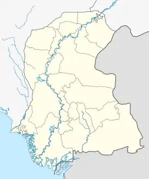
Daulatpur, Sindh
Daulatpur (Sindhi: دولت پور) is a town, 20 km (12 mi) north of Kazi Ahmed and 20 km (12 mi) south of Moro,[2] in Kazi Ahmed Taluka (formally Daulatpur Taluka) Nawabshah District of the Sindh province of Pakistan. It was also taluka headquarters but in 2009 the taluka Status was shifted to Kazi Ahmed Town. It lies on the main N-5 National Highway and is near the Indus River. The Villages Near The Daulatpur Are Sardar Raza Mohammad Dahri, Kharr, Inayatullah Dahri, Dino Machine, KarimAbad, etc. People Of Daulatpur Mostly Speak Urdu And Sindhi. Shahi Bazaar Is The Main Bazaar In Daulatpur. Moro Is At The Distance Of 19.7 km Far From Daulatpur. Most Of The People Have Their Own Shops Or Business.[3]
Daulatpur
دولت پور | |
|---|---|
Town | |
 Daulatpur  Daulatpur | |
| Coordinates: 26°24′30″N 68°09′23″E | |
| Country | |
| Province | |
| Division | Shaheed Benazir Abad |
| District | Nawabshah District |
| Taluka | Kazi Ahmed Taluka |
| Taluka Status | 14 Nov 1989 |
| Taluka Status shifted | 22 Oct 2009 |
| Elevation | 25 m (82 ft) |
| Population | |
| • City | 24,305 |
| Time zone | UTC+5 (PST) |
| Calling code | 0244 |
History
It was at the forefront of the Movement for Restoration of Democracy (MRD) of 1983.[2]
The Taluka was established on the bifurcation of District Nawabshah in 14 Nov 1989,[4] when Naushahro Feroze District created after bifurcation of Nawabshah District Moro Taluka be the part of newly Naushahro Feroze District but some parts of Moro Taluka (Daulatpur town) remain in Nawabshah District then some areas of Sakrand Taluka (Kazi Ahmed Town) separated to merged with Daulatpur Town to created a new Taluka Daulatpur, Kazi Ahmed Headquarter established in Daulatpur Town.[5]
The name of Taluka always confused because indicating both towns then the Sindh Government overcome this issue By its fourth resolution on 22 Oct 2009, moved jointly by Sardar Jam Tamachi and Law Minister Ayaz Soomro, the assembly recommended “to the government of Sindh that Taluka Daulatpur, Kazi Ahmed, of District Shaheed Benazirabad may be renamed as Taluka Kazi Ahmad.”[6]
Transport
- The main N-5 highway passes through.
- The railway line operated until the 1980s.[2]
References
- "Sindh (Pakistan): Province, Major Cities, Municipalites [sic] & Towns - Population Statistics, Maps, Charts, Weather and Web Information".
- "Travelling on the N-5 Part 1, Pakistaniat, Retrieved on 10 June 2010". Pakistaniat.com. Retrieved 2012-08-05.
- Report, Dawn (2022-08-11). "Heavy rain batters most areas in province". DAWN.COM. Retrieved 2023-10-20.
- "New de-limitations of PA seats in upper Sindh". DAWN.COM. 2002-08-26. Retrieved 2023-10-20.
- InpaperMagazine, From (2012-03-03). "Kalhora dynasty: Domes and debris". DAWN.COM. Retrieved 2023-10-20.
- "KARACHI: Revenue secretary gets powers to cancel fake land allotments". DAWN.COM. 2009-10-22. Retrieved 2023-10-19.