Naushahro Feroze District
Naushahro Feroze District (Sindhi: نوشهرو فيروز ضلعو, Urdu: ضلع نوشهرو فیروز) is a district in the province of Sindh, Pakistan. Its capital is Naushahro Feroze city. Administratively subdivided into five talukas and 51 union councils, according to the 2017 census of Pakistan it had a population of 1,612,373.[2] The Naushahro Feroze was given the status of District on 15 November 1989 and. Before, it was Taluka of Nawabshah District (Now Shaheed Benazirabad). On given status as district, Naushahro Feroze was placed under administrative control of Sukkur Division however, it has been placed under Shaheed Benazirabad Division during 2011.
Naushahro Feroze District
ضلع نوشہرو فیروز نوشهرو فيروز ضلعو | |
|---|---|
.jpg.webp) Fields in Naushahro Feroze district | |
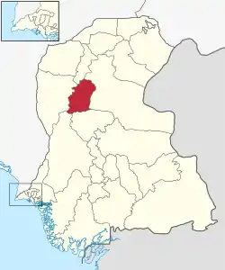 Map of Sindh with Naushahro Feroze District (نوشهرو فیروز) highlighted | |
| Country | |
| Province | |
| Division | Shaheed Benazir Abad |
| Largest city | Moro |
| Headquarters | Naushahro Feroze |
| Government | |
| • Type | District Administration |
| • Deputy Commissioner | Muhammad Arslan Saleem |
| • District Police Officer | Qayum pitafi |
| • District Health Officer | N/A |
| Area | |
| • Total | 2,946 km2 (1,137 sq mi) |
| Population | |
| • Total | 1,612,047 |
| • Density | 550/km2 (1,400/sq mi) |
| Time zone | UTC+5 (PST) |
| Website | www |
Government and politics
National Assembly representation
District Naushahro Feroze has two members in National Assembly of Pakistan. The district electoral is referred to as NA-211 and NA-212. The member elected from NA-212 represents the constituencies of Moro and Naushahro Feroze Talukas. The member elected from NA-211 represents Kandiaro, Bhirya and Mehrabpur Talukas.
Provincial Assembly representation
The district has five member representation in Provincial Assembly of Sindh. The provincial assembly electoral for the district is as below:
- PS-35 (Naushahro Feroze city, Mithiani, Abran, Bhorti)
- PS-34 (Tharushah, Bhirya, Darbelo)
- PS-33 (Halani, Kandiaro, Mehrabpur)
decreased one seat in census 2017
- PS-36 (Moro, New Jatoi, Dars)
Local governments (tehsils of district)
| Administrative unit | Number of Kanungo circles/ Supervisory uapas | Number of mouzas Circles/Ttpas | Total | Rural | Urban | Partly Urban | Forest | Unpopulated | Population |
|---|---|---|---|---|---|---|---|---|---|
| Naushahro Feroze | 3 | 21 | 60 | 51 | 01 | 07 | -- | 01 | 372,821 [2] |
| Bhiria | 2 | 17 | 33 | 21 | 01 | 10 | -- | 01 | 301,044 [2] |
| Moro | 4 | 26 | 53 | 47 | -- | 02 | 03 | 01 | 368,789 [2] |
| Kandiaro | 3 | 17 | 53 | 46 | -- | 03 | 04 | 01 | 322,439 [2] |
| Mehrabpur | 2 | 16 | 34 | 29 | -- | 05 | -- | -- | 247,280 [2] |
| Total | 14 | 97 | 233 | 194 | 02 | 27 | 07 | 03 | 1,612,373 [2] |
Transportation
The main N-5 passes through the district.
The main railway track passes through the district which is not functional for a long time. The route was from Padidan to NF, Moro, Dadu, etc. but it has ended now. Now the main major railway station for the NF peoples is Padidan which is fully functional and having second longest platform in Pakistan with a vast locoshed area. Have major trains stop, Hazara Express, Awami Express, Fareed Express, Pakistan Express and Sukkur Express.
Demographics
At the time of the 2017 census, Naushahro Feroze district had a population of 1,612,047, of which 831,392 were males and 780,446 females. The rural population was 1,232,814 (76.48%) and urban 379,233 (23.52%). The literacy rate is 53.83%: 66.22% for males and 40.73% for females.[1]
The majority religion is Islam, with 98.30% of the population. Hinduism (including those from Scheduled Castes) is practiced by 1.64% of the population.[1]
At the time of the 2017 census, 89.45% of the population spoke Sindhi, 4.68% Urdu and 3.34% Punjabi as their first language.[1]
List of Dehs
The following is a list of Naushahro Feroze District's Dehs, organised by Tehsils:[3]
- Naushahro Feroze Tehsil (58 Dehs)
- Wagan,
- Agham
- Arban
- Batil
- Bhanbhri
- Bhurnd
- Bookar
- Chanari
- Changal
- Cheeho
- Dall
- Danheja
- Dhori Bachal
- Gejh No. 1
- Gejh No. 2
- Ghanghro
- Izzat Waggan
- Jarri
- Jiskani
- Kajhar
- Kalooro
- Kalro
- Kanghal
- Keti Abu Bakar No. 1
- Keti Abu Bakar No. 2
- Khariro
- Khuhawar No. 1
- Khuhawar No. 2
- Khuhi Jalal
- Koor Gahno
- Koor Hassan
- Loothi
- Masur Ji Wai
- Menghlo
- Miranpur
- Mithiani No. 1
- Mithiani No. 2
- Mubejani
- Nathar Detha
- Naushahro
- Noor Pur
- Paddidan
- Panjo
- Parya
- Phull
- Pir Parto
- Sahib Khan
- Seengarchi
- Serhal
- Sher Khan
- Shuja Muhammad
- Tetri
- Thatt No. 1
- Thatt No. 2
- Veesar
- Wagan
- Wassan
- Wassayo
- Moro Tehsil (53 Dehs)
- Abad Kahkot
- Belo Khero Dero
- Belo Lalia
- Bet Budho
- Bhambhro Dero
- Borarai
- Chando
- Chaneja
- Dalchand
- Daris
- Deparja
- Dheeran Jagir
- Dilo Shah
- Doro Behan
- Dumber Ji Wai
- Fareed Dero
- Fato Balal
- Fazil Jagir
- Ganghan Jagir
- Ghairabad Kahkot
- Gharho
- Junalo
- Kacho Koheri
- Kalhora
- Karap
- Kareja
- Karocho
- Kenchi Jagir
- Khair Wah
- Khaliso
- Khero Dero
- Khokhar
- Korai
- Kot Satabo
- Lalia
- Lett
- Lundki
- Malkani
- Manaheen
- Mari
- Miran Jatoi
- Misri
- Moro
- New Gachero
- Old Gachero
- Qaim Koor
- Sadhuja
- Saleh Pur
- Sehra
- Sultan Beghan
- Wad Pagia
- Waryaso Jagir
- Waryaso Rayati
- Mehrabpur Tehsil (34 Union councils)
- Bago Daro
- Behlani
- Bhorgi
- Chibhar Babhan
- Deengaro
- Dehat
- Dewan
- Dodha
- Godho Hindu
- Halani
- Hote Khan Jalbani
- Kotri Kabeer
- Langarji
- Mad Ibyani
- Mehar Haji
- Mehrabpur
- Moule Dino Haji
- Natho Rajper
- Nau-Abad
- Peer Waito
- Punjaban
- Qaisar Mari
- Rajo Dahri
- Saeed Pur
- Saleh Sahito
- Sangi
- Sittar Dino Mangrio
- Syed Shuja
- Tuttah
- Vighia Mal
- Kandiaro Tehsil (52 Dehs)
- Abad-111
- Bahri-1
- Bahri-2
- Bazidpur
- Beelo Kamaldero
- Bello Mohbatdero
- Dello Sumita
- Belo Bhounar
- Bhagodero-1
- Bhagodero-2
- Bhority
- Budak
- Chachak
- Dabhro
- Darbelo new
- Darbelo old
- Detha
- Ghanghra
- Ghulam Shah
- Gul Shah
- Haji Shah
- Jea Pota
- Kalatagar-1
- Kalatagar-2
- Kamaldero-1
- Kamaldero-2
- Kandhar
- Kandiaro
- Khairodero
- Khanwahan
- Kouro Khushik
- Ladho Bisharat
- Lakha
- Larik
- Lundi
- Machi
- Mahessar
- Manjuth
- Mirzapur
- Mohbatdero Jagir
- Mohbatdero Siyal
- Moria
- Mosodero
- Pirmard
- Sahita
- Salehpur
- Samita
- Sethar
- Shah Mirdero
- Shanikhani
- Sona Bindi
- Thatt Moosa
- Bhiria Tehsil (32 Dehs)
- Baran
- Bella Wah
- Bhiria
- Bhiro
- Burira
- Chaheen Manomal
- Chakar Wah
- Dali
- Dalipota
- Dheengaro
- Dingaro
- Gher Gujo
- Jalbani
- Kajar
- Kandir
- Khah Jagir
- Khahi Mamon
- Khahi Qasim
- Khahi Rahu
- Kot Bahadur
- Ladho Rano
- Machur
- Madd Aleem
- Mango
- Molhan Jagir
- Molhan Rayati
- Palano
- Panhwari
- Pano Usman
- Rajo Keerio
- Soondhan
- Tharushah
References
- "District-wise Tables - Census 2017 Final Results". pbs.gov.pk. Pakistan Bureau of Statistics. 2017.
- "DISTRICT WISE CENSUS RESULTS CENSUS 2017" (PDF). www.pbscensus.gov.pk. Archived from the original (PDF) on 2017-08-29.
- "List of Dehs in Sindh" (PDF). Sindh Zameen. Retrieved 22 March 2021.
Bibliography
- 1998 District census report of Naushahro Firoze. Census publication. Vol. 92. Islamabad: Population Census Organization, Statistics Division, Government of Pakistan. 2000.
External links
Provincial capital: Karachi | ||
| Banbhore | 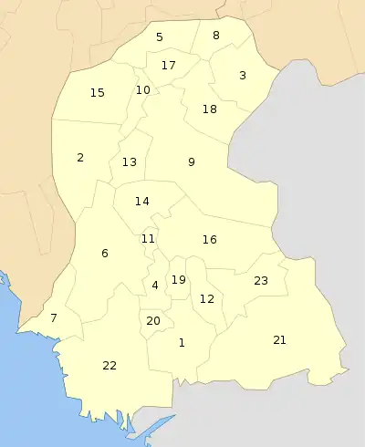 | |
| Hyderabad | ||
| Karachi | ||
| Larkana | ||
| Mirpur Khas | ||
| Sukkur | ||
| Shaheed Benazir Abad | ||