Karachi District (South District)
Karachi South District (Urdu: ضلع کراچی جنوبی) is an administrative district of Karachi Division in Sindh, Pakistan.
Karachi South District
ضلع کراچی جنوبی ڪراچي ڏکڻ ضلعو | |
|---|---|
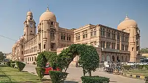 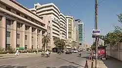  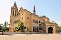  Clockwise from top-left: Old Karachi Municipal Corporation, I. I. Chundrigar Road, Frere Hall, View of Mazar-e-Quaid, National Museum of Pakistan | |
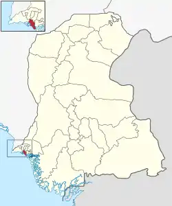 Map of Karachi South District | |
| Country | |
| Province | |
| Division | Karachi |
| Established | 1972 |
| Re-established | 11 July 2011 |
| Headquarters[1] | DMC East office |
| Government | |
| • Type | Municipal corporation |
| • Body | DMC South |
| • Deputy Commissioner | Capt (R) Muhammad Saeed Laghari [3] |
| • Administrator | Afshan Rabab[2] |
| Area | |
| • Total | 122 km2 (47 sq mi) |
| Population (2017)[4] | |
| • Total | 1,769,230 |
| • Density | 15,000/km2 (38,000/sq mi) |
| Website | dmcsouth |
History
Karachi South District is the economic backbone of the country. It has Head Offices of many Corporations, Companies and Banks. Chief Secretary House, Governor House, Chief Minister House, Commissioner House, Commissioner Office, Sindh Assembly, High Court, Embassies and Consulates of different countries and other government offices are also located there.
The district was abolished in 2000, and was divided into two towns namely: Jamshed Town, and Saddar Town.
On 11 July 2011, the Sindh Government restored again Karachi South District.[5]
In November 2013, Jamshed Town was added into Karachi East District, after three eastern towns of that district split up to form a new district named Korangi. Now Karachi South comprise Saddar along with Clifton and Defence area. Karachi South is considered to be the most affluent area of the city. mujeeb baloch pm of karachi
Demographics
At the time of the 2017 census, Karachi South district had a population of 1,769,230, of which 930,691 were males and 838,349 females. The entire population was urban. The literacy rate is 77.79%: 79.98% for males and 75.33% for females.[4]
The majority religion is Islam, with 94.13% of the population. Hinduism (including Scheduled Castes) is practiced by 4.01% and Christianity by 1.70% of the population.[4]
At the time of the 2017 census, 25.62% of the population spoke Urdu, 15.79% Sindhi, 11.07% Punjabi, 10.67% Balochi, 9.95% Pashto, 5.08% Hindko and 3.73% Saraiki as their first language. A large percentage of the population speaks languages recorded as 'Other' on the census, such as Gujarati.[4]
Administrative Towns of Karachi South
Following is the list of two administrative towns of Karachi South District.[6]
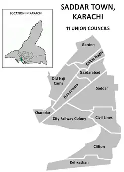
Saddar Town
| Union Council |
|
|---|---|
| U.C. 1 Old Haji Camp | |
| U.C. 2 Garden | |
| U.C. 3 Kharadar | |
| U.C. 4 City Railway Colony | |
| U.C. 5 Nanak Wara | |
| U.C. 6 Gazdarabad | |
| U.C. 7 Millat Nagar/Islam Pura | |
| U.C. 8 Saddar | |
| U.C. 9 Civil Line | |
| U.C. 10 Clifton | |
| U.C. 11 Kehkashan | |
See also
References
- "ADMINISTRATIVE DISTRICTS". Commissioner, Karachi Division.
- "Puddles of rainwater cause hardships for motorists". The News International (newspaper). 6 January 2022. Retrieved 11 January 2022.
- "We'll promote sports and populate the grounds: Issani". The Nation (newspaper). 11 May 2022. Retrieved 19 May 2022.
- "District-wise Tables - Census 2017 Final Results". pbs.gov.pk. Pakistan Bureau of Statistics. 2017.
- Karachi's district status restored, notification issued, Published in The News Tribe on 11 July 2011, Retrieved on 22 August 2012
- "District". 12 November 2012. Archived from the original on 12 November 2012. Retrieved 31 August 2023.
Provincial capital: Karachi | ||
| Banbhore |  | |
| Hyderabad | ||
| Karachi | ||
| Larkana | ||
| Mirpur Khas | ||
| Sukkur | ||
| Shaheed Benazir Abad | ||