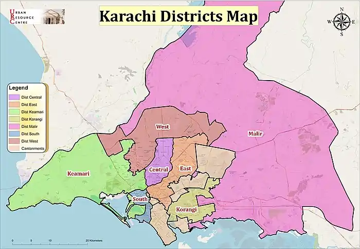
Malir District
Malir District (Urdu: ضلع ملير) is an administrative district of Karachi Division in Sindh, Pakistan.
Malir District
ضلع ملیر ملير ضلعو | |
|---|---|
  | |
 Seal | |
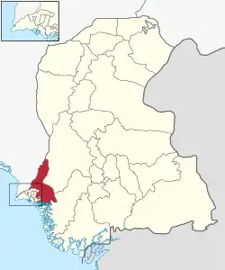 Map of Malir District | |
| Country | |
| Province | |
| Division | Karachi |
| Established | 1996 |
| Re-established | 11 July 2011 |
| Headquarters[1] | DMC Malir |
| Government | |
| • Type | Municipal corporation |
| • Body | DMC Malir |
| • Deputy Commissioner | Arfan Salam Mirwani [3] |
| • Administrator | Riaz Khatri[2] |
| Area | |
| • Total | 2,160 km2 (830 sq mi) |
| Population (2017)[4] | |
| • Total | 1,924,346 |
| • Density | 890/km2 (2,300/sq mi) |
History
Before the independence of Pakistan, there were small villages of Sindhi and Lateeg now known by Kalmati Baloch after becoming Money and status in the Gadap Town and Malir Town of modern Karachi. Now both towns are developed as the suburbs of the city because of the urban sprawl.[5]
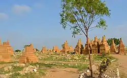
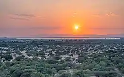
Countryside
Malir has been regarded in history as the countryside of Karachi City due to its open atmosphere and lush green farms, but now these are no more.[6]
Agriculture land
Malir was once famous for its fruit and vegetable farms; but, now due to severe scarcity of groundwater, these farmlands are being converted into residential areas, thus increasing urbanization and environmental degradation. The Society for Conservation and Protection of Environment (SCOPE) has been concerned about drought and desertification in Malir district and has launched a campaign against illegal sand and gravel mining in dry river beds of Malir and its tributaries. Because sand and gravel mining cause lowering of ground water, as rainwater can cannot percolate in the aquifer. SCOPE is developing rainwater reservoirs in drought affected rural areas.[7]
Administrative status
Malir District was established in 1996.
Malir District was abolished in 2000 and divided into three towns namely:
On 11 July 2011, Sindh Government restored again Malir District.[8]
Demographics
At the time of the 2017 census, Malir district had a population of 1,924,346, of which 1,028,865 were males and 895,329 females. The rural population was 857,634 (44.57%) and urban 1,066,712 (55.43%). The literacy rate is 63.69%: 69.85% for males and 56.43% for females.[4]
The majority religion is Islam, with 96.39% of the population. Christianity is practiced by 1.78% and Hinduism (including Scheduled Castes) is practiced by 1.77% of the population.
Epidemic of mysterious Chikungunya virus
Due to pollution, mainly resulting from garbage dumps and overflow of sewerage water, Emergency declared in Malir Town, as thousands of patients were affected by mysterious Chikungunya virus in December, 2016. Despite joint denial by WHO and Health Ministry of Pakistan, Provincial Government of Sindh discloses that aedes aegypti mosquito is responsible for spreading Chikungunya in the area.[9][10]
See also
References
- "ADMINISTRATIVE DISTRICTS". Commissioner, Karachi Division.
- "Commissioner inspects preparations for Eid Miladun Nabi". The News International (newspaper). 16 October 2021. Retrieved 11 January 2022.
- "Karachi commissioner calls for quick removal of public complaints". Samaa TV. 6 October 2021. Retrieved 11 January 2022.
- "Malir District Tables - Census 2017 Final Results". pbs.gov.pk. Pakistan Bureau of Statistics. 2017. Retrieved 7 March 2022.
- "From Zardaris to Makranis: How the Baloch came to Sindh". The Express Tribune. 27 March 2014. Retrieved 18 October 2020.
- "Save the Green Belt of Malir". The Nation. 18 August 2019. Retrieved 18 October 2020.
- "SCOPE - Society for Conservation and Protection of Environment". www.scope.org.pk. Retrieved 7 March 2022.
- Five districts of Karachi restored, notification issued Geo TV News website, Published 11 July 2011, Retrieved 7 March 2022
- Khawar Khan (20 December 2016). "More patients arrive at Karachi hospital with symptoms of mysterious virus". Geo TV News website. Retrieved 7 March 2022.
- "Aedes aegypti mosquito responsible for Chikungunya virus in Karachi: report". Dunya TV News website. 21 December 2016. Retrieved 7 March 2022.
Provincial capital: Karachi | ||
| Banbhore | 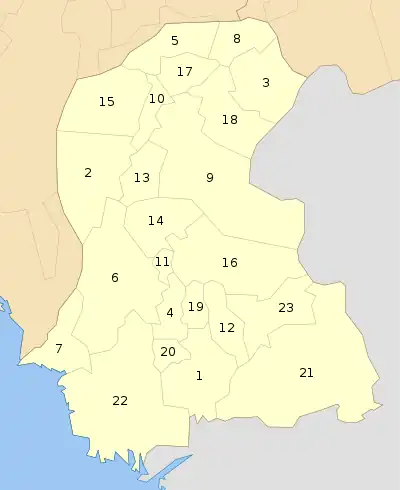 | |
| Hyderabad | ||
| Karachi | ||
| Larkana | ||
| Mirpur Khas | ||
| Sukkur | ||
| Shaheed Benazir Abad | ||