Deepstep, Georgia
Deepstep is a town in Washington County, Georgia, United States. The population was 132 at the 2000 census.
Deepstep, Georgia | |
|---|---|
 United Methodist Church | |
 Location in Washington County and the state of Georgia | |
| Coordinates: 33°1′19″N 82°58′6″W | |
| Country | United States |
| State | Georgia |
| County | Washington |
| Area | |
| • Total | 0.88 sq mi (2.29 km2) |
| • Land | 0.82 sq mi (2.11 km2) |
| • Water | 0.07 sq mi (0.18 km2) |
| Elevation | 312 ft (95 m) |
| Population (2020) | |
| • Total | 117 |
| • Density | 143.38/sq mi (55.38/km2) |
| Time zone | UTC-5 (Eastern (EST)) |
| • Summer (DST) | UTC-4 (EDT) |
| ZIP code | 31082 |
| Area code | 478 |
| FIPS code | 13-22108[2] |
| GNIS feature ID | 0331534[3] |
History
A post office called Deepstep was established in 1886.[4] The Georgia General Assembly incorporated the place in 1900 as the "Town of Deepstep".[5] The town is named after Deepstep Creek.[6]
Geography
Deepstep is located at 33°1′19″N 82°58′6″W (33.021827, -82.968337).[7]
According to the United States Census Bureau, the town has a total area of 0.8 square miles (2.1 km2), of which 0.8 square miles (2.1 km2) is land and 0.04 square miles (0.10 km2) (2.53%) is water.
Demographics
| Census | Pop. | Note | %± |
|---|---|---|---|
| 1910 | 149 | — | |
| 1920 | 184 | 23.5% | |
| 1930 | 180 | −2.2% | |
| 1940 | 174 | −3.3% | |
| 1950 | 159 | −8.6% | |
| 1960 | 139 | −12.6% | |
| 1970 | 107 | −23.0% | |
| 1980 | 120 | 12.1% | |
| 1990 | 111 | −7.5% | |
| 2000 | 132 | 18.9% | |
| 2010 | 131 | −0.8% | |
| 2020 | 117 | −10.7% | |
| U.S. Decennial Census[8] | |||
As of the census[2] of 2000, there were 132 people, 54 households, and 40 families residing in the town. The population density was 170.0 inhabitants per square mile (65.6/km2). There were 59 housing units at an average density of 76.0 per square mile (29.3/km2). The racial makeup of the town was 100.00% White.
There were 54 households, out of which 37.0% had children under the age of 18 living with them, 72.2% were married couples living together, 3.7% had a female householder with no husband present, and 24.1% were non-families. 24.1% of all households were made up of individuals, and 16.7% had someone living alone who was 65 years of age or older. The average household size was 2.44 and the average family size was 2.90.
In the town, the population was spread out, with 21.2% under the age of 18, 4.5% from 18 to 24, 27.3% from 25 to 44, 26.5% from 45 to 64, and 20.5% who were 65 years of age or older. The median age was 42 years. For every 100 females, there were 103.1 males. For every 100 females age 18 and over, there were 100.0 males.
The median income for a household in the town was $44,583, and the median income for a family was $51,875. Males had a median income of $32,500 versus $25,000 for females. The per capita income for the town was $20,182. There were 4.9% of families and 3.3% of the population living below the poverty line, including no under eighteens and none of those over 64.
See also
References
- "2020 U.S. Gazetteer Files". United States Census Bureau. Retrieved December 18, 2021.
- "U.S. Census website". United States Census Bureau. Retrieved January 31, 2008.
- "US Board on Geographic Names". United States Geological Survey. October 25, 2007. Retrieved January 31, 2008.
- "Post Offices". Jim Forte Postal History. Retrieved April 19, 2018.
- Acts Passed by the General Assembly of Georgia. J. Johnston. 1900. p. 279.
- Krakow, Kenneth K. (1975). Georgia Place-Names: Their History and Origins (PDF). Macon, GA: Winship Press. p. 60. ISBN 0-915430-00-2.
- "US Gazetteer files: 2010, 2000, and 1990". United States Census Bureau. February 12, 2011. Retrieved April 23, 2011.
- "Census of Population and Housing". Census.gov. Retrieved June 4, 2015.
Municipalities and communities of Washington County, Georgia, United States | ||
|---|---|---|
| Cities | 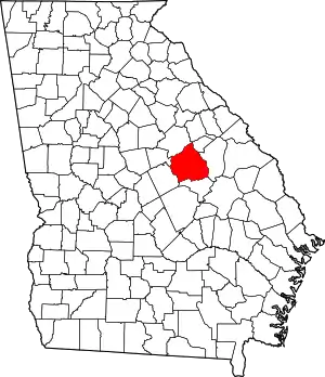 Map of Georgia highlighting Washington County | |
| Towns | ||
| CDP | ||
| Other unincorporated communities | ||