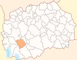
Demir Hisar Municipality
Demir Hisar (Macedonian: Демир Хисар [dɛˈmir‿xisar] ⓘ) is a municipality in the southwestern part of North Macedonia. Demir Hisar, which means "iron fortress" in Turkish, is also the name of the town where the municipal seat is found. Demir Hisar municipality is part of the Pelagonia Statistical Region.
Municipality of Demir Hisar
Општина Демир Хисар | |
|---|---|
Municipality | |
 Flag | |
 | |
| Country | |
| Region | |
| Municipal seat | Demir Hisar |
| Government | |
| • Mayor | Nikola Najdovski (VMRO-DPMNE)[1] |
| Area | |
| • Total | 480.13 km2 (185.38 sq mi) |
| Population | |
| • Total | 7,260 |
| • Density | 15/km2 (39/sq mi) |
| Time zone | UTC+1 (CET) |
| Area code | 47 |
| car plates | DH |
Geography
The municipality borders Kičevo Municipality to the north, Kruševo Municipality and Mogila Municipality to the east, Bitola Municipality to the south, and Resen Municipality, Ohrid Municipality, and Debarca Municipality to the west.
Demographics
According to the last national census from 2021 this municipality has 7,260 inhabitants.
Ethnic groups in the municipality include:
| 2002 | 2021 | |||
| Number | % | Number | % | |
| TOTAL | 9,497 | 100 | 7,260 | 100 |
| Macedonians | 9,179 | 96.7 | 6,708 | 92.4 |
| Persons for whom data are taken from administrative sources | n/a | n/a | 269 | 3.71 |
| Albanians | 232 | 2.4 | 218 | 3.0 |
| Turks | 35 | 0.4 | 4 | 0.06 |
| others | 51 | 0.5 | 61 | 0.84 |
References
- Local Elections 2021 – Mayor of Demir Hisar. State Election Commission.
External links
| Eastern | ||
|---|---|---|
| Northeastern | ||
| Pelagonia | ||
| Polog | ||
| Skopje | ||
| Southeastern | ||
| Southwestern | ||
| Vardar | ||
| City of Skopje | ||
| Former |
| |
This article is issued from Wikipedia. The text is licensed under Creative Commons - Attribution - Sharealike. Additional terms may apply for the media files.