Demirköy, Kırklareli
Demirköy (Turkish: Demirköy, "iron village"; known as Малък Самоков, Malak Samokov in Bulgarian) is a town in Kırklareli Province, in the Marmara region of Turkey. It is the seat of Demirköy District.[2] Its population is 3,489 (2022).[1] According to the Ottoman population statistics of 1914, the kaza of Demirköy had a total population of 9,133, consisting of 5,110 Greeks and 4,023 Muslims.[3] The inhabitants are mainly descendants of Pomaks Muslims from the village of Tisovo[4] and other villages from the Greek side of the Chech region who were settled in Demirköy during the population exchange between Greece and Turkey in 1923/1924. Prior to that, the village was known as Samakovo (Greek: Σαμάκοβο) or Samokov (Bulgarian: Самоков).
Demirköy | |
|---|---|
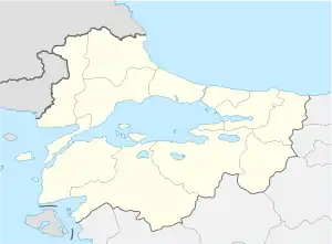
 Demirköy Location in Turkey  Demirköy Demirköy (Marmara) | |
| Coordinates: 41°49′21″N 27°45′47″E | |
| Country | Turkey |
| Province | Kırklareli |
| District | Demirköy |
| Government | |
| • Mayor | Recep Gün (AKP) |
| Elevation | 300 m (1,000 ft) |
| Population (2022)[1] | 3,489 |
| Time zone | TRT (UTC+3) |
| Area code | 0288 |
| Climate | Cfb |
| Website | www |
The mayor is Recep Gün, elected in 2019.[5]
Visitor attractions

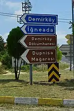
A historic metalworking facility dating back to the 15th century, the Demirköy Foundry (Turkish: Demirköy Dökümhanesi), currently an archaeological site, is located 3.8 km (2.4 mi) southeast of Demirköy.[6]
The Dupnisa Cave (Turkish: Dupnisa Mağarası) is a show cave located deep in the Strandzha forests 25 km (16 mi) southwest of the town.[7]
The İğneada Floodplain Forests National Park (Turkish: İğneada Longoz Ormanları Milli Parkı) is at 25 km (16 mi) east of Demirköy near İğneada.[8] The Lake Saka Nature Reserve is situated inside the national park.[9]
References
- "Address-based population registration system (ADNKS) results dated 31 December 2022, Favorite Reports" (XLS). TÜİK. Retrieved 13 March 2023.
- İlçe Belediyesi, Turkey Civil Administration Departments Inventory. Retrieved 1 March 2023.
- Kemal Karpat (1985), Ottoman Population, 1830-1914, Demographic and Social Characteristics, The University of Wisconsin Press, p. 170-171
- https://nisanyanmap.com/?y=&t=Demirk%C3%B6y&cry=TR&u=1&ua=0
- Recep Gün, Sözcü. Retrieved 14 April 2023.
- "Demirköy (Samakocuk) Fatih Dökümhanesi" (in Turkish). Kırklareli Kültür Varlıkları Envanteri. Retrieved 2015-07-16.
- "Dupnisa Mağarası - Kırklareli" (in Turkish). Kültür ve Turizm Bakanlığı-Yatırım ve İşletmeler Genel Müdürlüğü. Retrieved 2015-07-16.
- "İğneada Longoz Ormanları Milli Parkı" (in Turkish). Doğa Koruma ve Milli Parklar Genel Müdürlüğü. Archived from the original on 2013-11-23. Retrieved 2015-07-16.
- "Kırklareli Kültür ve Tabiat Varlığı - Saka Gölü Tabiatı Koruma Alanı" (in Turkish). Kırklareli Yerel Net. Retrieved 2015-07-16.