Dianbai District
Dianbai District, alternately romanized as Tinpak,[lower-alpha 1] is an urban district of the prefecture-level city of Maoming in southwestern Guangdong Province, China.
Dianbai
电白区 Tinpak | |
|---|---|
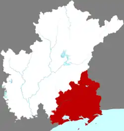 Location of Dianbai in Maoming | |
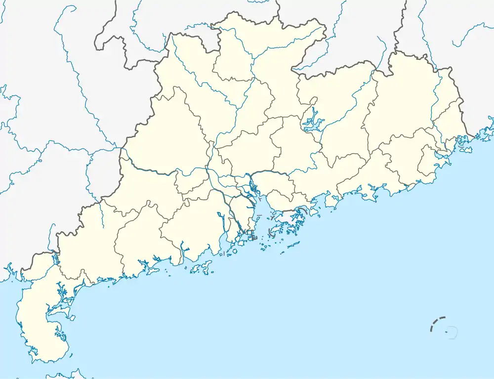 Dianbai Location in Guangdong | |
| Coordinates: 21°42′N 111°11′E | |
| Country | People's Republic of China |
| Province | Guangdong |
| Prefecture-level city | Maoming |
| Area | |
| • Total | 1,855 km2 (716 sq mi) |
| Population (2020)[1] | |
| • Total | 1,503,737 |
| • Density | 810/km2 (2,100/sq mi) |
| Time zone | UTC+8 (China Standard) |
| Dianbai District | |||||||||||||
|---|---|---|---|---|---|---|---|---|---|---|---|---|---|
| Simplified Chinese | 电白 | ||||||||||||
| Traditional Chinese | 電白 | ||||||||||||
| Postal | Tinpak | ||||||||||||
| |||||||||||||
History
Dianbei Commandery was established in AD 528 under the Liang dynasty. It and the subsequent Dianbei County were organized under Gaozhou Commandery.[3] Under the Qing, Dianbai was one of the major ports of Guangdong. After the Chinese Civil War, it was placed under Maoming and eventually promoted to an urban district. Dianbai absorbed Maoming's former Maogang District on 23 February 2014.
Climate
| Climate data for Dianbai (1991–2020 normals, extremes 1981–2010) | |||||||||||||
|---|---|---|---|---|---|---|---|---|---|---|---|---|---|
| Month | Jan | Feb | Mar | Apr | May | Jun | Jul | Aug | Sep | Oct | Nov | Dec | Year |
| Record high °C (°F) | 28.1 (82.6) |
30.8 (87.4) |
30.7 (87.3) |
33.1 (91.6) |
34.8 (94.6) |
37.1 (98.8) |
38.2 (100.8) |
37.5 (99.5) |
35.4 (95.7) |
34.6 (94.3) |
32.7 (90.9) |
29.8 (85.6) |
38.2 (100.8) |
| Average high °C (°F) | 20.9 (69.6) |
21.5 (70.7) |
23.9 (75.0) |
27.0 (80.6) |
30.2 (86.4) |
31.6 (88.9) |
32.0 (89.6) |
32.2 (90.0) |
31.6 (88.9) |
29.9 (85.8) |
26.7 (80.1) |
22.7 (72.9) |
27.5 (81.5) |
| Daily mean °C (°F) | 16.4 (61.5) |
17.6 (63.7) |
20.5 (68.9) |
23.8 (74.8) |
26.9 (80.4) |
28.4 (83.1) |
28.7 (83.7) |
28.3 (82.9) |
27.4 (81.3) |
25.3 (77.5) |
21.9 (71.4) |
17.8 (64.0) |
23.6 (74.4) |
| Average low °C (°F) | 13.3 (55.9) |
15.1 (59.2) |
18.1 (64.6) |
21.6 (70.9) |
24.5 (76.1) |
26.0 (78.8) |
26.1 (79.0) |
25.6 (78.1) |
24.5 (76.1) |
21.9 (71.4) |
18.4 (65.1) |
14.5 (58.1) |
20.8 (69.4) |
| Record low °C (°F) | 3.2 (37.8) |
4.4 (39.9) |
5.2 (41.4) |
11.6 (52.9) |
16.0 (60.8) |
18.5 (65.3) |
22.1 (71.8) |
22.1 (71.8) |
17.2 (63.0) |
11.7 (53.1) |
6.0 (42.8) |
2.0 (35.6) |
2.0 (35.6) |
| Average precipitation mm (inches) | 36.5 (1.44) |
35.1 (1.38) |
55.5 (2.19) |
118.8 (4.68) |
219.0 (8.62) |
238.9 (9.41) |
256.0 (10.08) |
280.9 (11.06) |
205.0 (8.07) |
88.5 (3.48) |
25.5 (1.00) |
34.6 (1.36) |
1,594.3 (62.77) |
| Average precipitation days (≥ 0.1 mm) | 5.9 | 7.7 | 9.1 | 11.0 | 14.1 | 15.8 | 15.2 | 16.9 | 13.8 | 6.2 | 5.4 | 5.0 | 126.1 |
| Average relative humidity (%) | 78 | 82 | 85 | 87 | 86 | 85 | 84 | 85 | 83 | 76 | 74 | 72 | 81 |
| Mean monthly sunshine hours | 124.6 | 93.7 | 80.5 | 102.5 | 165.4 | 183.1 | 218.1 | 203.5 | 193.6 | 210.8 | 176.9 | 153.0 | 1,905.7 |
| Percent possible sunshine | 37 | 29 | 22 | 27 | 41 | 46 | 53 | 51 | 53 | 59 | 53 | 46 | 43 |
| Source: China Meteorological Administration[4][5] | |||||||||||||
Notes
- The Postal Map romanization reflects the local Cantonese pronunciation of the name. It was also formerly romanized as Teen-pih[2] and Teën-pih.[3]
References
- "Diànbái Qū (District, China) - Population Statistics, Charts, Map and Location".
- Baynes, T. S., ed. (1878), , Encyclopædia Britannica, vol. 5 (9th ed.), New York: Charles Scribner's Sons
- Gützlaff, Charles (1838), China Opened, p. 527.
- 中国气象数据网 – WeatherBk Data (in Simplified Chinese). China Meteorological Administration. Retrieved 28 May 2023.
- 中国气象数据网 (in Simplified Chinese). China Meteorological Administration. Retrieved 28 May 2023.
Further reading
- Weikang, Bo (1 July 1998). "Dianbai County (Guangdong Province)". Chinese Education & Society. 31 (4): 41–65. doi:10.2753/CED1061-1932310441. ISSN 1061-1932. Retrieved 29 June 2022.
| Sub-provincial cities |
| ||||||||||||||||||||||||||||||||||||||||||||||||||||||||||||||||||||
|---|---|---|---|---|---|---|---|---|---|---|---|---|---|---|---|---|---|---|---|---|---|---|---|---|---|---|---|---|---|---|---|---|---|---|---|---|---|---|---|---|---|---|---|---|---|---|---|---|---|---|---|---|---|---|---|---|---|---|---|---|---|---|---|---|---|---|---|---|---|
| Prefecture-level cities |
| ||||||||||||||||||||||||||||||||||||||||||||||||||||||||||||||||||||
This article is issued from Wikipedia. The text is licensed under Creative Commons - Attribution - Sharealike. Additional terms may apply for the media files.