Xinyi, Guangdong
Xinyi, alternately romanized as Sunyi,[lower-alpha 1] is a county-level city in Guangdong Province, China. It is administered as part of the prefecture-level city of Maoming in the southwestern corner of the province,[3] bordering Guangxi to the west. As of the 2020 census, it had a population of 1,014,577 people. Though its metro area is much smaller with 418,731 inhabitants considered urban.[1]
Xinyi
信宜市 Sunyi; Hsini | |
|---|---|
 | |
 Xinyi is the northernmost division on this map of Maoming | |
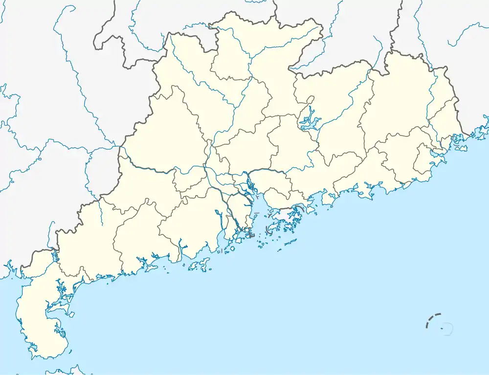 Xinyi Location in Guangdong | |
| Coordinates: 22°21′18″N 110°56′48″E | |
| Country | People's Republic of China |
| Province | Guangdong |
| Prefecture-level city | Maoming |
| Area | |
| • County-level city | 3,081 km2 (1,190 sq mi) |
| • Metro | 3,081 km2 (1,190 sq mi) |
| Population (2020 census[1]) | 1,014,577 |
| • Metro | 1,014,577 |
| • Metro density | 330/km2 (850/sq mi) |
| Time zone | UTC+8 (China Standard) |
| Postal code | 525300 |
| Area code | (0)668 |
| License plate prefixes | 粤K |
| Website | www |
| Xinyi | |||||||||
|---|---|---|---|---|---|---|---|---|---|
| Simplified Chinese | 信宜 | ||||||||
| Postal | Sunyi | ||||||||
| |||||||||
History
Under the Qing, Xinyi County formed part of the prefecture of Gaozhou.[2] After the Chinese Civil War, it was reorganized under Maoming.
Transportation
Schools
Xinyi Middle School, the first county school in Xinyi District, was set up in 1916. It is now a national-level model high school.
Districts
Climate
| Climate data for Xinyi (1991–2020 normals, extremes 1981–2010) | |||||||||||||
|---|---|---|---|---|---|---|---|---|---|---|---|---|---|
| Month | Jan | Feb | Mar | Apr | May | Jun | Jul | Aug | Sep | Oct | Nov | Dec | Year |
| Record high °C (°F) | 29.0 (84.2) |
33.3 (91.9) |
34.9 (94.8) |
35.0 (95.0) |
36.3 (97.3) |
38.3 (100.9) |
38.9 (102.0) |
37.6 (99.7) |
37.5 (99.5) |
35.7 (96.3) |
34.4 (93.9) |
30.4 (86.7) |
38.9 (102.0) |
| Average high °C (°F) | 20.2 (68.4) |
21.6 (70.9) |
24.3 (75.7) |
28.0 (82.4) |
31.2 (88.2) |
32.5 (90.5) |
33.2 (91.8) |
33.2 (91.8) |
32.4 (90.3) |
30.1 (86.2) |
26.7 (80.1) |
22.2 (72.0) |
28.0 (82.4) |
| Daily mean °C (°F) | 15.2 (59.4) |
16.8 (62.2) |
19.8 (67.6) |
23.6 (74.5) |
26.4 (79.5) |
27.7 (81.9) |
28.3 (82.9) |
28.1 (82.6) |
27.2 (81.0) |
24.9 (76.8) |
21.1 (70.0) |
16.8 (62.2) |
23.0 (73.4) |
| Average low °C (°F) | 11.8 (53.2) |
13.6 (56.5) |
16.7 (62.1) |
20.5 (68.9) |
23.3 (73.9) |
24.9 (76.8) |
25.2 (77.4) |
25.0 (77.0) |
24.0 (75.2) |
21.3 (70.3) |
17.4 (63.3) |
13.2 (55.8) |
19.7 (67.5) |
| Record low °C (°F) | 2.0 (35.6) |
2.6 (36.7) |
3.9 (39.0) |
9.2 (48.6) |
14.8 (58.6) |
17.9 (64.2) |
21.2 (70.2) |
21.8 (71.2) |
15.8 (60.4) |
10.9 (51.6) |
4.4 (39.9) |
1.9 (35.4) |
1.9 (35.4) |
| Average precipitation mm (inches) | 42.9 (1.69) |
42.0 (1.65) |
71.4 (2.81) |
193.3 (7.61) |
302.6 (11.91) |
344.1 (13.55) |
276.1 (10.87) |
253.1 (9.96) |
141.9 (5.59) |
58.3 (2.30) |
41.9 (1.65) |
33.0 (1.30) |
1,800.6 (70.89) |
| Average precipitation days (≥ 0.1 mm) | 7.8 | 8.7 | 11.7 | 14.0 | 18.9 | 20.4 | 18.0 | 19.0 | 13.9 | 6.2 | 6.2 | 5.8 | 150.6 |
| Average relative humidity (%) | 72 | 76 | 79 | 80 | 81 | 83 | 81 | 82 | 78 | 69 | 68 | 66 | 76 |
| Mean monthly sunshine hours | 115.4 | 88.2 | 77.3 | 99.7 | 152.5 | 155.3 | 195.3 | 191.5 | 190.5 | 212.2 | 176.6 | 155.8 | 1,810.3 |
| Percent possible sunshine | 34 | 27 | 21 | 26 | 37 | 39 | 48 | 48 | 52 | 59 | 54 | 47 | 41 |
| Source: China Meteorological Administration[4][5] | |||||||||||||
Notes
- Xinyi was also formerly romanized Sin-e.[2]
References
- "China: Guăngdōng (Prefectures, Cities, Districts and Counties) - Population Statistics, Charts and Map". citypopulation.de. Retrieved 26 November 2021.
- Gützlaff, Charles (1838), China Opened, p. 527
- F_127. "China's army aviation airdrop necessities to disaster-stricken Xinyi, Guangdong - People's Daily Online". english.peopledaily.com.cn. Retrieved 19 April 2018.
- 中国气象数据网 – WeatherBk Data (in Simplified Chinese). China Meteorological Administration. Retrieved 28 May 2023.
- 中国气象数据网 (in Simplified Chinese). China Meteorological Administration. Retrieved 28 May 2023.
External links
 Media related to Xinyi, Guangdong at Wikimedia Commons
- Official website (in Chinese)
| Sub-provincial cities |
| ||||||||||||||||||||||||||||||||||||||||||||||||||||||||||||||||||||
|---|---|---|---|---|---|---|---|---|---|---|---|---|---|---|---|---|---|---|---|---|---|---|---|---|---|---|---|---|---|---|---|---|---|---|---|---|---|---|---|---|---|---|---|---|---|---|---|---|---|---|---|---|---|---|---|---|---|---|---|---|---|---|---|---|---|---|---|---|---|
| Prefecture-level cities |
| ||||||||||||||||||||||||||||||||||||||||||||||||||||||||||||||||||||
This article is issued from Wikipedia. The text is licensed under Creative Commons - Attribution - Sharealike. Additional terms may apply for the media files.