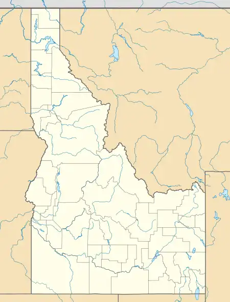
Dixie, Idaho County, Idaho
Dixie is an unincorporated community in Idaho County, Idaho, United States, located 43 miles (69 km) east-northeast of Riggins. Dixie was an important gateway to the Thunder Mountain Mines of Idaho during the early 1900s when Dixie was on the northern terminus of the Three Blaze Trail, a shortcut route to the mines via Campbell's Ferry, and what is now the Frank Church-River of No Return Wilderness, Chamberlain Basin, and southward to the mining community of Roosevelt, located on Monumental Creek.
Dixie, Idaho | |
|---|---|
 Dixie  Dixie | |
| Coordinates: 45°33′15″N 115°27′40″W | |
| Country | United States |
| State | Idaho |
| County | Idaho |
| Elevation | 5,620 ft (1,710 m) |
| Time zone | UTC-8 (Pacific (PST)) |
| • Summer (DST) | UTC-7 (PDT) |
| Area code(s) | 208, 986 |
| GNIS feature ID | 1802953[1] |
Climate
Dixie has a dry summer continental subarctic climate (Dsc) according to the Köppen climate classification system.
| Climate data for Dixie (1952-2011) | |||||||||||||
|---|---|---|---|---|---|---|---|---|---|---|---|---|---|
| Month | Jan | Feb | Mar | Apr | May | Jun | Jul | Aug | Sep | Oct | Nov | Dec | Year |
| Record high °F (°C) | 54 (12) |
59 (15) |
64 (18) |
78 (26) |
86 (30) |
88 (31) |
96 (36) |
99 (37) |
93 (34) |
80 (27) |
64 (18) |
53 (12) |
99 (37) |
| Average high °F (°C) | 30.8 (−0.7) |
35.4 (1.9) |
39.9 (4.4) |
46.6 (8.1) |
56.7 (13.7) |
65.9 (18.8) |
76.4 (24.7) |
75.9 (24.4) |
66.6 (19.2) |
53.8 (12.1) |
38.2 (3.4) |
31.1 (−0.5) |
51.4 (10.8) |
| Average low °F (°C) | 4.8 (−15.1) |
7.1 (−13.8) |
12.8 (−10.7) |
21.1 (−6.1) |
28.7 (−1.8) |
34.8 (1.6) |
37.4 (3.0) |
35.1 (1.7) |
28.9 (−1.7) |
22.8 (−5.1) |
14.1 (−9.9) |
5.8 (−14.6) |
21.1 (−6.1) |
| Record low °F (°C) | −42 (−41) |
−42 (−41) |
−36 (−38) |
−9 (−23) |
4 (−16) |
19 (−7) |
23 (−5) |
19 (−7) |
9 (−13) |
−13 (−25) |
−35 (−37) |
−49 (−45) |
−49 (−45) |
| Average precipitation inches (mm) | 3.55 (90) |
2.55 (65) |
2.64 (67) |
2.24 (57) |
2.44 (62) |
2.51 (64) |
1.09 (28) |
1.3 (33) |
1.41 (36) |
1.88 (48) |
3.17 (81) |
3.5 (89) |
28.27 (718) |
| Average snowfall inches (cm) | 42.6 (108) |
29.7 (75) |
28.4 (72) |
15.9 (40) |
5.1 (13) |
0.6 (1.5) |
0 (0) |
0 (0) |
0.9 (2.3) |
5 (13) |
28.9 (73) |
41 (100) |
198.1 (503) |
| Average precipitation days | 15 | 12 | 13 | 12 | 12 | 10 | 5 | 6 | 6 | 8 | 13 | 15 | 127 |
| Source: WRCC[4] | |||||||||||||
| Climate data for Dixie N, Idaho, 1991–2020 normals: 5740ft (1750m) | |||||||||||||
|---|---|---|---|---|---|---|---|---|---|---|---|---|---|
| Month | Jan | Feb | Mar | Apr | May | Jun | Jul | Aug | Sep | Oct | Nov | Dec | Year |
| Average high °F (°C) | 30.7 (−0.7) |
33.0 (0.6) |
38.4 (3.6) |
45.5 (7.5) |
56.7 (13.7) |
64.5 (18.1) |
75.9 (24.4) |
75.6 (24.2) |
65.3 (18.5) |
52.1 (11.2) |
35.8 (2.1) |
27.7 (−2.4) |
50.1 (10.1) |
| Daily mean °F (°C) | 17.8 (−7.9) |
20.4 (−6.4) |
25.5 (−3.6) |
32.9 (0.5) |
42.6 (5.9) |
49.5 (9.7) |
57.3 (14.1) |
56.0 (13.3) |
48.2 (9.0) |
37.9 (3.3) |
24.8 (−4.0) |
16.6 (−8.6) |
35.8 (2.1) |
| Average low °F (°C) | 4.9 (−15.1) |
7.8 (−13.4) |
12.7 (−10.7) |
20.4 (−6.4) |
28.5 (−1.9) |
34.5 (1.4) |
38.6 (3.7) |
36.3 (2.4) |
31.1 (−0.5) |
23.7 (−4.6) |
13.8 (−10.1) |
5.5 (−14.7) |
21.5 (−5.8) |
| Average precipitation inches (mm) | 3.80 (97) |
3.58 (91) |
3.05 (77) |
3.25 (83) |
3.10 (79) |
2.79 (71) |
1.15 (29) |
0.88 (22) |
1.40 (36) |
2.27 (58) |
3.57 (91) |
4.79 (122) |
33.63 (856) |
| Source: NOAA[5] | |||||||||||||
Transportation
Airports
The following public-use airports are located near Dixie
- Dixie USFS Airport (A05)
- Wilson Bar USFS Airport (C48)
References
- "US Board on Geographic Names". United States Geological Survey. October 25, 2007. Retrieved January 31, 2008.
- Davis, Ellis A. (1909). Davis' New Commercial Encyclopedia: Washington, Oregon, and Idaho, the Pacific Northwest. Ellis A. Davis. p. 189.
- World Book Encyclopedia. Vol. I. Field Enterprises Corporation. 1960. p. 27.
- "DIXIE, ID (102575)". Western Regional Climate Center. Retrieved November 26, 2015.
- "Dixie N, Idaho 1991-2020 Monthly Normals". Retrieved September 3, 2023.
This article is issued from Wikipedia. The text is licensed under Creative Commons - Attribution - Sharealike. Additional terms may apply for the media files.