Doropo
Doropo is a town in the far northeast of Ivory Coast. It is a sub-prefecture of and the seat of Doropo Department in Bounkani Region, Zanzan District, adjacent to the border with Burkina Faso. Doropo is also a commune. Fifteen kilometres northwest of town is a border crossing with Burkina Faso. In 2021, the population of the sub-prefecture of Doropo was 48,225.[1]
Doropo | |
|---|---|
Town, sub-prefecture, and commune | |
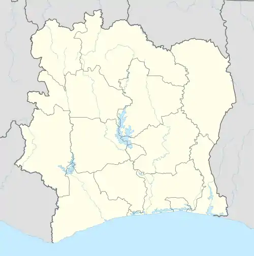 Doropo Location in Ivory Coast | |
| Coordinates: 9°49′N 3°21′W | |
| Country | |
| District | Zanzan |
| Region | Bounkani |
| Department | Doropo |
| Area | |
| • Total | 785 km2 (303 sq mi) |
| Population (2021 census)[1] | |
| • Total | 48,225 |
| • Density | 61/km2 (160/sq mi) |
| • Town | 14,388[2] |
| (2014 census) | |
| Time zone | UTC+0 (GMT) |
Villages
The hundred and four villages of the sub-prefecture of Doropo and their population in 2014 are:[3]
- Babadjou (225)
- Bidjinadouo 2 (171)
- Bingora (134)
- Dabonkiro 1 (281)
- Dabonkiro 2 (97)
- Dabonkiro 3 (60)
- Dabonkiro 4 (216)
- Doropo (14 388)
- Kakota (222)
- Kalambourou (276)
- Kamassama (381)
- Karwedouo (229)
- Kinandouo (219)
- Kobilou (233)
- Kountoumbi (109)
- Kporomi 1 (252)
- Létcharé (158)
- Nominéré (127)
- Péou (53)
- Saiko-Gbonon (98)
- Sokorolaye (89)
- Tchantibi 1 (180)
- Tchantibi 2 (93)
- Tchartchara (91)
- Tchormidouo (50)
- Timbiéla (171)
- Tingo (334)
- Tingo-Yalo (407)
- Yolonkora (481)
- Yolontchèra (74)
- Angaye (895)
- Babaldouo (211)
- Baltan (87)
- Banié (452)
- Batéfigui (166)
- Bénimbara (132)
- Bidjinadouo 1 (210)
- Biebdouo (85)
- Bielfi-Letchard (289)
- Biélpindouogbé (225)
- Brotto (220)
- Dakpolongui 1 (217)
- Dakpolongui 2 (139)
- Dambélessi (236)
- Danagnara (60)
- Dejlmidouo (156)
- Déko 1 (30)
- Dininémina (130)
- Doundouo (81)
- Douogbe-Guidre (354)
- Gangatta (139)
- Garihoussié (15)
- Gbasséra (71)
- Gborodouo (212)
- Gnano - Koté (237)
- Holara (259)
- Kapari (142)
- Kiamouno (128)
- Kirkpadouo (80)
- Kodo (604)
- Kodo-Bissankoué (241)
- Koguiénou (270)
- Koiton (294)
- Kopitédouo (116)
- Kossamiguié (102)
- Koudinadouo (39)
- Kourénou (130)
- Koutiana (347)
- Kpaldouo (262)
- Kpilimitédouo (105)
- Lankio (390)
- Lantaga (205)
- Latrougo (308)
- Lintéra (398)
- Miakoura (98)
- Nakélé (313)
- Natantchohiè (263)
- Niando-Tinkoi (403)
- Niona (431)
- Nodjodouo (125)
- Nofardouo (103)
- Nogatédouo (117)
- Nounkouwouridouo (80)
- Oulomperdouo (217)
- Parankoyédouo (337)
- Ponorodouo (82)
- Proura (886)
- Sangbanari (581)
- Sékodouo (126)
- Sémadouo (86)
- Sénandi 1 (110)
- Sénandi 2 (90)
- Sonfordouo (686)
- Tangbadouo (117)
- Tesso (288)
- Tibinandouo (378)
- Tibroti (59)
- Tinlou (114)
- Tintiouri (63)
- Tioboulonao (18)
- Toboura 1 (158)
- Varalé (1 032)
- Wadara (127)
- Youternérédouo (885)
Notes
- Citypopulation.de Population of the regions and sub-prefectures of Ivory Coast
- Citypopulation.de Population of cities & localities in Ivory Coast
- Citypopulation.de Population of the localities in the sub-prefecture of Doropo
Regional seat: Bouna | ||
| Bouna Department | 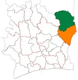 | |
| Doropo Department | ||
| Nassian Department | ||
| Téhini Department | ||
* also a commune | ||
This article is issued from Wikipedia. The text is licensed under Creative Commons - Attribution - Sharealike. Additional terms may apply for the media files.