Drásov (Příbram District)
Drásov is a municipality and village in Příbram District in the Central Bohemian Region of the Czech Republic. It has about 400 inhabitants.
Drásov | |
|---|---|
_in_spring_2012_(7).jpg.webp) Eastern part of Drásov | |
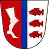
 Flag  Coat of arms | |
 Drásov Location in the Czech Republic | |
| Coordinates: 49°42′8″N 14°7′4″E | |
| Country | |
| Region | Central Bohemian |
| District | Příbram |
| First mentioned | 1057 |
| Area | |
| • Total | 5.47 km2 (2.11 sq mi) |
| Elevation | 434 m (1,424 ft) |
| Population (2023-01-01)[1] | |
| • Total | 443 |
| • Density | 81/km2 (210/sq mi) |
| Time zone | UTC+1 (CET) |
| • Summer (DST) | UTC+2 (CEST) |
| Postal code | 261 01 |
| Website | www |
Administrative parts
The village of Skalka is an administrative part of Drásov.
Geography
Drásov is located about 7 kilometres (4 mi) east of Příbram and 40 km (25 mi) southwest of Prague. It lies on the border between the Benešov Uplands and Brdy Highlands. The highest point is the hill Velký Chlum at 481 m (1,578 ft) above sea level. The Kocába River flows through the municipality and supplies a system of several ponds.
History
The first written mention of Drásov is from 1057.[2]
Transport
The D4 motorway passes through the municipality.
Sights
There are no protected cultural monuments in the municipality.[3] The most notable building is the Chapel of Saint Wenceslaus.[4]
References
- "Population of Municipalities – 1 January 2023". Czech Statistical Office. 2023-05-23.
- "O obci" (in Czech). Obec Drásov. Retrieved 2023-03-02.
- "Výsledky vyhledávání: Kulturní památky, okres Příbram". Ústřední seznam kulturních památek (in Czech). National Heritage Institute. Retrieved 2023-03-02.
- "Kaple svatého Václava v Drásově". Drobné památky (in Czech). Retrieved 2023-03-02.